News
Storm drops 47″ in 48 hours, Extreme Avalanche Danger
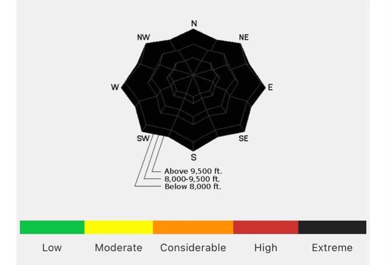
This avalanche danger rose points to 'extreme' levels of danger in the Salt Lake area today. Photo: Courtesy of Utah Avalanche Center
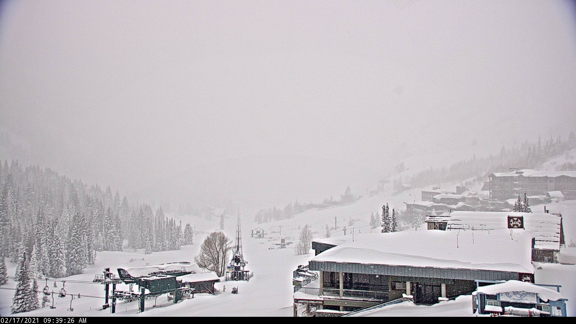
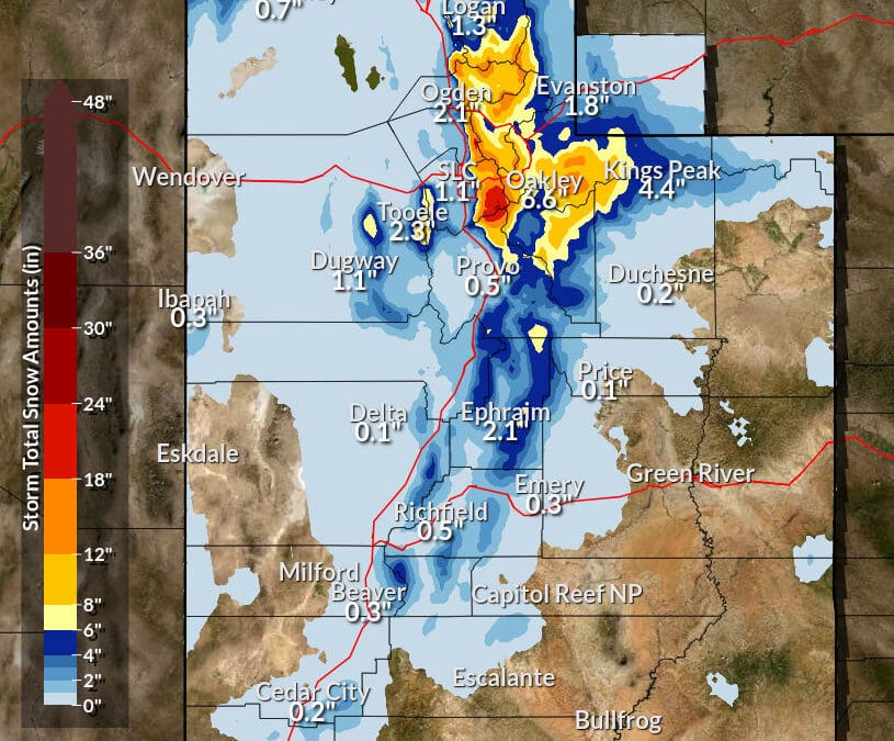
SALT LAKE CITY, Utah. — The most recent storm cycle brought plentiful snow to the Salt Lake Area over the past two days, with the U.S. National Weather Service reporting up to 47″ at Alta. This significant snowfall has closed Little Cottonwood Canyon as of 8:30 a.m. with no estimated opening. Public safety for the town of Alta posted a request on Twitter this morning for building head counts after declaring “Max Security Interlodge.” Interlodged means residents, employees, and guests in the area must remain indoors until given an all-clear of avalanche danger.
TOA Max Security Interlodge Go to low levels away from windows, If you have a protocol for your building reply with head count when ready
— Alta Central (@AltaCentral) February 17, 2021
The Powder Buoy, Parkite Mike Ruzek, posted an image of the avalanche danger ‘rose’ to Instagram today, writing, “I know for a fact I have never seen this before. This is basically the defcon level 1 (highest level) of avalanche and snow instability warnings. Any avalanche terrain is suspect, even if you are on a hike or walking your dog and there is a slope above you…”
The Utah Avalanche Center (UAC) has a tutorial on how to read a danger rose.
“We designed the avalanche danger rose to show, at a glance, the avalanche danger in avalanche terrain by aspect and elevation,” UAC says of the rose on their website. “It represents a single mountain with the danger ratings painted on the mountain presented in 3-D to make it easier to visualize. The shape is based on the standard rose diagram used in Europe, which is not round or octagonal-shaped but with ridges and gullies like real mountain.”
Education helps people “know before they go” outside and recreate in backcountry terrain. There are multiple resources and tutorials on their site as well, from essential gear to Utah resort uphill policies. Below is the full avalanche report for Feb. 17 from the UAC.
Utah Avalanche Center Forecast for the Salt Lake Area Mountains
Report issued by Trent Meisenheimer, Wednesday, February 17, 2021
DANGEROUS AVALANCHE CONDITIONS EXIST. AVOID ALL AVALANCHE TERRAIN.
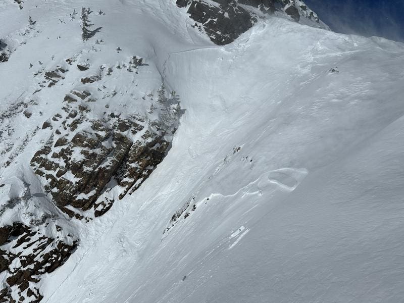
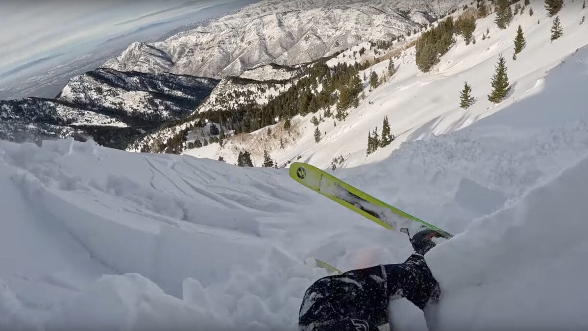
Today the avalanche danger is EXTREME on all aspects and elevations. Avoid being under or near any steep slope. Even very small slopes can bury a person.
Heavy snowfall and a weak faceted snowpack have created very dangerous avalanche conditions. Natural and human-triggered avalanches are certain. Even unusual avalanches are possible in atypical terrain on atypical aspects and elevations.
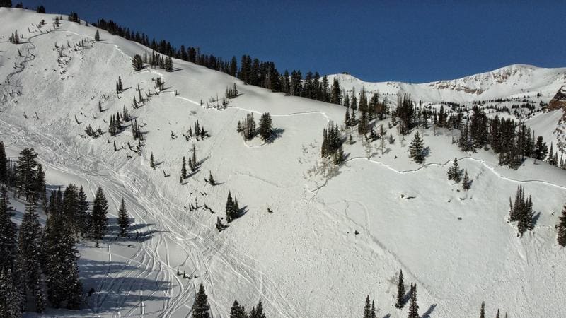
The Utah Avalanche Center goes over “unsurvivable avalanches” during a day of fieldwork in American Fork.
TownLift

7948 Red Tail Court
Park City, UT 840601068 W Shoreline Dr
Layton, UT 840417566 E Ponderosa Dr
Huntsville, UT 843172600 N 1200 West, Suite 6
Lehi, UT 840434536 N Painted Sky Drive
St. George, UT 847703137 East George White Road
Moab, UT 84532Talk of the Town


Park City Jobs
Summer Concert Staff, Park City Institute
Today Contractor $25.00 - $35.00 hourly
Office Administrator, Park City Soccer Club
1 day ago Part time $21.00 - $23.00 hourly

Community Liaison & Administrative Assistant to the General Manager, K&K Property Management
14 days ago Full time $20.00 - $23.00 hourly

Full-time paint retailer at Park City Paint, Park City Paint
17 days ago Full time $20.00 - $24.00 hourly

Park City Gardens is hiring for the summer!, Garden Cafe at Park City Gardens
23 days ago Seasonal $17.00 - $22.00 hourly
You must be logged in to post a comment.