Weather
Utah faces another round of critical fire weather as heat, wind, and low humidity persist
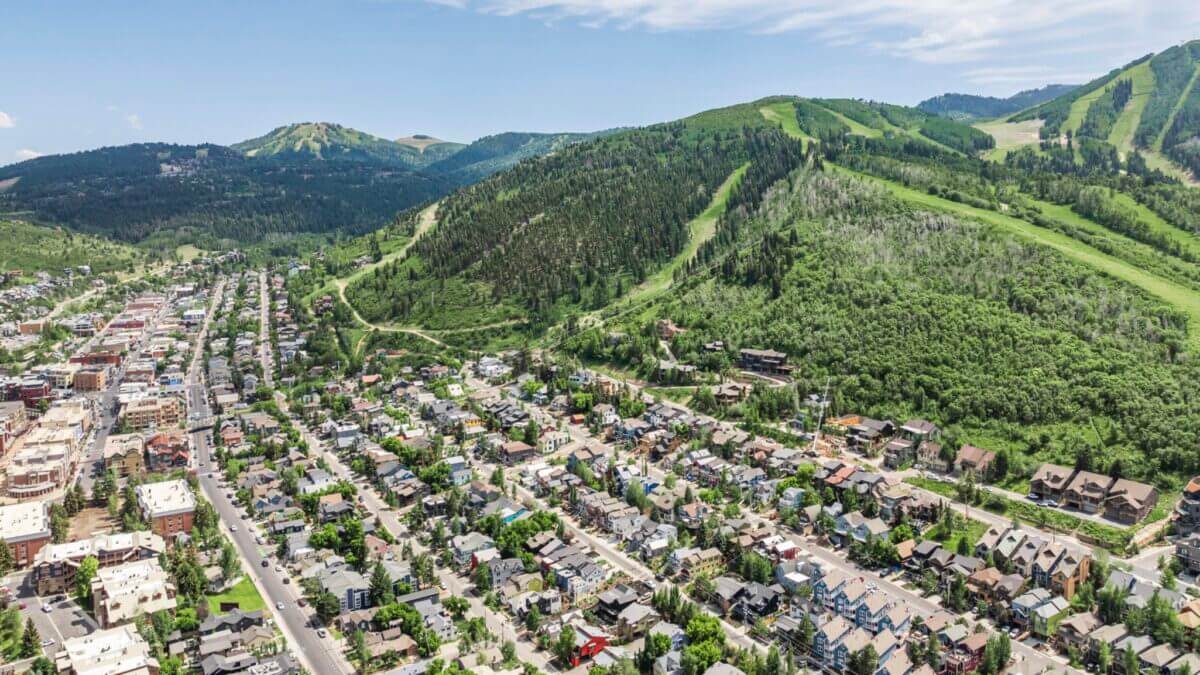
Photo: Inhabit Park City.
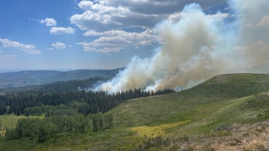
PARK CITY, Utah — Hot, dry, and windy conditions are expected to keep fire danger elevated across parts of Utah through the end of the week, with the National Weather Service warning that new or existing fires could spread rapidly.
The National Weather Service in Salt Lake City issued a Red Flag Warning for portions of west-central and southwest Utah from Friday afternoon into Friday night, citing gusty winds and low relative humidity. The warning includes the Central Utah West Desert and Color Country West Desert, where southwest winds of 15 to 25 mph could gust up to 35 mph, and relative humidity could fall as low as 9%.
“Critical fire weather conditions are expected,” the National Weather Service said. “Any new fire starts, or existing fires may spread rapidly.”
The warning follows several days of above-average heat and dry air across the state. Meteorologist Chase Thomason said in a Tuesday forecast that high pressure would keep summer heat “locked in” across Utah through midweek, while hot temperatures, low humidity, and gusty northwest winds created dangerous fire conditions across central, eastern, and southern Utah.
By Friday, another weather system moving into the Great Basin is expected to bring gusty southwest winds, with many areas seeing gusts between 25 and 40 mph, especially across western Utah, Thomason said. The National Weather Service forecast discussion echoed that outlook, saying gusty winds of 30 to 40 mph, combined with very low humidity, would bring a renewed threat of critical fire weather conditions to western Utah on Friday, with the threat potentially shifting into southern and eastern Utah on Saturday.
Northern Utah is also expected to see some of the hottest temperatures of the season so far on Friday. The National Weather Service said portions of the Wasatch Front could see highs in the mid- to upper 90s, with overnight lows near 70 degrees providing little relief and increasing the risk of heat-related illnesses.
A weak, mostly dry cold front is expected to move through over the weekend, bringing temperatures closer to seasonal norms. Isolated thunderstorms are possible Saturday across northern Utah, but forecasters said many storms may produce little rainfall. Gusty, erratic winds could still develop near storms, creating additional fire concerns.
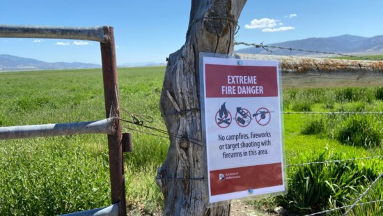
Residents are urged to avoid activities that could spark a wildfire, including outdoor burning, dragging chains, parking vehicles over dry grass, using equipment that creates sparks, or improperly discarding cigarettes.
A Red Flag Warning means critical fire weather conditions are occurring or imminent. The National Weather Service says strong winds, low humidity, and warm temperatures can contribute to extreme fire behavior.
By: Rebecca Brenner

24 South 600 East
Salt Lake City, UT 84102
19 East 100 North
Spring City, UT 84662
10584 Basin Canyon Road
Park City, UT 84098
965 Goshen Canyon Road
Mona, UT 84645Talk of the Town


Park City Jobs

Assistant Manager, LOMA
7 days ago Full time $35.00 hourly
Property Inspector, Park City Rental Properties
8 days ago Full time $23.00 - $25.00 hourly
Owner Relations Manager, Park City Rental Properties
8 days ago Full time
Operations Manager, Park City Rental Properties
8 days ago Full time

Hiring Barista Assistants and Baristas, Silver King Coffee
10 days ago Part time $17.00 - $30.00 hourly