Weather
March begins with unseasonable warmth, but changes are on the way Monday
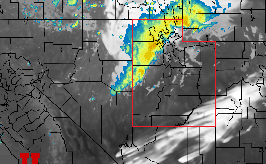
Photo: The HRRR weather model shows a strong cold front entering Utah from the west early this afternoon // UofU Dept. of Atmospheric Sciences
5-10” of snow expected for parts of the Wasatch as quick-moving cold front rolls through this evening, with another storm possible Thursday
PARK CITY, Utah – With another warmer-than-normal, slightly below average snowfall month in the books, we begin March with a mild spring-like storm.
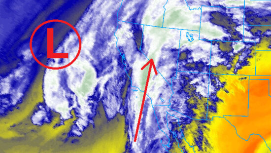
Mid-mountain temperatures have been in the 40s over the weekend as an unseasonably warm, somewhat moist airmass has been in place, with some scattered showers that have not produced any significant snow accumulation. Things will change on Monday as a small cutoff low-pressure system currently off the California coast begins to track eastward and cross Utah in the afternoon.
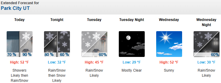
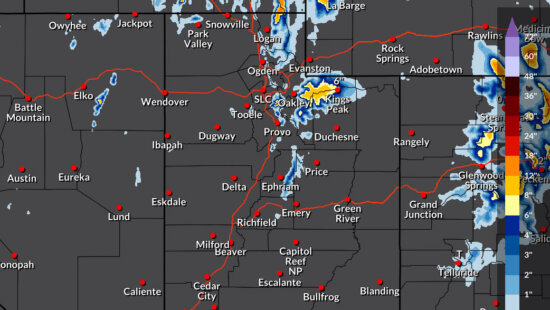
Forecast Snow Totals for Monday-Tuesday
- Cottonwood Canyons: 6 – 11″
- Deer Valley/PCMR: 3 – 7″
- N. Wasatch (Powder/Snowbasin): 4 – 9”
- PC Base/Town: T – 1″
A band of heavy snow is expected as the front moves through, dropping the majority of the precipitation Monday evening and into the early morning hours Tuesday. Some thunder and graupel are also possible with the passage of the cold front. Crest-level winds switch to northwesterly fairly quickly and are expected to remain so throughout Tuesday morning, which may produce additional accumulations in the Cottonwood Canyons and keep snowfall lingering.
Alta is reporting that 72.5” of snow fell in February, which is 81.2% of normal based on the long-term average (starting in 1980) of 89.3” for the month. March is historically Alta’s snowiest month, coming in at an average of 96.8”, so fingers crossed for a snowy month. The climate analysis for February 2026 also shows above-normal temperatures across much of the state and the rest of the Intermountain West, as shown below.
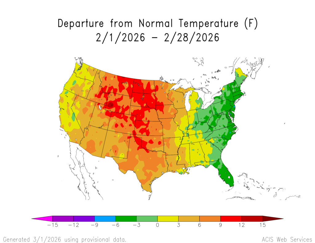
The National Weather Service is reporting that this winter has been the warmest on record, referring to “meteorological winter,” which runs from December through March, with an average temperature of 40.7 °F at the Salt Lake City International Airport official weather observing station.

Extended Outlook
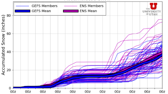
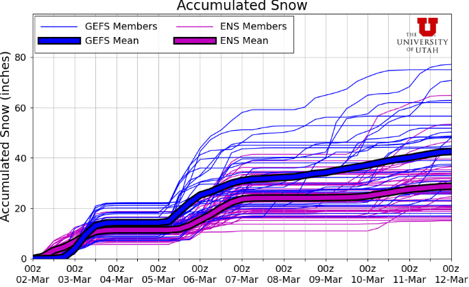
The next system looks to arrive overnight Wednesday into Thursday, with the potential for higher snowfall totals than the Monday storm. The forecast models are in slight disagreement with specifics, but in general, there looks to be a decent chance of around another foot of snow, with much colder temperatures expected as well.
By: Adam Lenkowski

2410 W Entrada Trail, Unit #4
St. George, UT 84770
950 S Aspen Circle
Woodland Hills, UT 84653
4739 W Snowflake Drive
Highland, UT 84003
1011 E Mill Road
Heber City, UT 84032Talk of the Town


Park City Jobs

Marketing Manager, Junction Commons
1 day ago Full time
LEAD BARTENDER, VR Inc
1 day ago Full time $21.00 - $22.00 hourly
Venue & Event Coordinator (Kimball Arts Festival VIP Lounge), Kimball Art Center
8 days ago Seasonal $20.00 - $22.50 hourly

Summer Garden Educator and Counselor, Summit Community Gardens and EATS
8 days ago Seasonal $19.00 - $20.00 hourly

Job Fair May 26 2026, Grand Hyatt Deer Valley
10 days ago Full time