Environment
Understanding the relationship between landslides and Utah
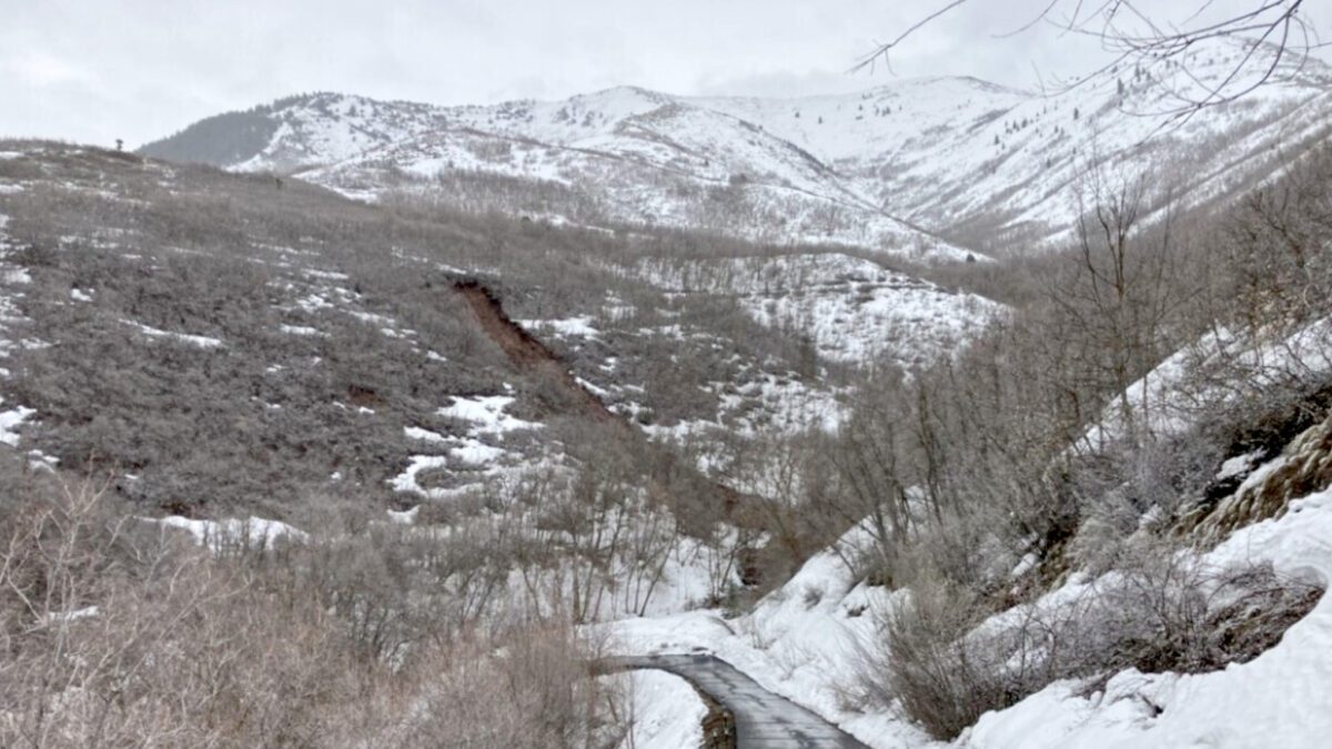
2023 Pioneer Gulch Landside in Emigration Canyon. Photo: Courtesy of Salt Lake City Public Works.
PARK CITY, Utah — The fast snowmelt and the problems it creates have been numerous over recent weeks as the weather starts to look more like spring. Mudslides, debris avalanches, wet slides, and everything in between have caused many problems, including road closures, accidents, and heavy traffic.
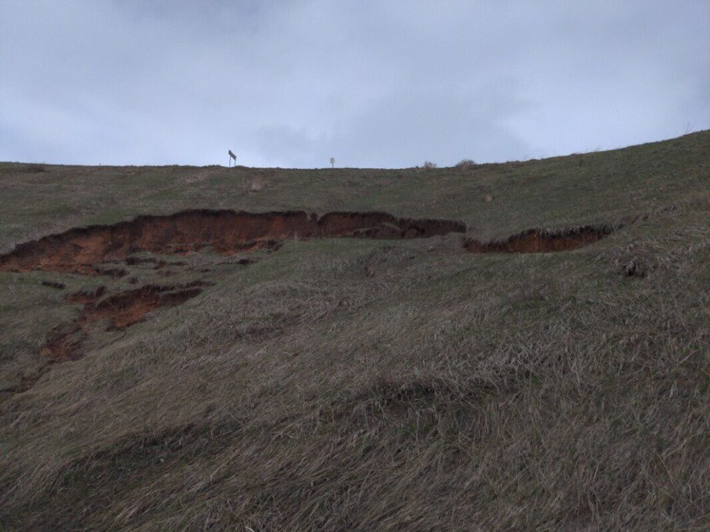
There are nine major types of landslides, according to the U.S. Geological Survey, with slides, rock falls, debris flows, and earth flows being the most common in Utah. Debris flows are particularly dangerous because they can be sudden and reach speeds of 30 to 50 mph.
Across the United States, landslides cause more than $2 billion in damages annually. In Utah, that number is considerably lower, with prime examples being in 2001, when damages exceeded $3 million, and in 2005, when estimated damages exceeded $10 million. While those might be typical years, the Thistle Landslide that occurred in 1983 was on a different level reaching $200 million in direct damages (over $600 million in 2023). Still, when including indirect losses listed by USGS, the total rises to $600 million($1.8 billion in 2023), making it the most costly landslide in U.S. history. The destruction and economic consequences felt by the entire region led to the landslide becoming the first U.S. Presidental declared disaster in Utah’s history.
The Thistle Landslide had a perfect storm of causes in that the prior year was exceptionally wet, and 1983 was a giant snowpack year with a rapid rise in temperature. At its peak, the slide moved at a rate of 3.5 feet per hour, leading to the damming of the Spanish Fork River within a few days. Its width reached 1,000 feet, close to 200 feet in thickness, and stretched over a mile long. The lower portion of the slide formed into a 220-foot high dam creating the “Thistle Lake” that reached a depth of 160 feet before being drained.
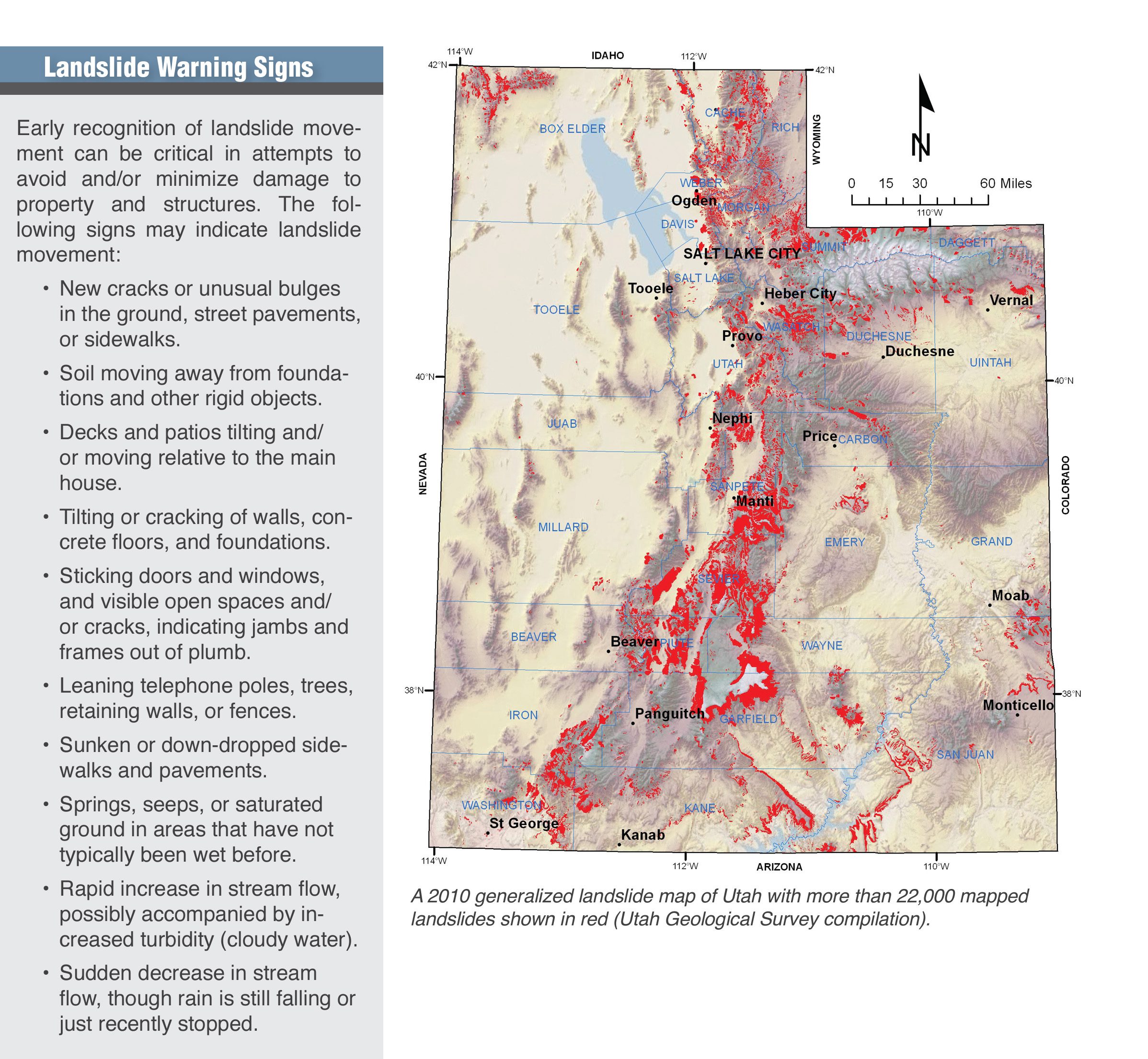
Landslides occur for many different reasons and can be natural or human-caused. Examples of natural landslides causes could be rising groundwater levels from precipitation or rapid snowmelt. The distribution of landslides across Utah can most easily be associated with the state’s geology. The zone stretching from the northern Wasatch Front and the back valleys southward to St. George contains weak rock types, steep slopes, and the areas of highest precipitation in the state, making it the most likely area for landslides to occur.
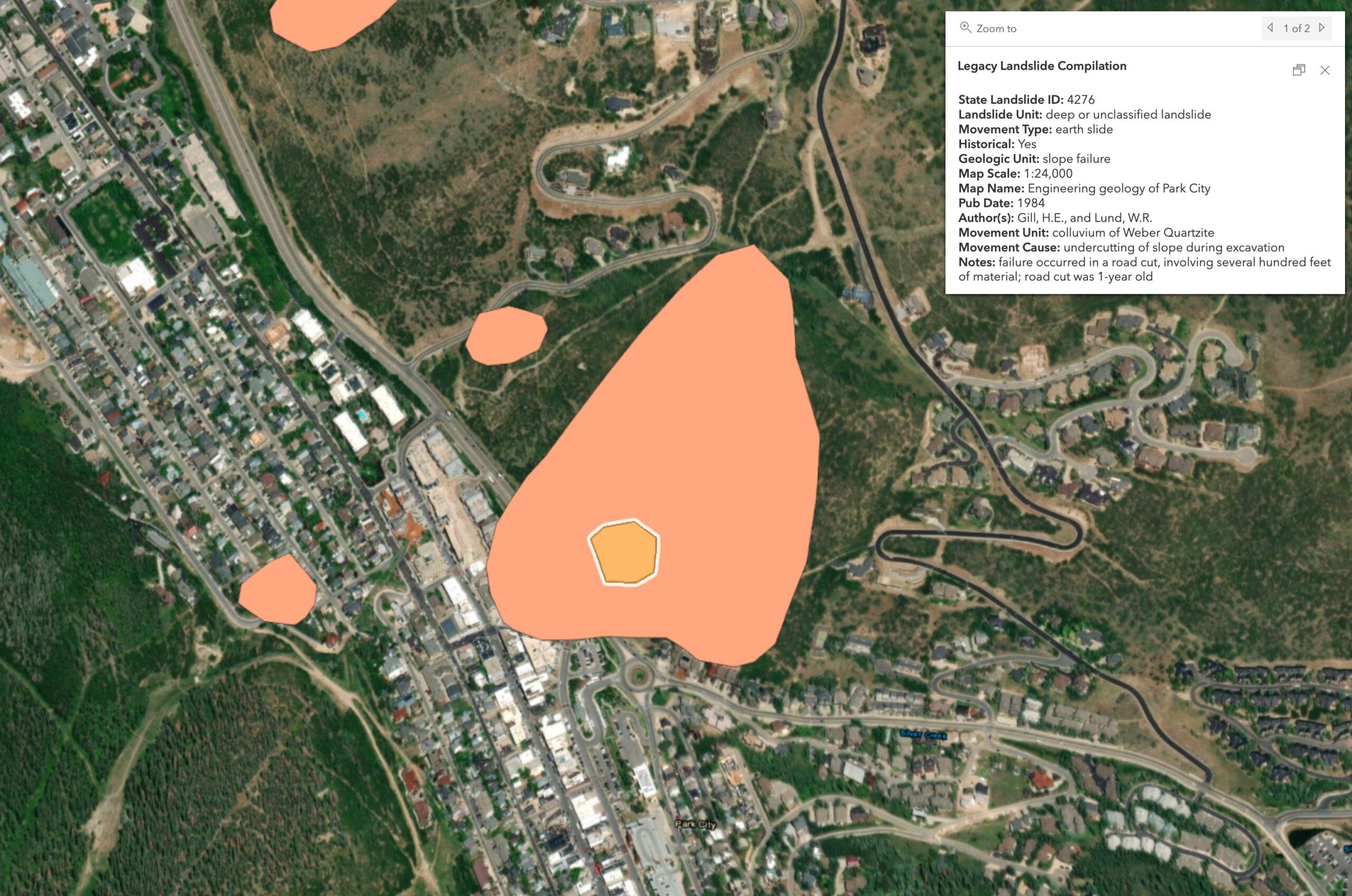
Human-caused landslides tend to be rooted in landscaping alterations such as leaks from water-conveyance structures (ponds, reservoirs, and pipelines) or landscape irrigation. Construction can also lead to landslides, such as in the case of one that occurred on the east side of Park City, in which several hundred feet of material slid during an excavation in 1984.
While landslides are not always easy to predict, some signs can indicate the likelihood of landslides occurring in the near future. Perhaps the best indication of a higher-risk area is the presence of a previous landslide occurring. The Utah Geologic Hazards Portal shows areas of risk that are mapped by UGS in addition to past occurrences.
Today the media joined UGS to learn how we respond to geologic hazards and monitor active landslides in areas of relatively high risk to the public. Learn more about landslides and the work we are doing – at https://t.co/fYYtbBq340. pic.twitter.com/EXVeKETRyt
— Utah Geological (@utahgeological) April 19, 2023
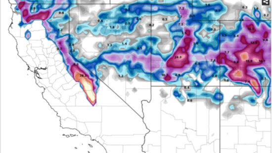
This year, record snowfall and a relatively fast-melting snowpack has increased the possibility of landslide occurrence throughout Utah in landslide-prone areas. This page provides updated geologic information on current landslide events in Utah. https://t.co/1zTEI5HZvT pic.twitter.com/jgoS9crXFT
— Utah Geological (@utahgeological) April 19, 2023
Appreciate the coverage? Help keep Park City informed.
TownLift is powered by our community. If you value independent, local news that keeps Park City connected and in the know, consider supporting our newsroom.
By: Kevin Cody

2549 W Sinagua Trail, #26
St. George, UT 84770
5497 S Walker Estates Circle
Holladay, UT 84117
1198 E Elkhorn Lane
Oakley, UT 84055
5314 W Rolling Brook Drive
Herriman, UT 84096
7020 E Creekside Road
Castle Valley, UT 84532Talk of the Town


Park City Jobs
Senior Development Manager, Park City Education Foundation
Today Full time $70,000 yearly
Development Associate, Park City Education Foundation
Today Full time $46,000 yearly
Stio Mountain Studio Associate Manager, Stio
1 day ago Full time $50,000 - $60,000 yearly
Pharmacist, Alpine Apothecary
4 days ago Part time

Dental Assistant, Rise Dental Wellness
4 days ago Part time