Snow
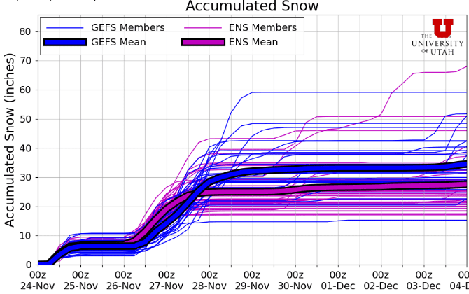
Two feet of snow possible for Wasatch Mountains by Thanksgiving
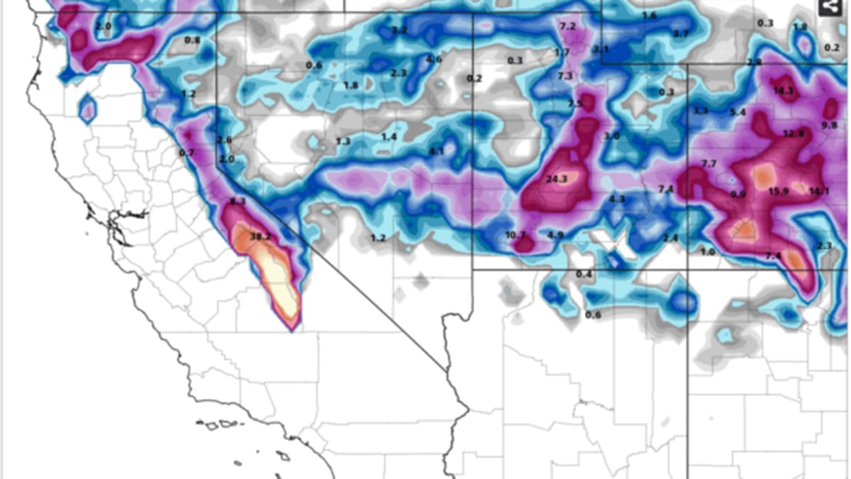
Total snowfall through Thursday, November 28. Photo: Pivotal Weather
Biggest winter storm of the season hits Park City Monday night through Wednesday
PARK CITY, Utah – Deep moisture from a weakening atmospheric river in California will spread into Utah Monday night, interacting with a storm system entering from the pacific northwest. This will be a warmer, multi-day storm system with wetter/heavier snow.

Today: Warm, moist air will begin to enter Utah in the evening with a chance of flurries after 6:00 pm. Overnight temperatures will remain mild, hanging right around freezing.
Tuesday-Wednesday: Precipitation will ramp up Tuesday morning along with snow levels, which will rise to around 7,000 feet before colder air begins to move in. A cold front entering from the northwest will arrive in the evening and overnight Wednesday. Enhanced snowfall is expected with the passage of the cold front and associated frontal band, with snow levels dropping to less than 5000 feet. Most of the precipitation is expected to end by midday Wednesday.
The Utah Avalanche Center warns that “with this next winter storm, we do expect dangerous avalanche conditions to develop over the next several days and well into Thanksgiving.”
Expected snow totals through Wednesday
Park City town/base: 4-8”
Park City / Deer Valley mountains: 10-18”
Cottonwood Canyons: 18-26”
Utah Ski Resort snow totals through Wednesday 11/27
| Low End Snowfall | Expected Snowfall | High End Snowfall | |
| Eagle Point Resort, UT | 19 | 31 | 40 |
| Alta Ski Area, UT | 20 | 28 | 30 |
| Snowbird Ski and Summer Resort, UT | 17 | 26 | 27 |
| Brighton Resort, UT | 16 | 24 | 26 |
| Solitude Mountain Resort, UT | 17 | 24 | 24 |
| Brian Head Resort, UT | 10 | 18 | 19 |
| Canyons Village, UT | 11 | 17 | 17 |
| Park City Mountain Resort, UT | 10 | 16 | 17 |
| Deer Valley, UT | 9 | 14 | 16 |
| Sundance Mountain Resort, UT | 9 | 14 | 15 |
| Beaver Mountain, UT | 7 | 13 | 14 |
| Cherry Peak Resort, UT | 6 | 9 | 11 |
| Snowbasin Resort, UT | 5 | 9 | 11 |
| Powder Mountain, UT | 5 | 8 | 10 |
| Nordic Valley, UT | 2 | 5 | 7 |
Snow totals from this past Sunday’s storm
The recent storm Sunday morning brought an even coat of white across the Wasatch with 5-6” of snow being reported from most high elevation weather stations. This fell on an increasingly weak backcountry snowpack, according to the Utah Avalanche Center.
One additional item of note is the potential significant impact on the higher terrain in central Utah, including the Tushar mountains and Fish Lake areas, which could receive 2-3 feet of snow. The southern Sierra Nevada in California are forecasted to get 3 to 6 feet of snow with this surge of moisture.
Appreciate the coverage? Help keep Park City informed.
TownLift is powered by our community. If you value independent, local news that keeps Park City connected and in the know, consider supporting our newsroom.


