NOAA’s winter outlook leaves Utah snowfall uncertain as El Niño strengthens

PARK CITY, Utah — Utah’s upcoming winter could be shaped by a strong El Niño, but the National Oceanic and Atmospheric Administration’s latest seasonal outlook does not point to a clear outcome when it comes to precipitation in the state.
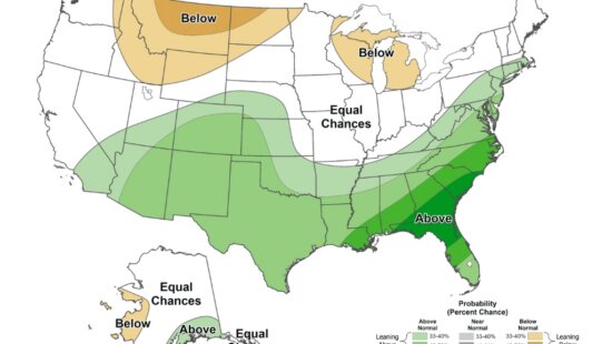
NOAA released its winter outlook Thursday, forecasting warmer-than-average temperatures across much of the northern United States and wetter-than-average conditions across the southern tier, including California and the Southwest.
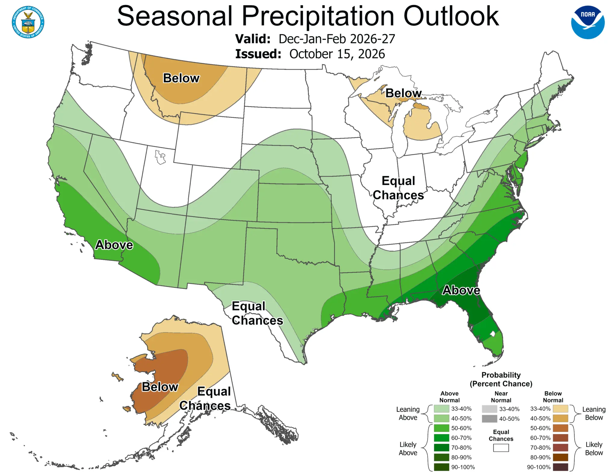
The seasonal forecast covers December 2026 through February 2027, the core winter period for Utah’s ski season.
Utah sits near the boundary between those broader patterns. NOAA’s outlook gives the Intermountain West equal chances of receiving below-normal, near-normal, or above-normal precipitation from December through February. That means the agency does not currently favor one of those outcomes for the region.
Precipitation and temperature categories describe the probability of seasonal averages, not what will happen during individual storms. Utah could still experience major snowstorms even if the winter as a whole ends up warmer or drier than normal.
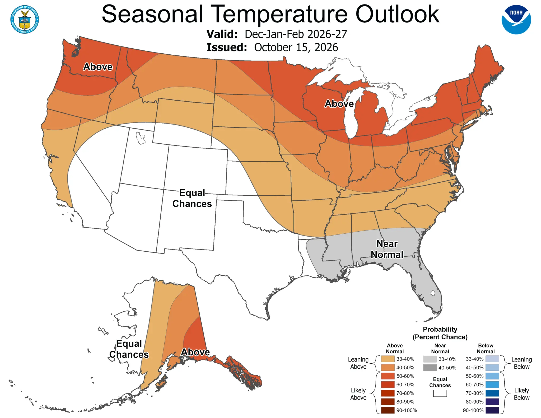
For Park City and the Wasatch Back, the forecast is not a prediction of a particularly snowy or dry ski season. Instead, it offers a broad look at the climate patterns that could influence winter weather in the coming months.
El Niño is expected to influence the winter
A key factor behind NOAA’s forecast is El Niño, a climate pattern associated with warmer-than-average sea surface temperatures in the central and eastern tropical Pacific Ocean.
The Climate Prediction Center said the developing El Niño continues to strengthen and is expected to persist into spring 2027. NOAA’s outlook is heavily influenced by the event, which can shift the jet stream and alter storm tracks across North America.
During El Niño winters, the Pacific jet stream often shifts south and east, increasing the likelihood of storms reaching parts of the southern United States. That pattern helps explain NOAA’s forecast for wetter conditions across the southern tier.
But El Niño does not produce the same results everywhere. Its influence on snowfall in Utah is less straightforward, and other atmospheric conditions also affect where storms travel and how much precipitation they deliver.
NOAA does not issue seasonal snowfall-total predictions because snow accumulation at a particular location is difficult to forecast months in advance. Individual storm tracks, temperatures and shorter-term weather patterns will ultimately determine conditions at the resorts.
Drought conditions forecasted to improve
Snowpack accumulated through winter is a major source of water for the state, but the seasonal outlook cannot determine how much snow will build up in the Wasatch Mountains or how much runoff will reach reservoirs next spring.
Similarly, warmer conditions can affect whether precipitation falls as rain or snow at lower elevations and influence how long snow remains on the ground. The seasonal outlook alone cannot establish how those factors will play out in a particular watershed.
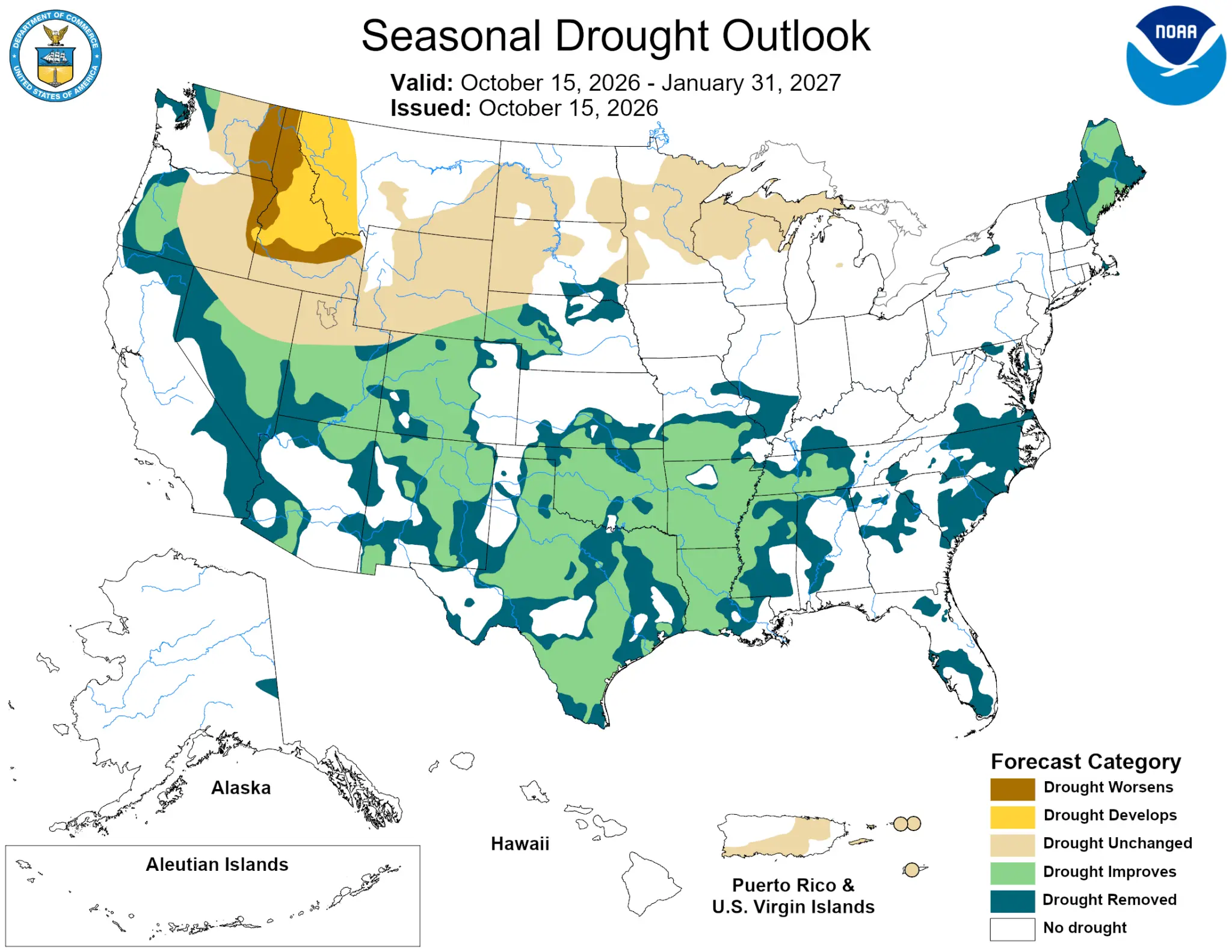
Given current data, NOAA forecasts drought conditions to improve across parts of the Southwest through January, while drought is more likely to develop or worsen in parts of the northern Rockies. Utah’s local conditions will depend on precipitation and other factors throughout the season.
NOAA’s seasonal outlook is a long-range planning tool, not a day-to-day weather forecast, and the agency updates its three-month outlook monthly as new observations and forecast information become available.
The next update is scheduled for Nov. 19. In the meantime, shorter-range forecasts will provide more useful information about incoming storms and expected snowfall in the Wasatch Range.


4251 E Lipizzan Jump
Moab, UT 84532