Weather
Late spring storm to bring several inches of snow to Park City Sunday into Monday
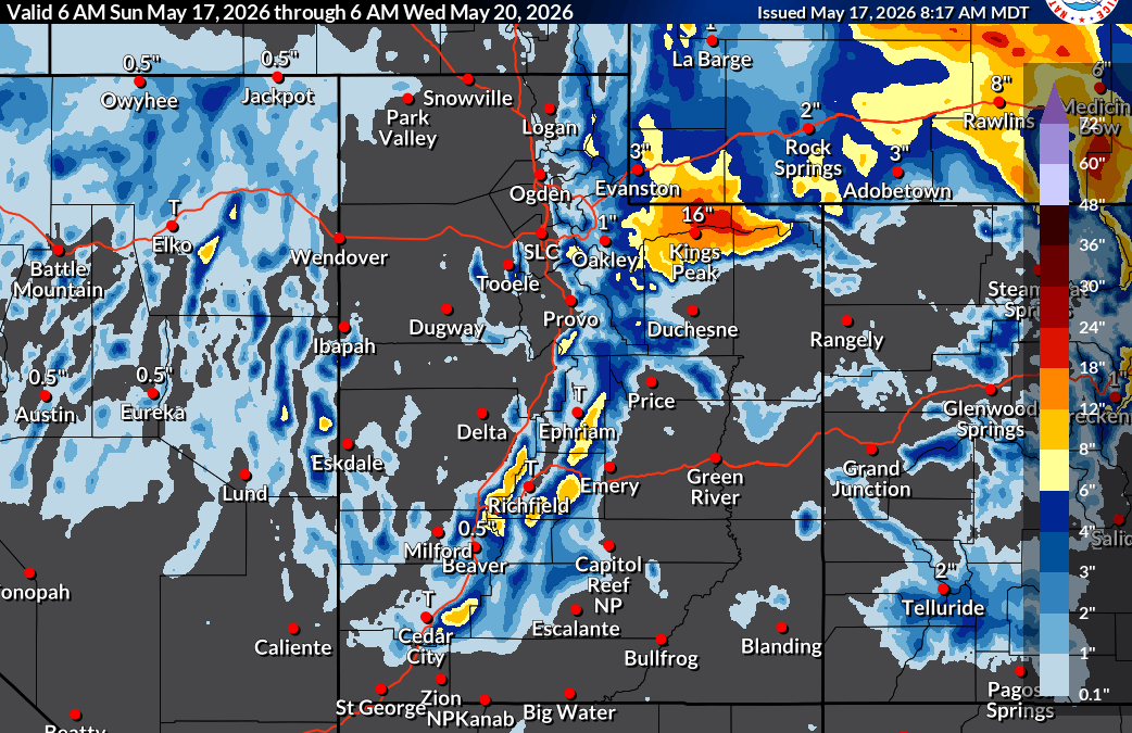
Total snow accumulations of 6 to 14 inches for the Western Uinta Mountains May 17, 2026 Photo: NWS
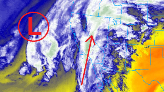
PARK CITY, Utah — A late-season winter storm moves into the Park City area Sunday afternoon, with snow showers continuing through Monday morning across the Wasatch Back and Western Uinta Mountains.
The National Weather Service in Salt Lake City has issued a Winter Weather Advisory for the Western Uinta Mountains and southwest Wyoming from noon Sunday through midnight Monday night, covering Moon Lake, Lyman, Evanston and the Mirror Lake Highway. Forecasters expect 6 to 14 inches in the Western Uintas with locally higher amounts, and 2 to 6 inches across southwest Wyoming, with totals exceeding 10 inches closer to the north slopes of the Uintas. Travel could be difficult at times and traction law restrictions may be enacted.
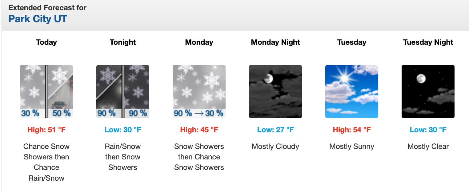
In Park City, Sunday brings a chance of snow showers before noon, mixing with rain through the afternoon under mostly cloudy skies and a high near 51. Some thunder is possible. Showers transition to all snow after midnight, with 1 to 3 inches of accumulation possible by Monday morning. Monday sees lingering snow showers before 9 a.m., a high near 45 and north winds gusting to 31 mph. Skies clear by Tuesday afternoon, with highs climbing back into the 60s by midweek and reaching the low 70s by Saturday.
Forecasted snowfall totals for area resorts
- Alta: 6 inches expected, up to 14 inches on the high end
- Snowbird: 5 inches expected, up to 13 inches on the high end
- Park City Mountain Resort: 6 inches expected, up to 8 inches on the high end
- Deer Valley: 4 inches expected, up to 7 inches on the high end
For Utah road conditions, drivers can check udottraffic.utah.gov.
By: TownLift

4539 S Willow Road
Holladay, UT 84117
965 Goshen Canyon Road
Mona, UT 84645
10584 Basin Canyon Road
Park City, UT 84098
24 South 600 East
Salt Lake City, UT 84102
19 East 100 North
Spring City, UT 84662Talk of the Town


Park City Jobs

Assistant Manager, LOMA
6 days ago Full time $35.00 hourly
Property Inspector, Park City Rental Properties
7 days ago Full time $23.00 - $25.00 hourly
Owner Relations Manager, Park City Rental Properties
7 days ago Full time
Operations Manager, Park City Rental Properties
7 days ago Full time

Hiring Barista Assistants and Baristas, Silver King Coffee
9 days ago Part time $17.00 - $30.00 hourly