Park City Weather
Current conditions, the hourly and 7-day forecast, and any weather alerts for Park City and the Wasatch Back, from the National Weather Service.
Weather alerts for Park City
Flood Watch
Until Monday 6:00pm · NWS Salt Lake City UT
- What
- Flooding caused by excessive rainfall continues to be possible.
- When
- Until 6 PM MDT this evening.
- Impacts
- Excessive runoff may result in flooding of rivers, creeks, streams, and recent burn scars. Flooding may occur in poor drainage and urban areas. Extensive street flooding and flooding of creeks and rivers are possible.
- What to do
- You should monitor later forecasts and be alert for possible Flood Warnings. Those living in areas prone to flooding should be prepared to take action should flooding develop.
Right now
52°
Showers And Thunderstorms
Wind ESE 4 mph, gusts 9 mph · Today 52° / 36°
Sunrise 7:34am · Sunset 6:50pm
Next 48 hours
- Today 4pm 49° 98% chance of precipitation Gusts 21
- 7pm 45° 98% chance of precipitation Gusts 25
- 10pm 44° 72% chance of precipitation Gusts 25
- Tomorrow 1am 43° 72% chance of precipitation Gusts 22
- 4am 41° 57% chance of precipitation Gusts 14
- 7am 38° 73% chance of precipitation Gusts 7
- 10am 39° 91% chance of precipitation Gusts 10
- 1pm 43° 91% chance of precipitation Gusts 12
- 4pm 42° 77% chance of precipitation Gusts 12
- 7pm 40° 78% chance of precipitation Gusts 12
- 10pm 39° 78% chance of precipitation Gusts 12
- Wednesday 1am 39° 52% chance of precipitation Gusts 7
- 4am 37° 52% chance of precipitation Gusts 7
- 7am 35° 33% chance of precipitation Gusts 13
- 10am 38° 48% chance of precipitation Gusts 15
- 1pm 43° 48% chance of precipitation Gusts 16
Forecast graph
For Park City in town, about 6,900 ft. The mountain runs colder and snowier: see the snow report.
- Temperature (°F)
- Chance of precipitation
- Wind (mph)
- Gusts
- Night
Show as a table
| Time | Forecast | Temp | Precip. | Wind | Gusts |
|---|---|---|---|---|---|
| Mon 3pm | Showers And Thunderstorms | 49° | 92% | 7 mph | 18 mph |
| Mon 4pm | Showers And Thunderstorms | 49° | 92% | 7 mph | 18 mph |
| Mon 5pm | Showers And Thunderstorms | 48° | 92% | 7 mph | 18 mph |
| Mon 6pm | Showers And Thunderstorms | 46° | 98% | 9 mph | 21 mph |
| Mon 7pm | Showers And Thunderstorms | 45° | 98% | 9 mph | 21 mph |
| Mon 8pm | Showers And Thunderstorms | 44° | 98% | 9 mph | 21 mph |
| Mon 9pm | Showers And Thunderstorms Likely | 45° | 61% | 10 mph | 25 mph |
| Mon 10pm | Showers And Thunderstorms Likely | 44° | 61% | 10 mph | 25 mph |
| Mon 11pm | Showers And Thunderstorms Likely | 44° | 61% | 10 mph | 25 mph |
| Tue 12am | Slight Chance T-storms | 44° | 72% | 9 mph | 22 mph |
| Tue 1am | Slight Chance T-storms | 43° | 72% | 9 mph | 22 mph |
| Tue 2am | Slight Chance T-storms | 42° | 72% | 9 mph | 22 mph |
| Tue 3am | Slight Chance T-storms | 41° | 57% | 6 mph | 14 mph |
| Tue 4am | Slight Chance T-storms | 41° | 57% | 6 mph | 14 mph |
| Tue 5am | Slight Chance T-storms | 39° | 57% | 6 mph | 14 mph |
| Tue 6am | Chance Rain And Snow Showers | 38° | 46% | 2 mph | 7 mph |
| Tue 7am | Chance Rain And Snow Showers | 38° | 46% | 2 mph | 7 mph |
| Tue 8am | Chance Rain And Snow Showers | 36° | 46% | 2 mph | 7 mph |
| Tue 9am | Rain And Snow Showers Likely | 38° | 73% | 1 mph | 7 mph |
| Tue 10am | Rain And Snow Showers Likely | 39° | 73% | 1 mph | 7 mph |
| Tue 11am | Rain And Snow Showers Likely | 41° | 73% | 1 mph | 7 mph |
| Tue 12pm | Showers And Thunderstorms | 42° | 91% | 2 mph | 10 mph |
| Tue 1pm | Showers And Thunderstorms | 43° | 91% | 2 mph | 10 mph |
| Tue 2pm | Showers And Thunderstorms | 43° | 91% | 2 mph | 10 mph |
| Tue 3pm | Slight Chance T-storms | 44° | 77% | 3 mph | 12 mph |
| Tue 4pm | Slight Chance T-storms | 42° | 77% | 3 mph | 12 mph |
| Tue 5pm | Slight Chance T-storms | 42° | 77% | 3 mph | 12 mph |
| Tue 6pm | Rain And Snow Showers Likely | 41° | 67% | 5 mph | 10 mph |
| Tue 7pm | Rain And Snow Showers Likely | 40° | 67% | 5 mph | 10 mph |
| Tue 8pm | Rain And Snow Showers Likely | 39° | 67% | 5 mph | 10 mph |
| Tue 9pm | Rain And Snow Showers | 40° | 78% | 5 mph | 12 mph |
| Tue 10pm | Rain And Snow Showers | 39° | 78% | 5 mph | 12 mph |
| Tue 11pm | Rain And Snow Showers | 40° | 78% | 5 mph | 12 mph |
| Wed 12am | Chance Rain And Snow Showers | 39° | 45% | 2 mph | 7 mph |
| Wed 1am | Chance Rain And Snow Showers | 39° | 45% | 2 mph | 7 mph |
| Wed 2am | Chance Rain And Snow Showers | 39° | 45% | 2 mph | 7 mph |
| Wed 3am | Chance Rain And Snow Showers | 38° | 52% | 1 mph | 5 mph |
| Wed 4am | Chance Rain And Snow Showers | 37° | 52% | 1 mph | 5 mph |
| Wed 5am | Chance Rain And Snow Showers | 36° | 52% | 1 mph | 5 mph |
| Wed 6am | Chance Rain And Snow Showers | 36° | 33% | 2 mph | 7 mph |
| Wed 7am | Chance Rain And Snow Showers | 35° | 33% | 2 mph | 7 mph |
| Wed 8am | Chance Rain And Snow Showers | 35° | 33% | 2 mph | 7 mph |
| Wed 9am | Chance Rain And Snow Showers | 36° | 33% | 5 mph | 13 mph |
| Wed 10am | Chance Rain And Snow Showers | 38° | 33% | 5 mph | 13 mph |
| Wed 11am | Chance Rain And Snow Showers | 39° | 33% | 5 mph | 13 mph |
| Wed 12pm | Chance Rain Showers | 41° | 48% | 5 mph | 15 mph |
| Wed 1pm | Chance Rain Showers | 43° | 48% | 5 mph | 15 mph |
| Wed 2pm | Chance Rain Showers | 44° | 48% | 5 mph | 15 mph |
National Weather Service hourly forecast for Park City. Shaded: night (sunset to sunrise).
7-day forecast
-
Columbus Day
52° / 36°
Showers and thunderstorms. Cloudy. High near 52, with temperatures falling to around 48 in the afternoon. South wind around 7 mph. Chance of precipitation is 90%. New rainfall amounts between a tenth and quarter of an inch possible.
Tonight: Showers and thunderstorms before midnight, then a slight chance of thunderstorms and rain and snow showers likely. Mostly cloudy. Low around 36, with temperatures rising to around 39 overnight. South southeast wind 6 to 10 mph. Chance of precipitation is 100%. New rainfall amounts between a tenth and quarter of an inch possible.
-
Tuesday
46° / 34°
Rain and snow showers likely before noon, then showers and thunderstorms between noon and 3pm, then a slight chance of thunderstorms and rain and snow showers. Mostly cloudy. High near 46, with temperatures falling to around 42 in the afternoon. Southwest wind around 3 mph. Chance of precipitation is 90%. New rainfall amounts between a tenth and quarter of an inch possible.
Tuesday Night: Rain and snow showers. Cloudy, with a low around 34. Northwest wind 1 to 5 mph. Chance of precipitation is 80%. New rainfall amounts between a tenth and quarter of an inch possible.
-
Wednesday
47° / 34°
A chance of rain and snow showers. Mostly cloudy, with a high near 47. North northwest wind 2 to 6 mph. Chance of precipitation is 50%.
Wednesday Night: A chance of rain showers before midnight. Mostly cloudy, with a low around 34. Chance of precipitation is 30%.
-
Thursday
56° / 33°
Sunny, with a high near 56.
Thursday Night: Clear, with a low around 33.
-
Friday
60° / 37°
Sunny, with a high near 60.
Friday Night: Clear, with a low around 37.
-
Saturday
62° / 39°
Sunny, with a high near 62.
Saturday Night: Mostly clear, with a low around 39.
-
Sunday
62° / 40°
Sunny, with a high near 62.
Sunday Night: Mostly clear, with a low around 40.
Snow
No snow expected in town (Park City, about 6,900 ft) over the next 3 days.
Park City Mountain: 2-7" through Thu 6am. Resort snow forecasts & snow report →
What forecasters are saying
- A Pacific Northwest low will be the dominant weather feature over the region through the middle of the week. Pairing with an abundant amount of moisture from tropical cyclone remnants, widespread precipitation with an elevated potential for flash flooding along with cooler temperatures and lowering snow levels, bringing accumulating mountain snow is expected through at least Tuesday.
- Some outlying valleys, including the Cache Valley, may see freezing temperatures as early as Tuesday morning, with freezing temperatures becoming more widespread Wednesday and Thursday mornings.
- Conditions will steadily dry for the latter half of the week with a gradual warming trend in temperatures through the weekend.
Key messages from the NWS Salt Lake City forecast discussion, issued Mon 2:44pm.
Radar & maps
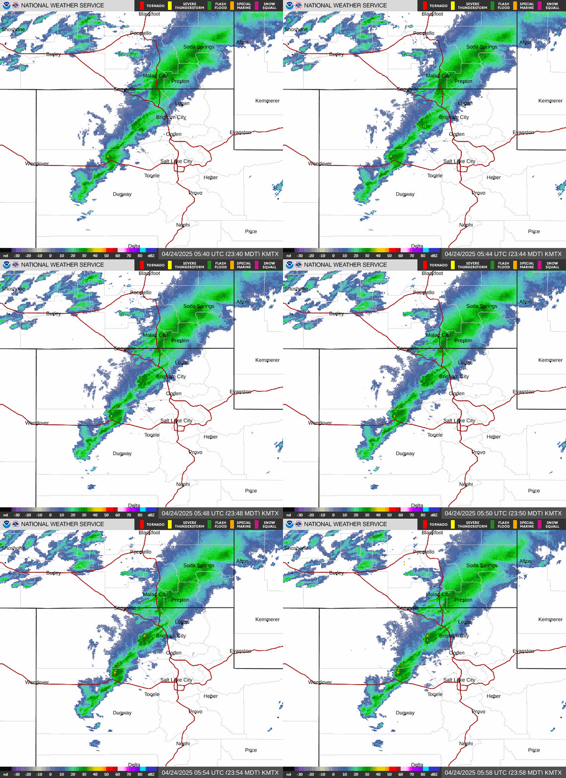
Radar: NOAA NEXRAD via the Iowa Environmental Mesonet (the Wasatch partly blocks the Salt Lake City radar's view of Park City, so light mountain snow can be missed). Rain totals: NOAA MRMS. Snow depth: NOAA NOHRSC. Base map: USGS The National Map.
Park City Weather FAQ
What is the weather in Park City right now?
Right now, near the top of this page, shows the current temperature, conditions and wind from the nearest National Weather Service station reporting (SR-224 at Meadows Drive, or the Heber Valley Airport), with today's high and low and sunrise and sunset.
Is there a weather warning or advisory for Park City?
Any National Weather Service warning, watch or advisory for Park City (the Wasatch Back and Summit County) shows at the top of this page with what to expect and what to do. If nothing is listed, none is in effect.
Will it snow in Park City this week?
The 7-day forecast and the Snow section show how much snow the National Weather Service expects in town over the next 24, 48 and 72 hours. Totals at the resorts, which sit 2,000 to 3,000 feet higher, are usually much larger: see the Park City snow report.
Why is the forecast different in town and on the mountain?
Park City sits at about 7,000 feet and the ridgelines above it reach 10,000 feet. Higher up it is colder, windier and snowier, and a storm can bring rain in town while it snows on the slopes.
Where does this forecast come from?
The forecast, alerts and forecasters' key messages come from the National Weather Service office in Salt Lake City, which covers Park City. Radar is from the NWS Salt Lake City radar.
How often is this page updated?
Alerts every 5 minutes, the forecast and current conditions every 30 minutes (every 10 minutes early in the morning) and the forecast discussion hourly.
Forecast, alerts and current conditions from the National Weather Service (Salt Lake City office; conditions from the SR-224 at Meadows Drive station), updated 2 hours ago.