Rocky Canyon Fire evacuation preparations expand as Franklin Canyon area moves to Set

Residents south of Franklin Canyon to Icy Springs and Wohali Way told to be ready to leave at a moment’s notice
SUMMIT COUNTY, Utah — Summit County officials escalated evacuation preparations Monday afternoon as the Rocky Canyon Fire continued burning at more than 13,000 acres with thunderstorms and strong winds expected over the fire area.
The area south of Franklin Canyon to Icy Springs and Wohali Way was moved to Set status at 12:25 p.m. Monday, according to a Summit County emergency alert. Residents should load vehicles with go-bags and essential belongings and be prepared to leave at a moment’s notice. The Set designation is not an evacuation order.
The change marks an escalation from Sunday night, when Franklin Canyon to Icy Spring and Wohali Way had been listed in Ready status.
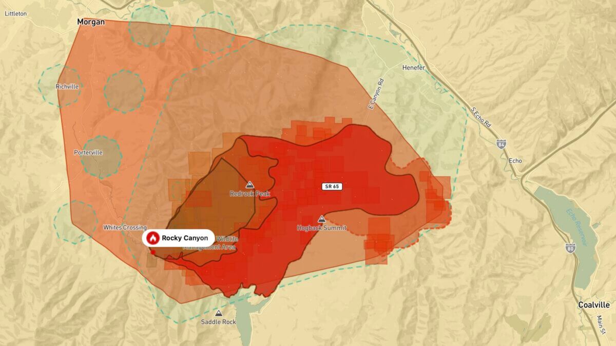
Mandatory evacuation orders remain in effect for residents from the Summit County line at Hog Back Summit to West Henefer Road on both sides of the road, Henefer residents west of 300 West and residents on both sides of South Henefer Road, also known as Ditch Road.
The remainder of Henefer remains in Set status, meaning residents should be packed, highly alert and prepared to evacuate immediately if conditions deteriorate.
Morgan County also issued a Ready notice at 9:50 a.m. Monday for Highway 66 from White’s Crossing toward Tifie Ranch. Residents there were told to prepare for possible evacuation.
An existing mandatory evacuation order in Morgan County remains in place for residents from White’s Crossing to East Canyon Dam, an order issued Sunday as the fire expanded.
The changes come as firefighters prepare for potentially difficult weather Monday afternoon.
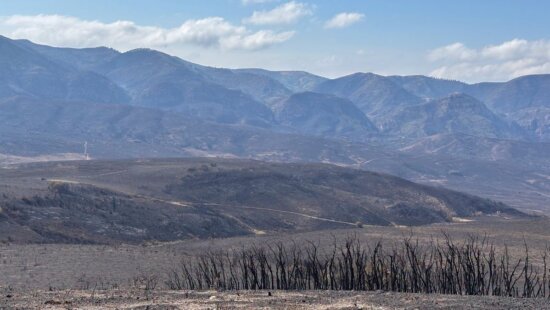
The Rocky Canyon Fire remained at 0% containment and more than 13,000 acres Monday morning, according to the Northern Utah Interagency Type 3 team. Fire officials said the blaze had grown and a mapping mission was expected Monday to provide a more precise acreage.
Firefighters reported progress overnight along the southern portion of the fire. Strategic firing operations between Hog Back and East Canyon Dam held, keeping the fire within its perimeter there and continuing to protect East Canyon State Park. The fire’s edge began cooling around 3 a.m., allowing crews to begin mop-up operations.
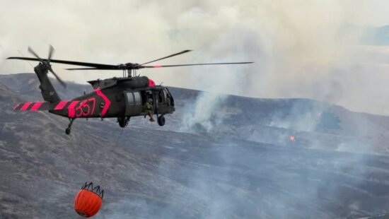
The northern and eastern sides remain more challenging. The fire has crossed Franklin Canyon, where difficult terrain limits access. Crews are working directly along the fire where possible, with dozers, ground crews and aircraft being used to slow its progression and protect structures.
Fire officials identified protection of the I-80/I-84 junction as a priority Monday, saying the southeast corner of the fire still has the potential for additional growth that could affect the transportation corridor.
Weather is expected to complicate suppression efforts. Isolated thunderstorms were forecast over the fire area Monday, becoming more likely around 2 p.m., with the potential for lightning and sustained winds of about 45 mph.
Those conditions follow rapid growth Sunday, when winds around 40 mph pushed the fire northeast toward Henefer and I-84. The fire spotted across SR-65 and pushed east and southeast toward the I-80/I-84 junction.
Helicopters are also drawing water from Rockport State Park. Boat ramps are temporarily closed, and visitors are prohibited from entering the water while aircraft operate. The park remains open for land-based recreation.
Residents in affected areas should continue monitoring official Summit and Morgan county emergency notifications as evacuation statuses may change quickly.


2266 E Garfield Avenue
Salt Lake City, UT 84108