Weather
Late July monsoon season may bring some fire and drought relief to Park City
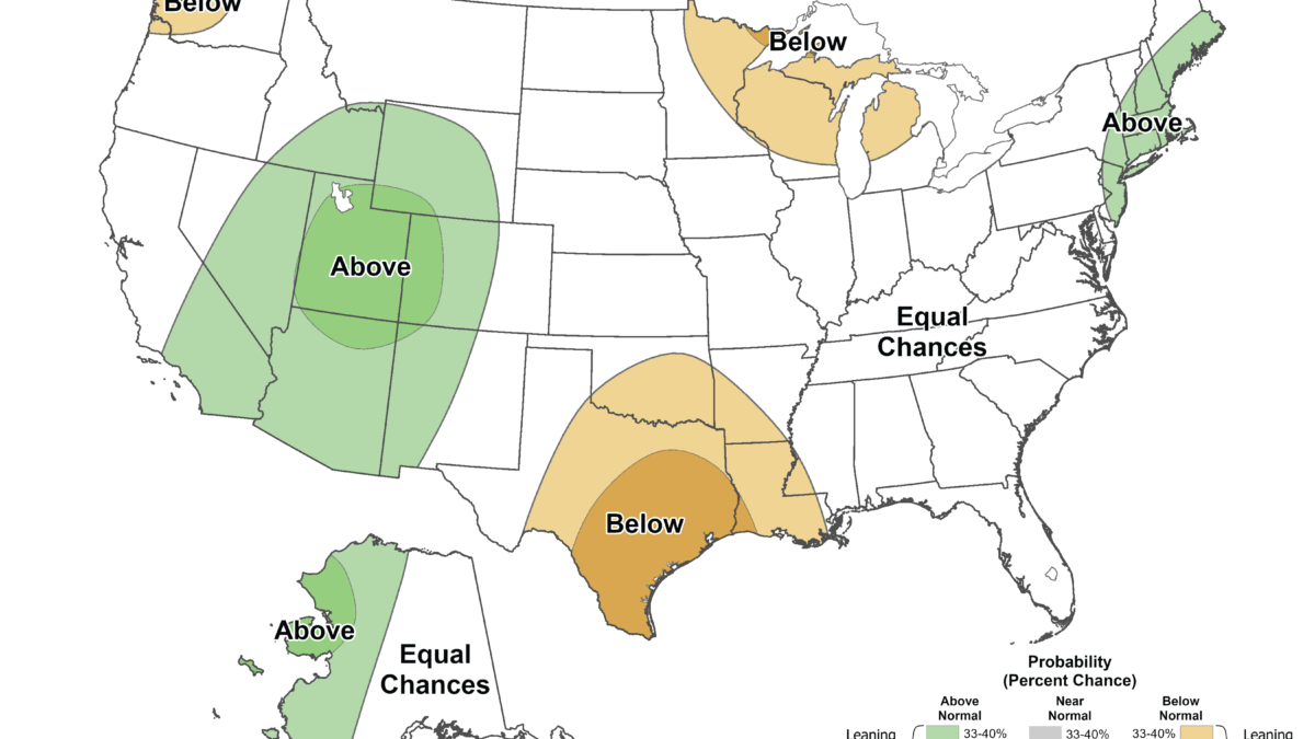
NOAA Climate Prediction Center seasonal precipitation outlook for July through September 2026. Green shading across Utah and the Four Corners indicates elevated odds of above-normal precipitation, with most of the region in the 33 to 40% range and a core area reaching 40 to 50%. Photo: NOAA/CPC
Forecasters are predicting an above-average monsoon season that could ease Utah's extreme fire danger by late July, but it won't be enough to break the drought.
PARK CITY, Utah — An above-average monsoon season is in the forecast for Utah, the best hope yet for relief across the state. But the rain is still weeks from reaching Park City and Summit County, where drought has deepened and fire danger just hit its highest level of the summer.
Fire danger now at “extreme”
Conditions have escalated fast. Officials raised Summit County’s fire danger to “extreme” on June 24 as thunderstorms moved into the Wasatch Back, with forecasters warning of damaging winds up to 60 mph and lightning. Stage 1 fire restrictions have been in effect across all state and unincorporated lands since June 6, prohibiting most open fires, fireworks, and equipment that could spark a blaze, with the same rules applying in Park City.
Statewide, the picture is grim. Utah Fire Info reported 353 wildfires this season as of Thursday morning, 268 of them human-caused, having burned a combined 141,743 acres. The state’s largest blaze, the Cottonwood Fire near Beaver, has spread into Eagle Point Resort, destroying several cabins and structures after igniting Monday near Cottonwood Campground off State Route 153 in the Fishlake National Forest.
A dire statewide picture
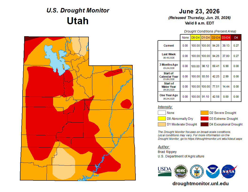
U.S. Drought Monitor map for Utah, valid June 23, 2026. Severe (orange), extreme (red), and exceptional (dark red) drought now cover the entire state, with extreme drought expanding to 39.13% over the past week.
The numbers behind the fire risk are stark. In the U.S. Drought Monitor reading valid June 23, all of Utah remained in drought, with 94% in severe drought or worse and 39% in the extreme-to-exceptional range. Governor Cox has declared a statewide drought emergency, and Lake Powell sits at 24% capacity, a June 1 low matched only by the mid-to-late 1960s when the reservoir was first filling.
When the rains are expected
Relief, if it comes, arrives in stages from south to north, and Park City is last in line. Monsoon season typically begins in late June in southern Utah and spreads into the rest of the state in early July. As the pattern matures through mid-July, it gradually expands into northern Utah and Colorado, putting the realistic window for the Wasatch Back at mid-to-late July at the earliest. Forecasters say the first part of the season favors regions to Utah’s south and east.
There are signs this season could start sooner and last longer than usual. Utah’s assistant state climatologist says several indicators point toward an earlier start, with conditions favorable for moisture to push farther inland. The bigger payoff may come later: El Niño-driven tropical storm moisture from the eastern Pacific is forecast to make its largest impact in August and September.
Holding out hope
NOAA’s Climate Prediction Center favors above-average precipitation for Utah this summer, placing the wet signal across the Intermountain West and Four Corners, with Utah generally in the 33 to 40% probability range and some areas reaching 40 to 50%. Long-range models, including the North American Multi-Model Ensemble, lean toward above-average seasonal rainfall.
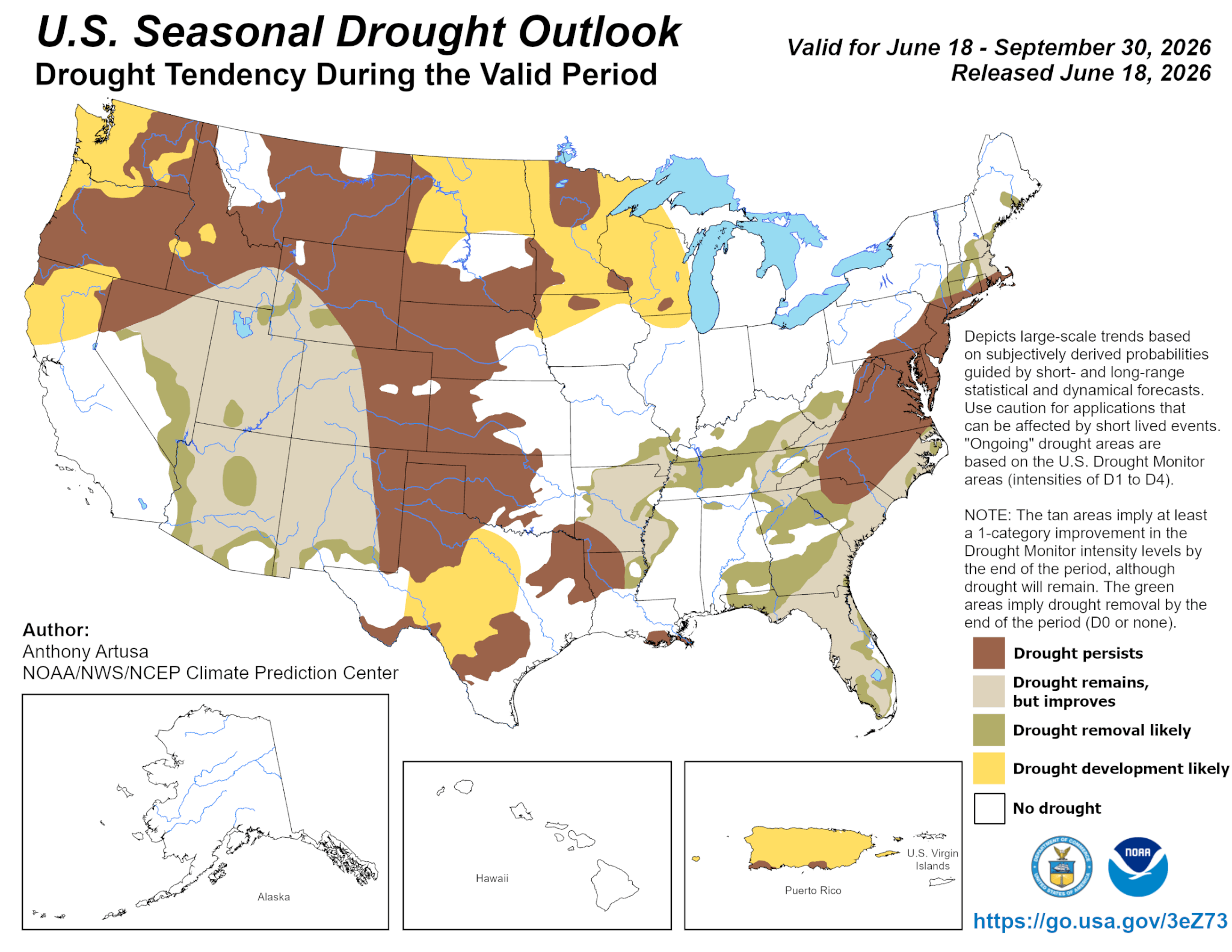
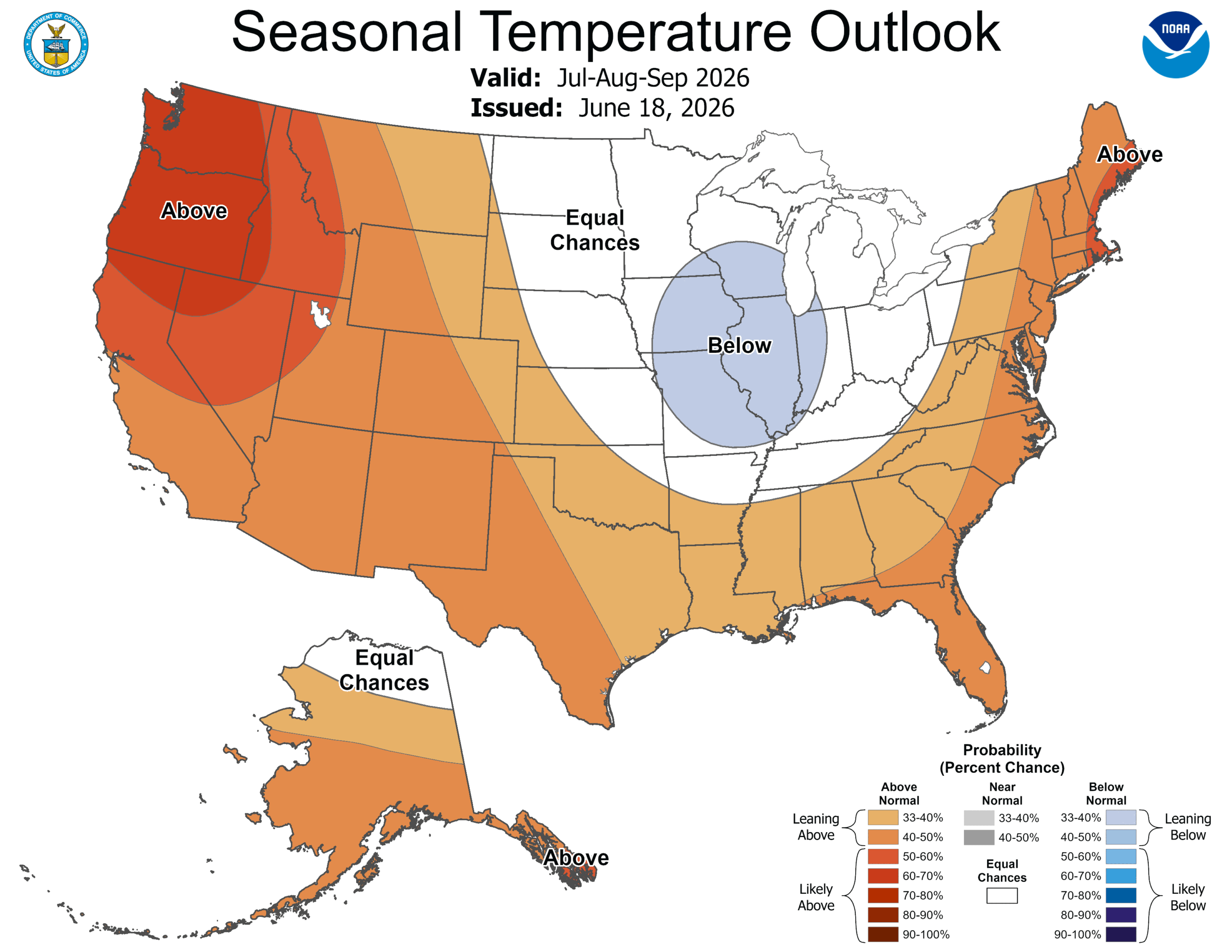
But forecasters are clear about the limits. An active monsoon would ease short-term drought by boosting soil moisture and lowering fire danger, but the long-term impacts of last winter’s record-low snowpack will remain, and reservoir levels are unlikely to change much. In a region where roughly 95% of the water supply comes from snowpack, summer downpours help the landscape far more than the water supply. The monsoon is also notoriously variable, and the heat fueling it is forecast to persist, with the interior West showing 50 to 60% odds of an above-normal-temperature summer.
By: TownLift

4539 S Willow Road
Holladay, UT 84117
10584 Basin Canyon Road
Park City, UT 84098
24 South 600 East
Salt Lake City, UT 84102
19 East 100 North
Spring City, UT 84662
965 Goshen Canyon Road
Mona, UT 84645Talk of the Town


Park City Jobs

Assistant Manager, LOMA
2 days ago Full time $35.00 hourly
Property Inspector, Park City Rental Properties
3 days ago Full time $23.00 - $25.00 hourly
Owner Relations Manager, Park City Rental Properties
3 days ago Full time
Operations Manager, Park City Rental Properties
3 days ago Full time

Hiring Barista Assistants and Baristas, Silver King Coffee
5 days ago Part time $17.00 - $30.00 hourly