August forecast favors more monsoonal moisture across Utah, Great Basin

PARK CITY, Utah — Park City has seen over two inches of rain in the past 10 days from recent monsoons delivering strong evening storms, and more may be coming next month.
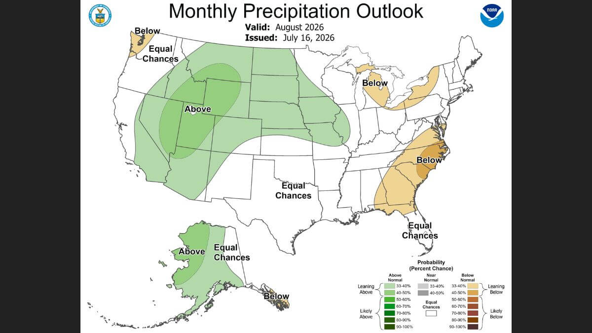
The NOAA Climate Prediction Center’s August outlook favors above-normal precipitation across much of Utah and the Great Basin, making the region one of the few areas in the country with an increased likelihood of seeing more rainfall than average during the month.
A wetter-than-normal August could continue to provide relief across Utah as the state continues to battle drought and an active wildfire season, according to the latest monthly outlook from the National Oceanic and Atmospheric Administration.
The forecast is tied to an expected continuation of the North American monsoon, which typically brings afternoon thunderstorms to the Intermountain West during late summer.
For Summit and Wasatch counties, the outlook could mean more frequent thunderstorms through August, bringing much-needed moisture to landscapes stressed by months of dry weather. The additional rainfall could help moderate wildfire conditions, though officials caution it is unlikely to eliminate fire danger altogether.
The forecast comes as Utah continues to contend with multiple wildfires, including several in northern Utah, despite recent storms that temporarily improved fuel moisture in some areas.
While the precipitation outlook offers reason for optimism, monsoonal thunderstorms can also create new hazards. Lightning remains a leading cause of wildfires in Utah, and storms can produce strong outflow winds, localized flooding and debris flows, particularly in steep terrain and recently burned areas.
The Climate Prediction Center’s outlook is based on probabilities rather than a day-by-day forecast. A wetter-than-normal outlook means precipitation is more likely to total above the historical average over the course of the month, but it does not guarantee daily rainfall or continuous wet conditions.
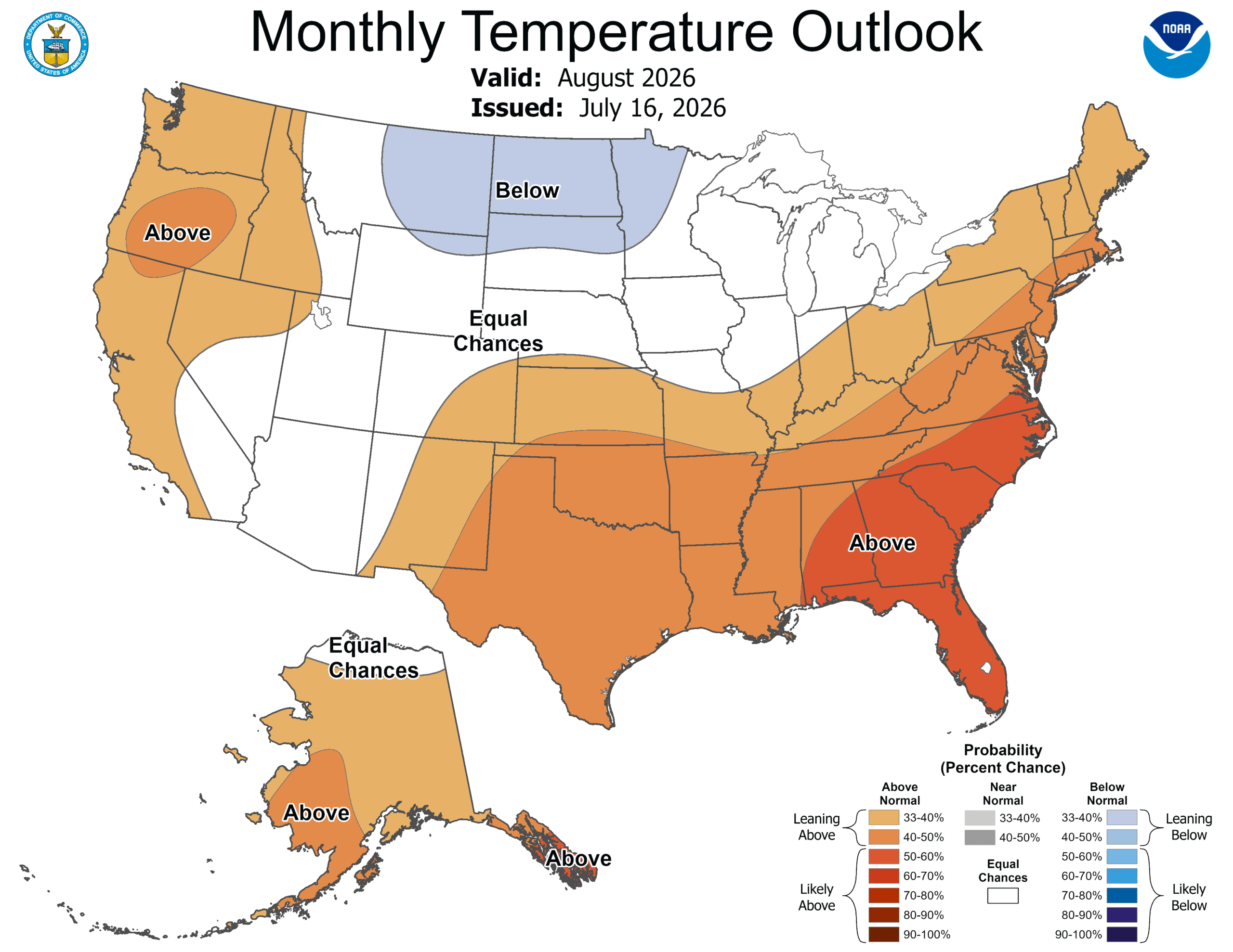
The temperature forecast for the Intermountain West shows the are equal chances for above and below average temperatures through August.
Recent monsoonal moisture has already prompted state officials to ease some wildfire-related restrictions. Earlier this week, Gov. Spencer Cox returned primary authority over fireworks restrictions to municipalities after storms improved fire conditions in parts of Utah, while allowing local governments to maintain stricter rules where wildfire risk remains elevated.
Even if August delivers above-average rainfall, fire officials continue to urge residents to use caution outdoors, as vegetation can dry quickly between storms and lightning strikes can ignite new fires despite wetter overall conditions.


2266 E Garfield Avenue
Salt Lake City, UT 84108