Weather
Warm storm brings rain to Park City, upper mountains could see significant accumulation
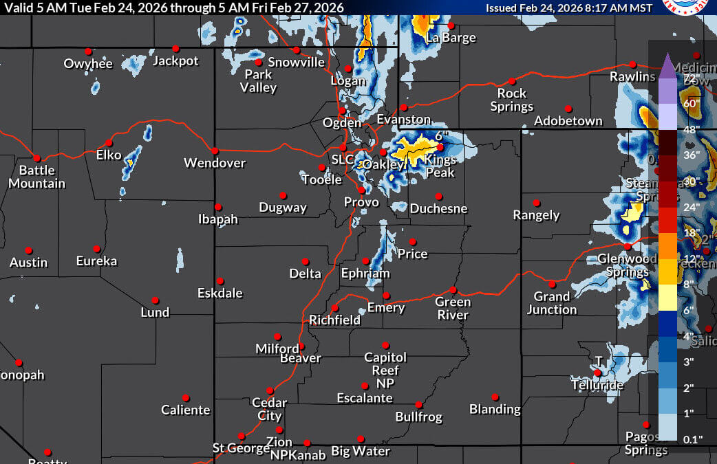
Expected snow totals, Feb. 24-27, 2026 Photo: NOAA
Snow starts in the mountains Tuesday, but rising temperatures will turn most of the storm to rain before it's over
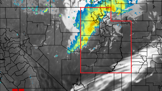
PARK CITY, Utah — A winter weather advisory is in effect for elevations above 8,000 feet in the Wasatch and Western Uinta Mountains from 8 a.m. Tuesday through 5 p.m. Wednesday, according to the National Weather Service in Salt Lake City. For Park City, the storm tells two very different stories depending on where you’re standing on the mountain.
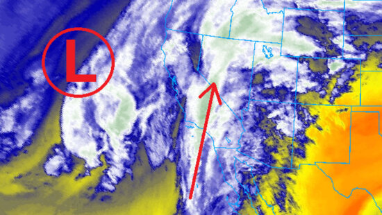
Westerly winds are already building ahead of the system, which is arriving on southwest flow. The timing of precipitation remains somewhat uncertain, with the Utah Avalanche Center estimating a late morning through afternoon arrival Tuesday. At valley level, expect a mix of rain and snow before 2 p.m. transitioning to straight rain through the afternoon and evening, with a high near 45 degrees.

A rain-on-snow event, not a powder day
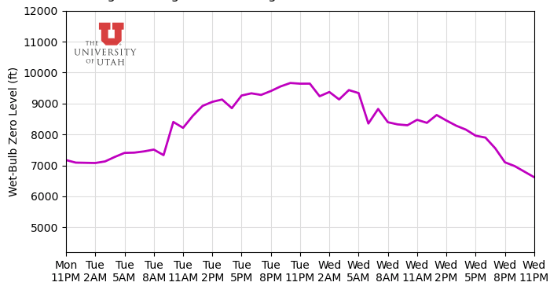
The warm nature of this storm is the defining characteristic skiers and backcountry users need to understand. Freezing levels will start around 7,800 feet Tuesday morning before rising as high as 9,800 feet by evening, meaning rain-on-snow is the more likely scenario than a full snow event for much of the day. The UAC estimates around a half-inch of liquid water input by 8 p.m., with not a significant amount of snow expected at most elevations before then.
Snow levels are forecast to begin around 6,500 feet at the onset of precipitation before rising quickly to 8,000 feet by Tuesday afternoon, and potentially reaching 10,000 feet overnight under heavier precipitation. The NWS describes the snow character as heavy and wet given the warm storm track.
Upper ridgelines will see the most significant wind impact, with gusts reaching up to 80 mph possible on exposed terrain. Travel on high-elevation routes including the Upper Cottonwoods, Logan Summit, and Wolf Creek Pass could be difficult through the advisory period, and traction law restrictions may be enacted. Gusty winds could also bring down tree branches.
What skiers can expect at area resorts
For those planning to ski Tuesday or Wednesday, total accumulations will vary considerably by resort elevation. Alta and Snowbird, which top out well above 10,000 feet, stand to pick up the most snow once the system fully loads overnight into Wednesday, with high-end estimates reaching 23 and 20 inches respectively. Park City Mountain Resort and Deer Valley, sitting at lower summit elevations, are forecast for more modest totals.
| Resort | Low | Mid | High |
|---|---|---|---|
| Alta | 2″ | 10″ | 23″ |
| Snowbird | 2″ | 10″ | 20″ |
| Park City Mountain Resort | 0.5″ | 3″ | 6″ |
| Deer Valley | T | 1″ | 3″ |
Wednesday brings continued wet conditions at valley level, with rain likely through the afternoon and a chance of thunderstorms. Snow levels may briefly return to the valley floor Wednesday night before the system clears.
Avalanche danger elevated heading into the storm
The Utah Avalanche Center is flagging elevated concern heading into this system, and the mechanics of the storm are a key reason why. That combination of rain loading onto an existing snowpack is a classic driver of avalanche instability, particularly on slopes that have already seen significant accumulation this season.
Dangerous backcountry conditions already exist ahead of the storm’s arrival, according to the UAC. Backcountry users are urged to check current forecasts at utahavalanchecenter.org before heading out and exercise extra caution through the advisory period.
Looking ahead
After the system clears Wednesday night, conditions improve quickly. Thursday brings mostly sunny skies and a high near 46 degrees. Friday looks even warmer with sunshine and a high near 52. The weekend introduces another chance of rain returning Saturday and persisting into Sunday, with a possible thunderstorm Sunday. Temperatures remain mild through early next week, with highs holding in the upper 40s to low 50s.
By: TownLift

4739 W Snowflake Drive
Highland, UT 84003
2410 W Entrada Trail, Unit #4
St. George, UT 84770
950 S Aspen Circle
Woodland Hills, UT 84653
1011 E Mill Road
Heber City, UT 84032Talk of the Town


Park City Jobs

Marketing Manager, Junction Commons
Today Full time
LEAD BARTENDER, VR Inc
Today Full time $21.00 - $22.00 hourly
Venue & Event Coordinator (Kimball Arts Festival VIP Lounge), Kimball Art Center
7 days ago Seasonal $20.00 - $22.50 hourly

Summer Garden Educator and Counselor, Summit Community Gardens and EATS
8 days ago Seasonal $19.00 - $20.00 hourly

Job Fair May 26 2026, Grand Hyatt Deer Valley
9 days ago Full time