Weather
Avalanche danger expected to spike across Utah this week as storms bring in long-awaited snow
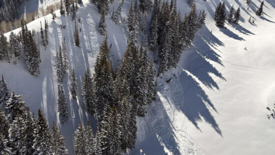
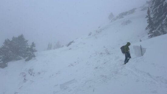
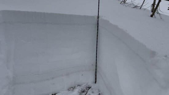
Photos of a backcountry avalanche in the Dutch Draw area from February 8, 2025. Photo: Summit County Sheriff
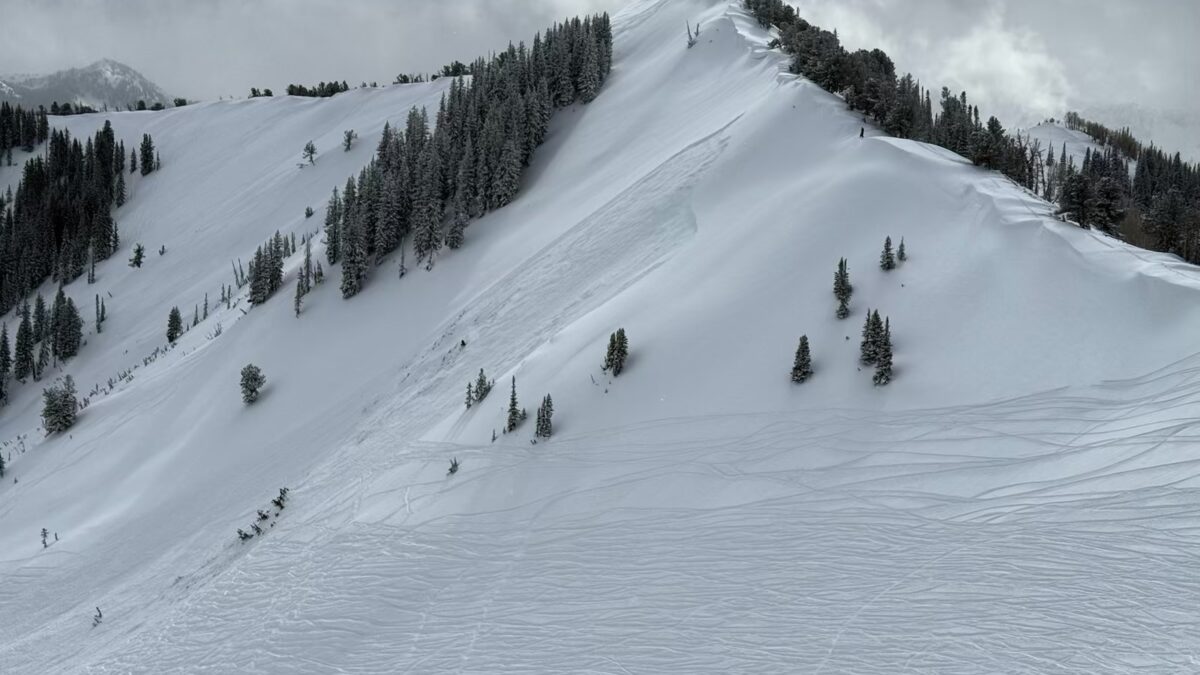
SALT LAKE CITY, Utah — A strong winter storm is set to hit northern, central, and southwestern Utah beginning Tuesday, bringing heavy snowfall and strong winds that forecasters say will rapidly increase avalanche danger across the state.
The Utah Avalanche Center warns that this storm will stress fragile mid-winter snow layers, creating highly unstable and complex avalanche conditions. Large natural avalanches, as well as avalanches triggered by people, are likely.
“Even though low elevations remain mostly bare, avalanches will occur where snow exists at higher elevations,” the center said in its advisory.
Why the Risk is So High
Avalanche experts explain that the incoming storm will overload weak, faceted snow layers that formed during a dry spell earlier this winter. This type of setup is known for producing unpredictable avalanches that can travel farther and break wider than expected.
Even after the storm passes, these unstable layers will persist, meaning avalanche danger will remain elevated in affected areas.
Safety Tips for Mountain Travelers
The Utah Avalanche Center urges anyone heading into the backcountry to take extra precautions:
- Avoid slopes steeper than 30 degrees.
- Never travel alone in avalanche terrain. Groups should carry and know how to use a transceiver, probe, and shovel.
- Skiers or snowboarders leaving resort boundaries are immediately in avalanche-prone backcountry.
- Stay up-to-date with the latest forecast at utahavalanchecenter.org
Anyone with questions can contact the Utah Avalanche Center, Forecaster on Duty at 801-365-5522, option 2.
The center’s warning underscores the importance of caution as Utah heads into a potentially dangerous week for winter recreation.
By: Heather Bergeson

10584 Basin Canyon Road
Park City, UT 84098
19 East 100 North
Spring City, UT 84662
965 Goshen Canyon Road
Mona, UT 84645
24 South 600 East
Salt Lake City, UT 84102Talk of the Town


Park City Jobs

Assistant Manager, LOMA
7 days ago Full time $35.00 hourly
Property Inspector, Park City Rental Properties
8 days ago Full time $23.00 - $25.00 hourly
Owner Relations Manager, Park City Rental Properties
8 days ago Full time
Operations Manager, Park City Rental Properties
8 days ago Full time

Hiring Barista Assistants and Baristas, Silver King Coffee
10 days ago Part time $17.00 - $30.00 hourly