Weather
Up to 3 feet of snow headed for Cottonwood Canyons, Park City under winter weather advisory
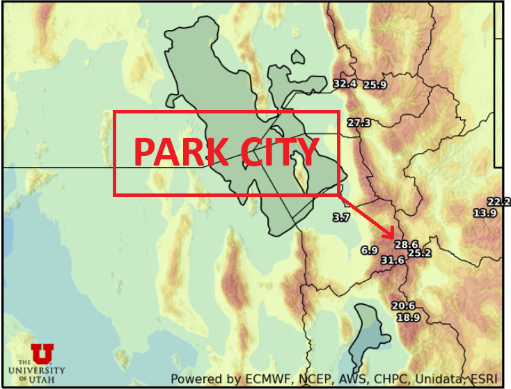
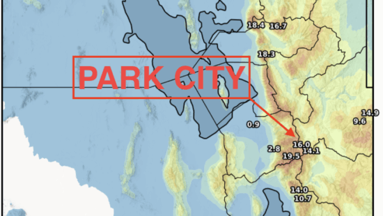
Photo: Utah Snow Ensemble model output total snowfall through Friday // UofU Dept. of Atmos. Sciences
1 to 2 feet of snow expected for Park City / Deer Valley resorts by Friday
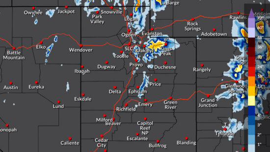
PARK CITY, Utah – As the last storm system just barely exited the area yesterday, another stronger winter storm is already impacting California and making its way to Utah, arriving later today. The Monday-Tuesday storm ended up dumping 24” of snow in Little Cottonwood and about 12” in Big Cottonwood, while the Park City area mountains drew the short end of the stick and only received about 5” of snow.
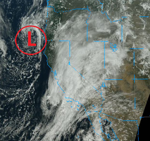
This next storm system, beginning this afternoon in the mountains, is taking a similar southerly track as we saw with the storm earlier in the week. However, there is a weak atmospheric river providing abundant moisture streaming across southern California currently, and this is a longer duration event, lasting through Friday evening.
Forecast snow totals through Friday
- Cottonwood Canyons: 24 – 38”
- Park City / Deer Valley: 14 – 24”
- Town of Park City: 5 – 10”
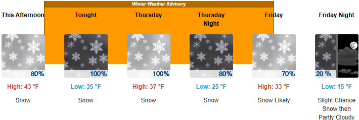
The first phase of this storm starting later this afternoon will be warm, wet, and windy, possibly favoring the Deer Valley area early on. Things change however on Thursday evening as the colder air and main low-pressure center arrive, and this is yet again the part of the storm that should tilt the odds in favor of the Cottonwoods, with snow persisting through at least Friday afternoon. Cold overnight temperatures in the teens will linger into the weekend as skies clear, with mild daytime temps.
To keep up with realtime conditions, check out our webcams on TownLift.
By: Adam Lenkowski

371 N Pinion Hills Drive
Dammeron Valley, UT 84783
8905 Parleys Lane
Park City, UT 84098
1475 E Lakewood Drive
Salt Lake City, UT 84117
1511 S Valley View Circle
Springville, UT 84663
2075 E Munsey Drive
Moab, UT 84532Talk of the Town


Park City Jobs

Property Manager, Mountain Estates Property Management
Today Full time
Social Media & Marketing Coordinator - Slopeside Village & Skyview Residences, EMG
1 day ago Full time $20.00 - $22.00 hourly
Maintenance Technician - Multiple Sites, EMG
1 day ago Full time $22.00 - $26.00 hourly
Property Manager - Skyview Residences, EMG
1 day ago Full time $63,000 - $65,000 yearly