Weather
Quick hitting storm this afternoon through tomorrow morning bringing 4-6″ to Park City mountains
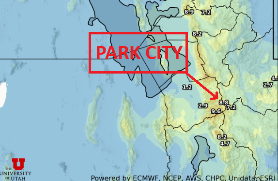
Total snow through Saturday evening Photo: UofU Dept. of Atmospheric Science
PARK CITY, Utah – Increasing southerly winds and a high temperature in the mid-40s are forecast for today with flurries possible, starting in the early afternoon. Expect snow accumulations in town to be somewhere in the 1-3” range, while the Park City mountains should see 4-6”. By mid-day Saturday snow showers should be winding down, as the storm splits from the main flow and digs far to our south before moving into New Mexico and tapping into moisture from the Gulf. Overnight lows will be dropping into the teens in the wake of the cold frontal passage Friday night into Saturday.

Tuesday storm re-cap and current snowpack
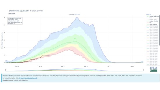
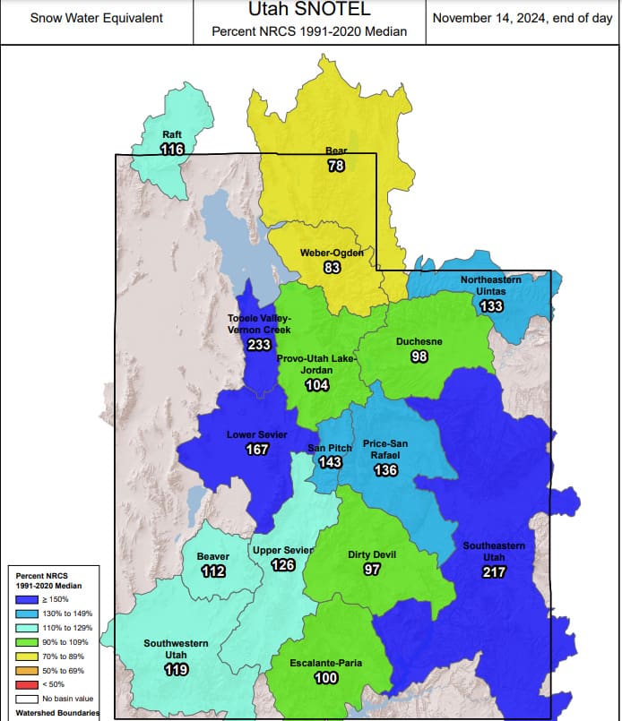
Snowfall totals from the recent storm this past Tuesday were similar to most totals we’ve seen from the past couple early season storms. Park City area mountains saw about 3-4” while Alta/upper Little Cottonwood recorded 10.” With the barrage of early season storms we’ve had since mid-October, most basins in Utah are sitting above normal.
Utah Ski Resort Totals through 11/16
| Low End Snowfall | Expected Snowfall | High End Snowfall | |
| Alta Ski Area, UT | 7 | 10 | 12 |
| Beaver Mountain, UT | 1 | 3 | 3 |
| Brian Head Resort, UT | 0 | 2 | 3 |
| Brighton Resort, UT | 5 | 8 | 9 |
| Canyons Village, UT | 3 | 6 | 7 |
| Cherry Peak Resort, UT | 4 | 6 | 8 |
| Deer Valley, UT | 2 | 4 | 5 |
| Eagle Point Resort, UT | 3 | 4 | 7 |
| Nordic Valley, UT | 3 | 4 | 6 |
| Park City Mountain Resort, UT | 3 | 5 | 5 |
| Powder Mountain, UT | 3 | 4 | 5 |
| Snowbasin Resort, UT | 6 | 8 | 11 |
| Snowbird Ski and Summer Resort, UT | 7 | 11 | 14 |
| Solitude Mountain Resort, UT | 5 | 9 | 9 |
| Sundance Mountain Resort, UT | 4 | 6 | 7 |
Long term outlook – more snow possible Monday
After a brief lull in activity on Sunday, the next low-pressure system begins to approach from the pacific northwest. It shows signs of weakening before reaching Utah, with current snowfall totals looking to be somewhere in the 2-5” range for the Wasatch.


