Weather
With high temperatures this weekend here’s what you need to know about flood risk
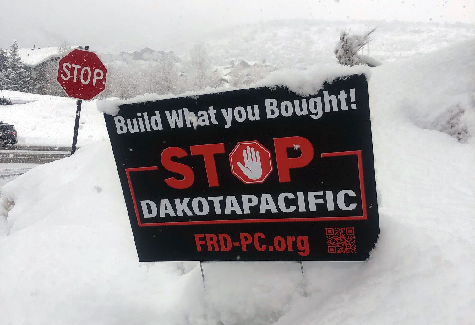
Sandbags are replacing snowbanks all around Park City. Kimball Jct Photo: TownLift
SUMMIT COUNTY, Utah — With daytime temperatures expected to reach the upper 60s over the weekend, faster snowmelt and an increased flooding risk will be present in Summit County and many other areas across the state.
Historically one of the main areas of flood concern in Park City is Silver Creek or “Poison Creek.” At NOAA’s Silver Creek flow meter located near Silver Gate Drive, the current height is 7.2 feet, with a flow of around 84 cubic feet per second(cfs). Current forecasts project a rise to 8.3 feet with a flow of 144 cfs by Tuesday, which is below the flood stage of 9 feet, but well above the action stage, where certain vulnerable locations could be affected.
In other words, the water level is projected to reach a level where action must be taken to manage the situation and monitor flow for things like obstructions. While the flow meter gives insight into what conditions the creek will see, areas within city limits, such as along the Rail Trail, could see higher levels.
Just outside of city limits is where NOAA’s McLeod Creek flow meter is located, just east of North 1300 West. Currently, the meter shows the creek at a height of 6.69 feet with a flow of 26.5 cfs, but it is projected to reach the action stage of over 8 feet with a flow of 106 cfs by Tuesday. The flood stage is listed at 8.9 feet.
While there was a spike in height between Wednesday and Thursday, where the creek peaked at 7.15 feet, the extra flow quickly disappeared in less than 12 hours.
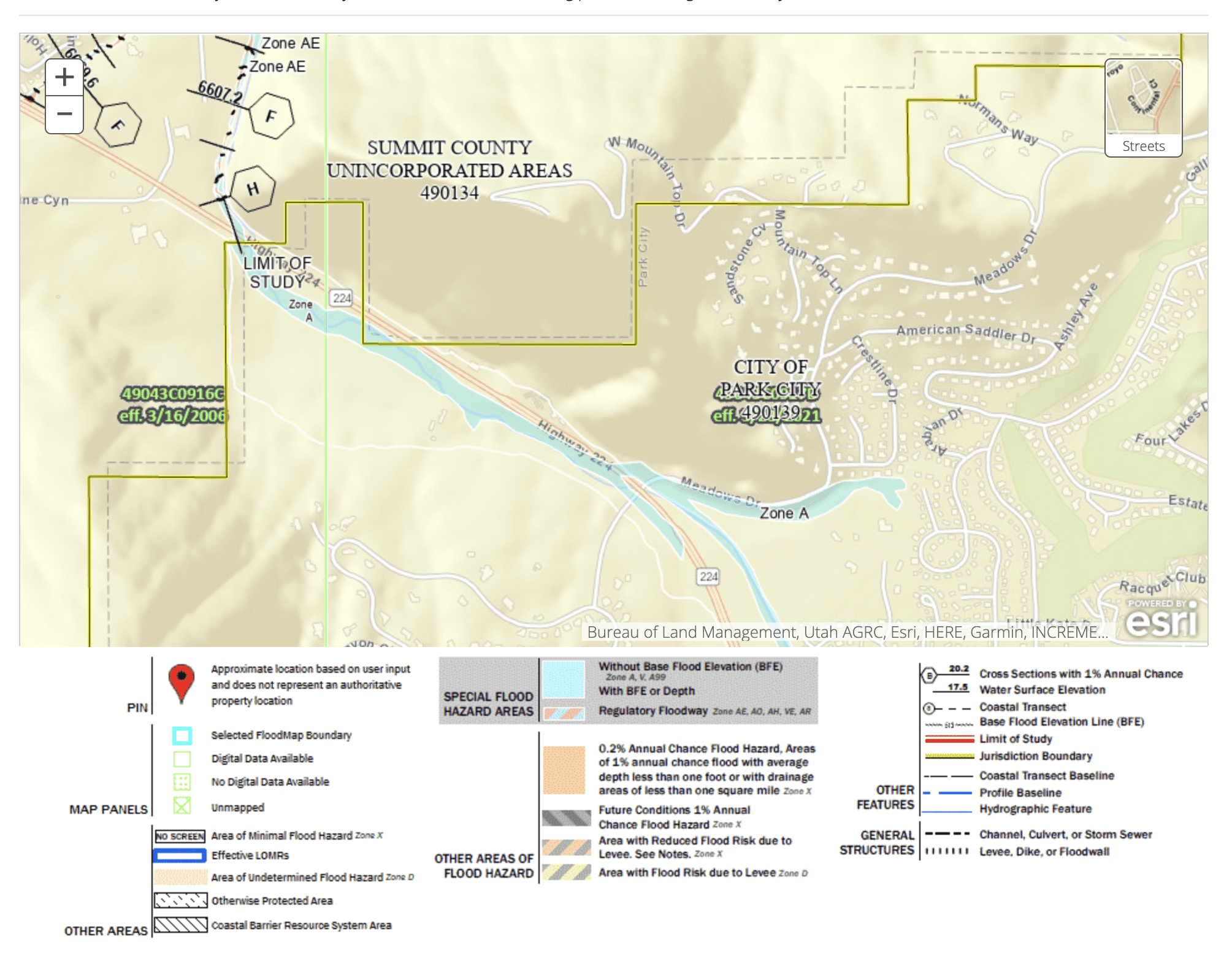
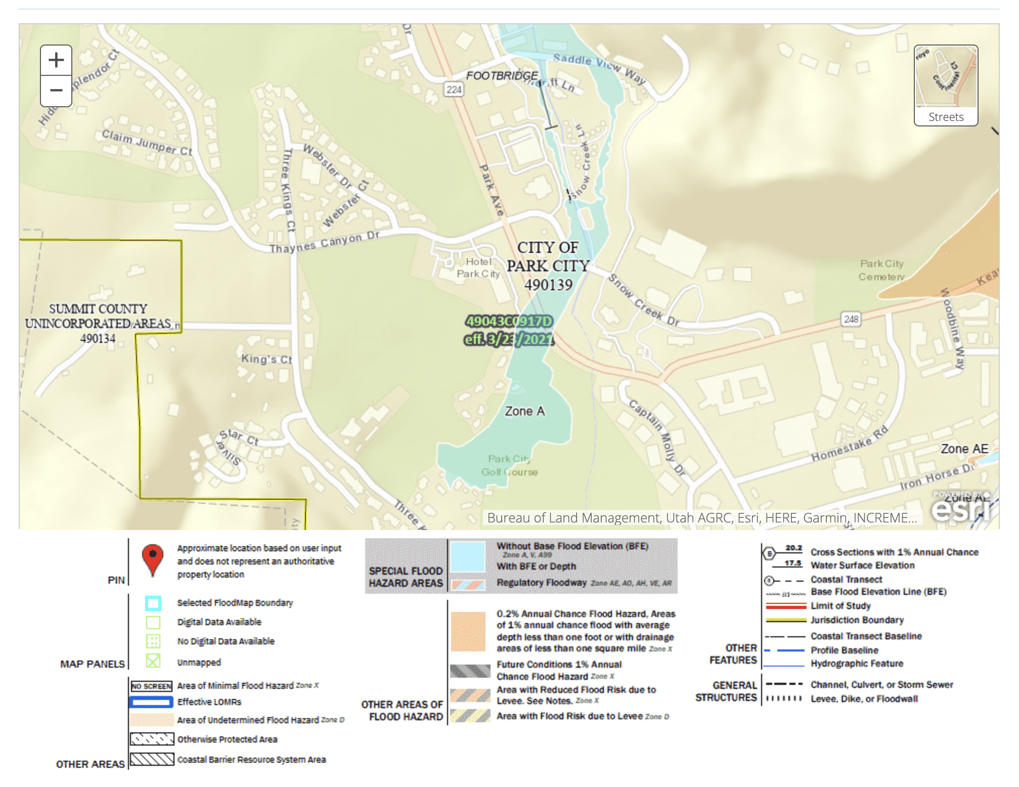
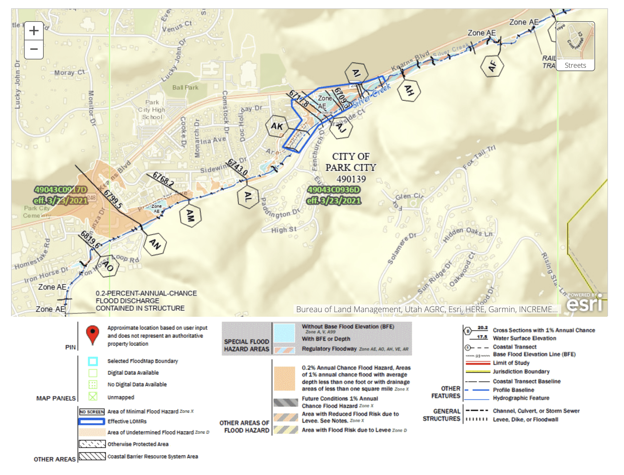
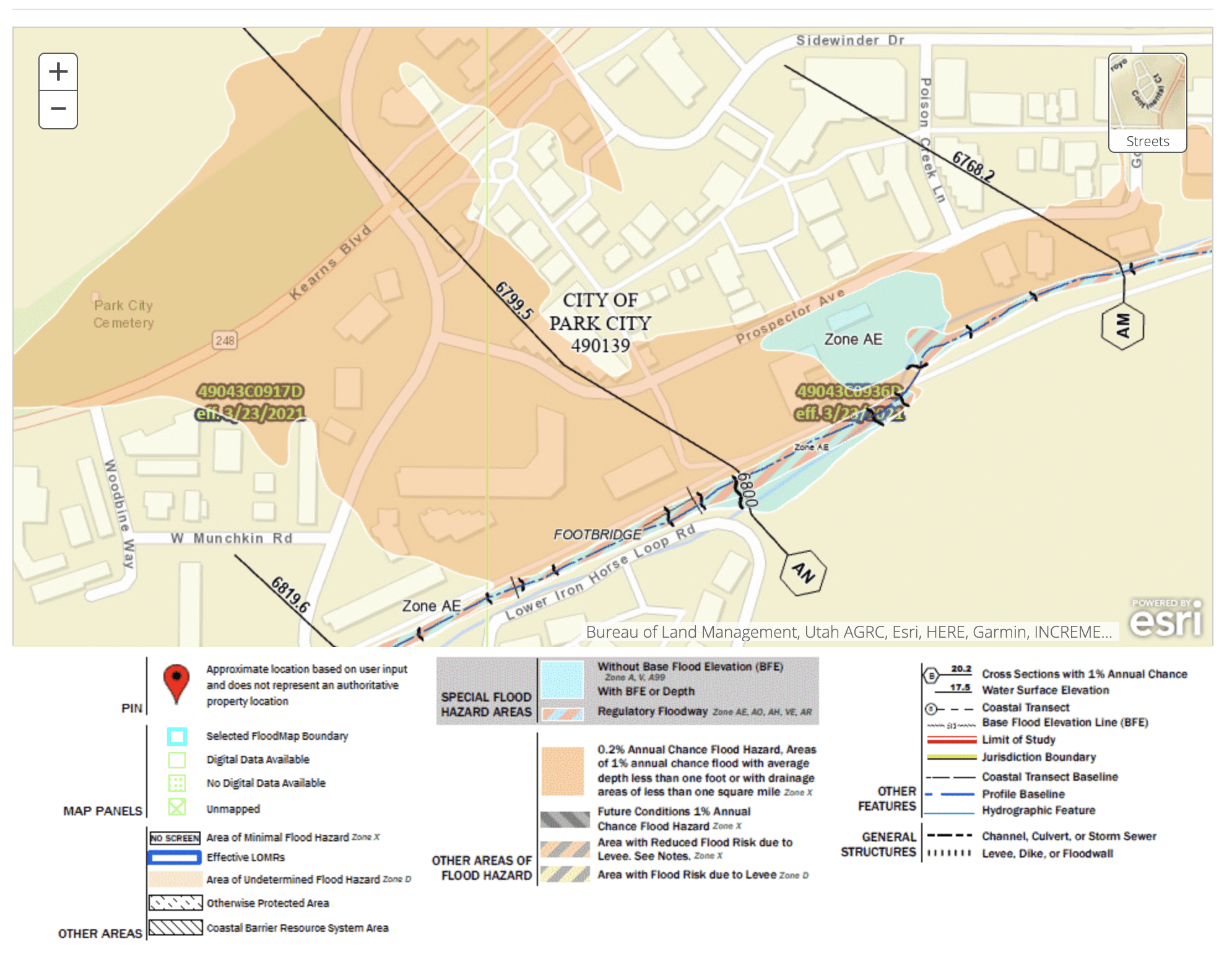
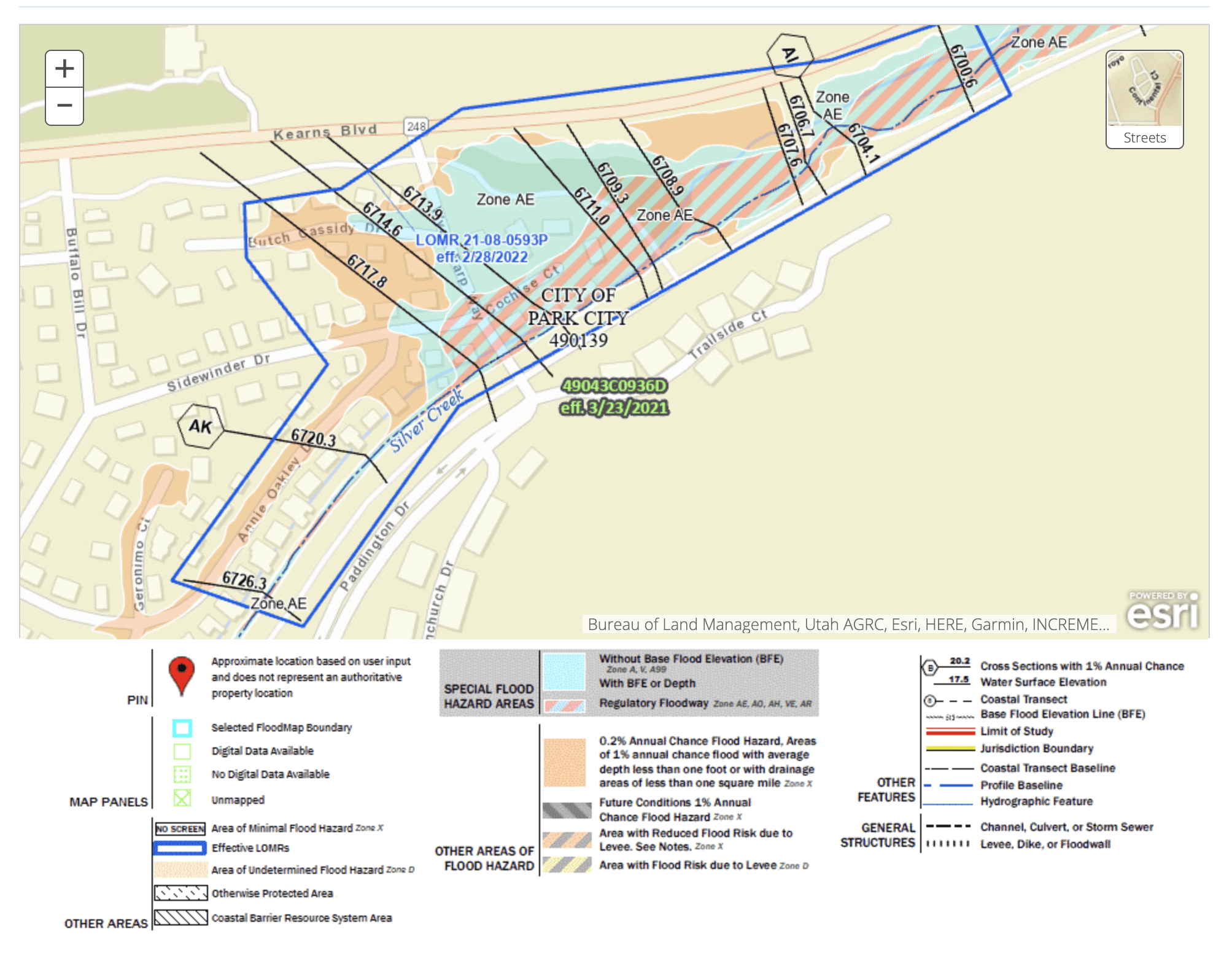
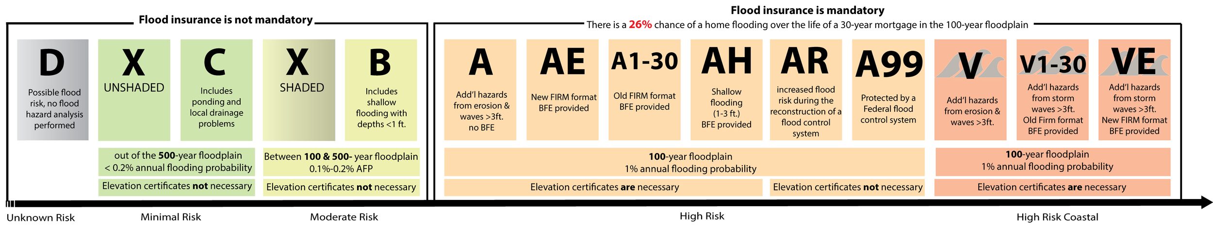
Looking at the Federal Emergency Management Agency’s (FEMA) mapping of flood risk areas anywhere where structures are built, such as businesses or homes within city limits, have, at worst, an A or AE rating, which is the base rating for high-risk areas of locations associated with rivers or stream flooding.
At either an A or AE rating, FEMA assigns a one percent annual chance of flooding and a 26% chance of flooding over 30 years, but specific data, such as the average depth of water in a flooding event, would likely reach is not collected. Moving closer to Silver Creek shows increased risk where a specific analysis has been done with each move further down the alphabet, equating to higher risk.
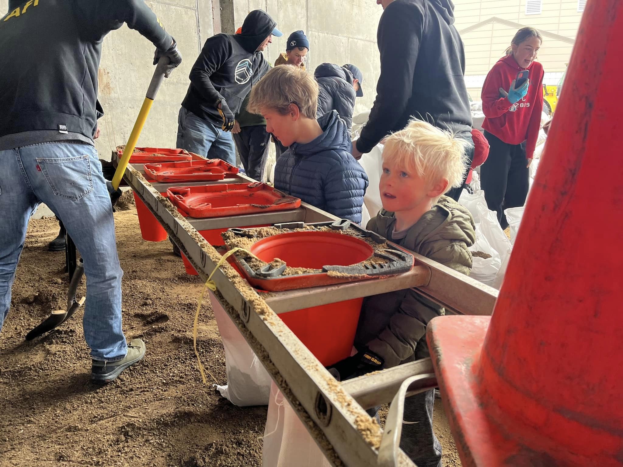
Park City Government shared this past weekend that volunteers helped fill over 1,000 sandbags at the public works department.
Residents and businesses can acquire up to 25 sandbags through a form on the Park City website or by calling 435-615-5463.
In emergencies or after hours, sandbags can be obtained by calling 435-615-5500. When calling the hotline, leave a message with your name, phone number, Park City address, and the time you would like to pick up sandbags.
In other areas of Summit County, key locations to watch would be Beaver Creek near Kamas, Silver Creek near Wanship, and areas along the Provo and Weber Rivers; however, none of the areas listed on Summit County’s Flooding 101 page show anything higher than an annual one percent chance of flooding using risk mapping created by the Utah Geospatial Research Center. Also on the Flood 101 page is information on acquiring sandbags, setting up emergency alerts, and other flood safety tips.
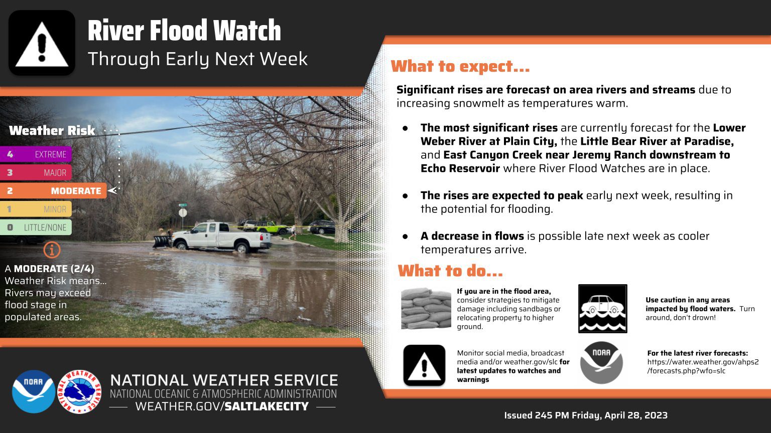
Along the Mirror Lake Byway, snowpack heights are close to five feet in many areas. The snow located at the road closure at Soapstone remains very high. The rate at which snowmelt occurs could indicate a need for concern downstream. Currently, there is no forecast showing a rise to flood levels at other NOAA flow meters in the county, including Provo River near East State Road 35, the Weber River near East Weber Wild Road, Weber River near Coalville, Weber River near Echo, East Canyon Creek at near the I-80 crossing, East Canyon Creek near Jeremy Ranch, or Chalk Creek near Coalville.
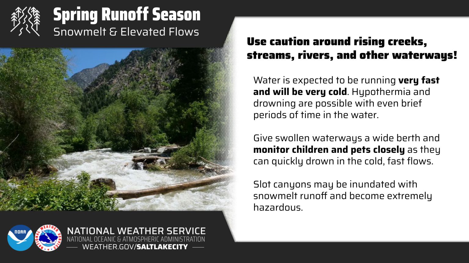
The National Weather Service(NWS) has issued a formal flood watch for the weekend at East Canyon Creek near Jeremy Ranch all the way downstream to Echo Reservoir. Lower Weber River at Plain City and Little Bear River at Paradise are two other areas mentioned in the announcement. NWS also advises that the public use caution near rising creeks, streams, rivers, and other waterways. Beyond the risk of drowning, hypothermia danger is significant, with the water being frigid.
To learn more about how flood risk mapping is created, here is a presentation by the Utah Division of Emergency Management. There is also a set of live streams produced by LVT and the Utah Division of Emergency Management that provide quick updates on the current conditions at several rivers and creeks across the state. The National Weather Service created a document on High Water Level Terminology that can help to understand changing conditions.
To find the specific flood risk at a particular address, use the FEMA Flood Map search on their website.
By: Kevin Cody

2075 E Munsey Drive
Moab, UT 84532
1511 S Valley View Circle
Springville, UT 84663
371 N Pinion Hills Drive
Dammeron Valley, UT 84783
8905 Parleys Lane
Park City, UT 84098Talk of the Town


Park City Jobs
Lodge Manager, National Ability Center
1 day ago Full time $55,000 - $56,000 yearly

Front Desk Supervisor, Black Rock Mountain Resort
2 days ago Full time $23.00 - $25.00 hourly

Sales Associate - Park City Paint, Park City Paint
3 days ago Full time $18.00 hourly
Property Inspector, Park City Rental Properties
5 days ago Full time $23.00 hourly

Junction Commons Retail Openings, Junction Commons
6 days ago Part time $16.00 - $22.00 hourly