Weather
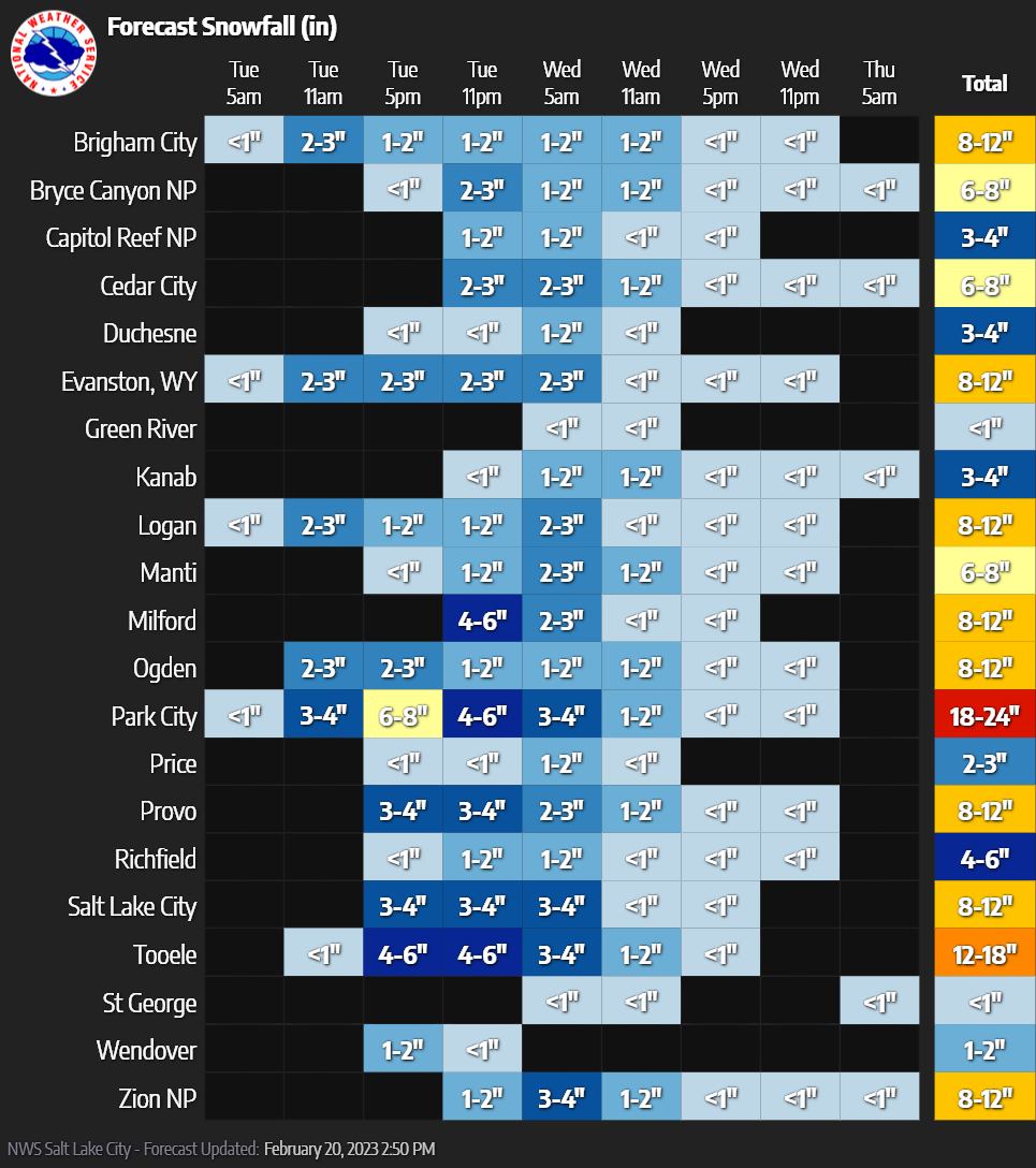
Major winter storm could bring 32-42″ of snow to Park City Mountains
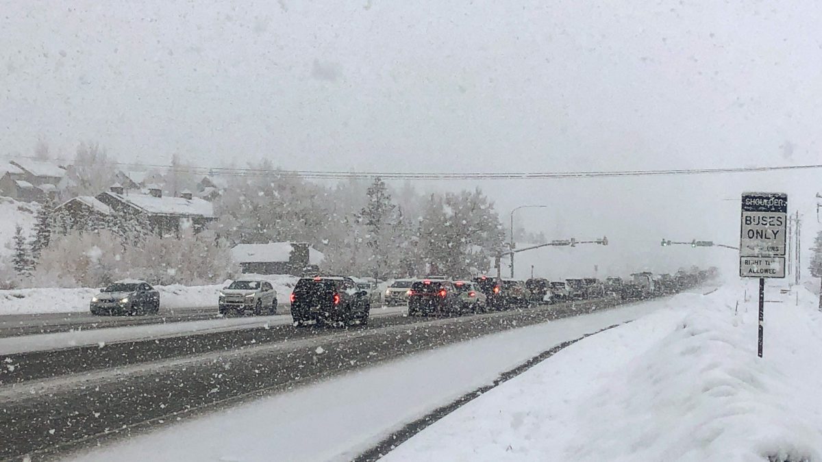
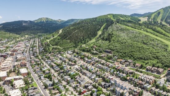
SR 224 Park City Winter Driving Conditions. Photo: TownLift.
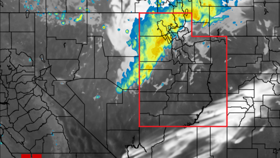
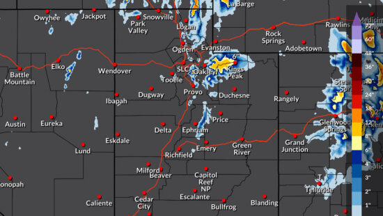
PARK CITY, Utah — A major winter storm has reached Park City after moving South through Northern Utah. This system is expected to be one of the most “impactful of the season” with reported snowfall rates in excess of 2″/hr. 18″ – 24″ of snow is predicted for Park City while the Utah Avalanche Center is estimating somewhere between 32-42″ of new snow in the mountains by Thursday morning. With all that new snow the UAC urges caution –
“We have a lot of water, snow, and wind on tap for the next few days. The avalanche danger is going to rise, the storm snow will be unstable, and we are going to see avalanches within the new snow.”
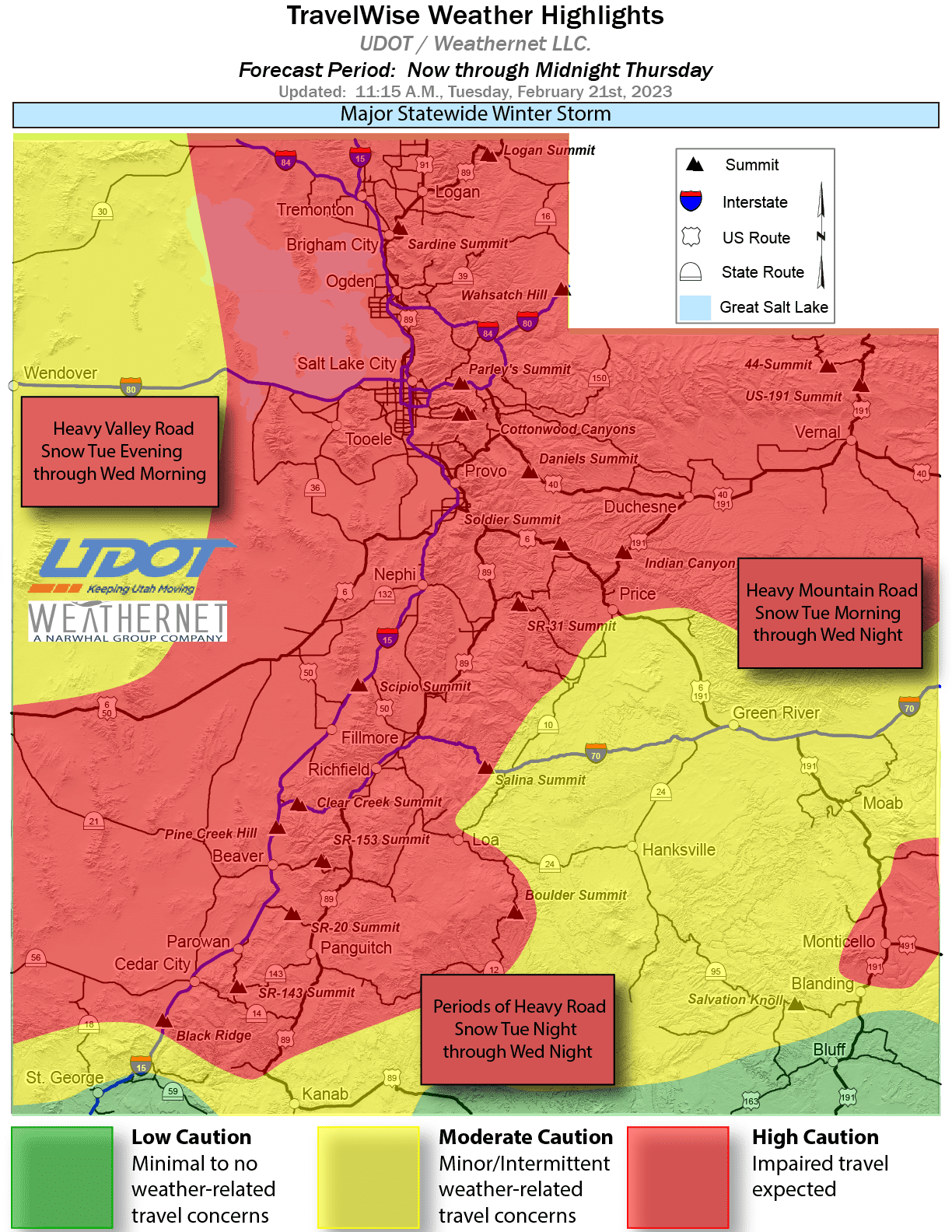
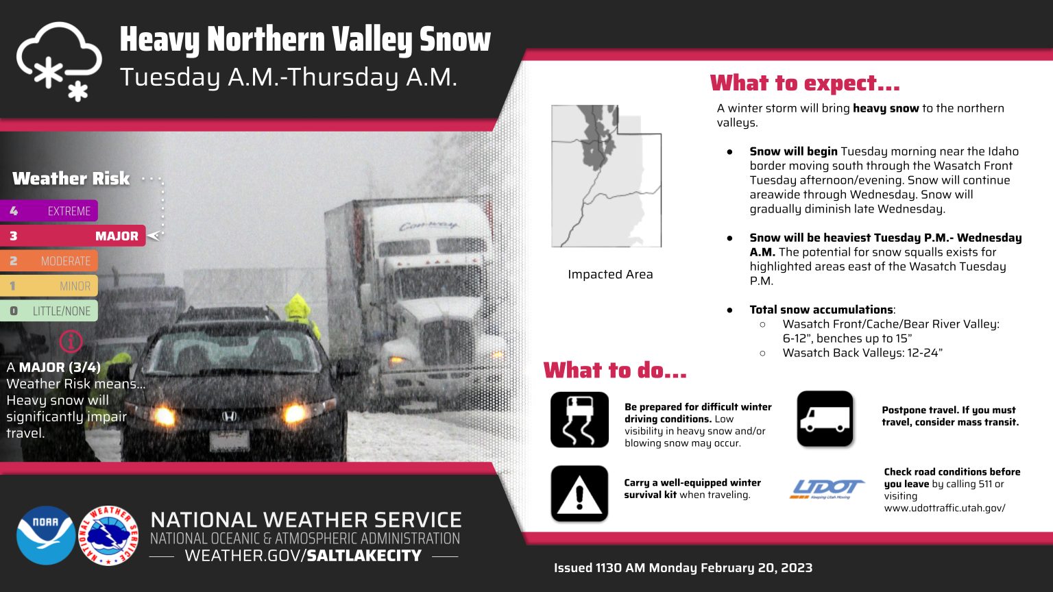
UDOT advises that winter driving conditions exist and that Tuesday evening and Wednesday morning commutes look to be highly impacted.
The Utah Avalanche center says that snowfall will remain heavy overnight, and winds will transition more northwesterly. Overnight snow totals could be between 10-20″ of new snow, with the high-end totals being closer to 25″ of new snow with almost 2.0″ of water. Storm totals continue to rise, looking to be somewhere between 32-42″ of new snow by Thursday morning.
View this post on Instagram
By: TownLift

597 Deer Valley Loop Road
Park City, UT 84060
2475 W White Pine Lane
Park City, UT 84060
2154 S Rio Verde
Moab, UT 84532
2400 E Walker Lane
Holladay, UT 84117
137 W Bridlewood Lane
Midway, UT 84049Talk of the Town


Park City Jobs
Full or Part Time Dishwasher/Prep Cook, Rebekah's Kitchen
1 day ago Part time $13.00 - $18.00 hourly
Head of Maintenance, Ptarmigan Property Services
4 days ago Full time $70,000 - $85,000 yearly