Weather
UDOT issues Road Weather Alert, storm expected to bring one to 2′ of snow through Saturday night.
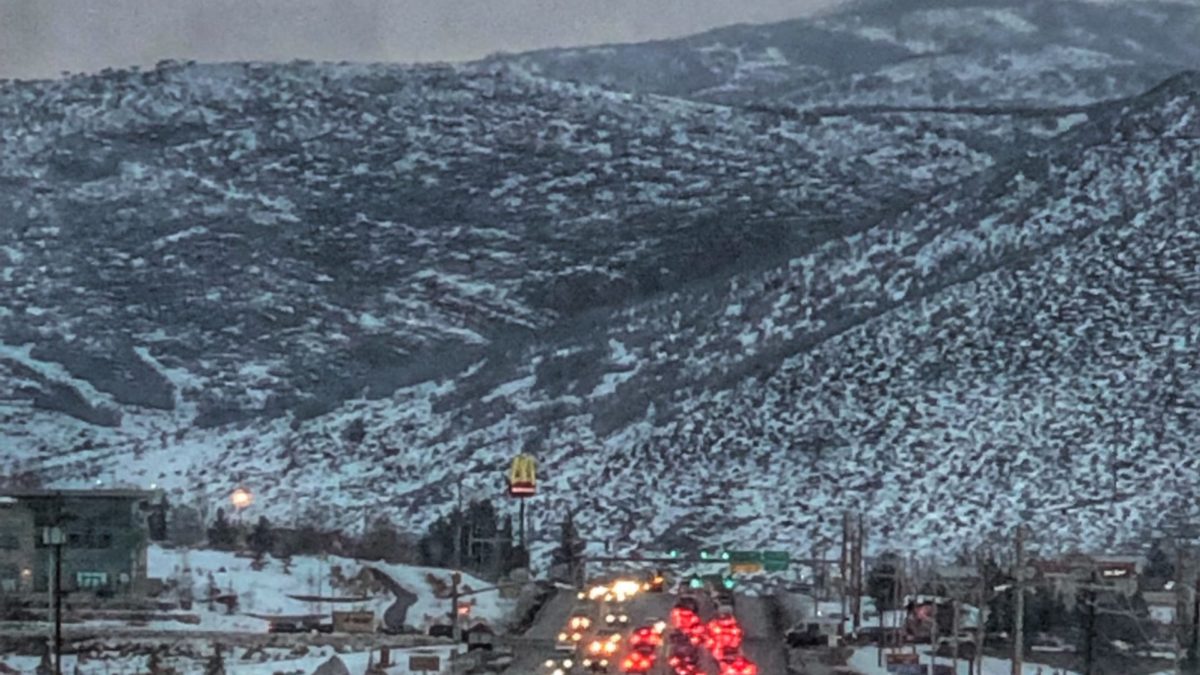
Park City traffic at Kimball Junction. Photo: TownLift
PARK CITY, Utah — The Utah Department of Transportation released a Road Weather Alert today, warning of a prolonged winter storm that will begin today and is expected to bring one to two feet of road snow through Saturday night.
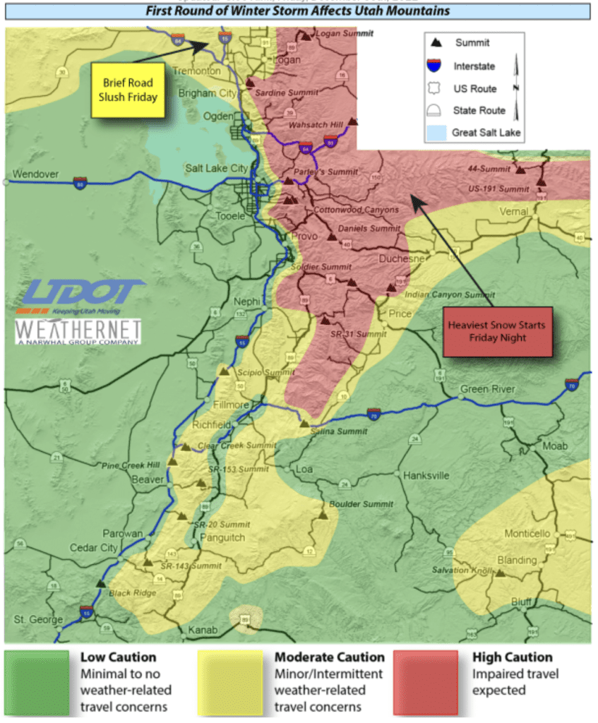
Mountains and valleys across northern and central Utah can expect snowfall to begin on Friday night, and the Wasatch Back is expected to receive the heaviest snowfall in the state.
Widespread snow impacts are expected in mountain areas, and northern Utah valleys could see road slush on Friday.
According to UDOT, the following routes are expected to experience weather-related travel concerns during the forecast period:
- I-15, ID Border to Brigham City
- I-80, Parley’s Canyon to WY Border
- I-84, 89 Jct to WY Border
- US-6, Spanish Fork to Price
- US-40, Silver Creek Jct to Duchesne; Vernal to CO Border
- US-89, ID Border to Brigham City; Thistle to Fillmore; Panguitch to Kanab
- US-189, Provo Canyon
- US-191, Uinta Mountains to Vernal; Duchesne to Price; Spanish Valley to Bluff
- SR-31, SR-31 Summit
- SR-92, American Fork Canyon
- SR-158, Powder Mountain
- SR-190, Big Cottonwood Canyon
- SR-210, Little Cottonwood Canyon
- SR-226, Snowbasin
Additional weather-related impacts are expected Sunday into Monday. Motorists are advised to use caution and check the UDOT website for further updates.
By: Ashtyn Asay

7457 Buckboard Drive
Park City, UT 84098
2154 S Rio Verde
Moab, UT 84532
137 W Bridlewood Lane
Midway, UT 84049
2475 W White Pine Lane
Park City, UT 84060
2400 E Walker Lane
Holladay, UT 84117Talk of the Town


Park City Jobs
Sushi Chef, VR Inc
1 day ago Seasonal $26.00 - $28.00 hourly

Sommet Blanc Senior Technician, Diversified Property Services
5 days ago Full time