Weather
Incoming storm to bring plummeting temps and predicted snow totals in double digits for mountains
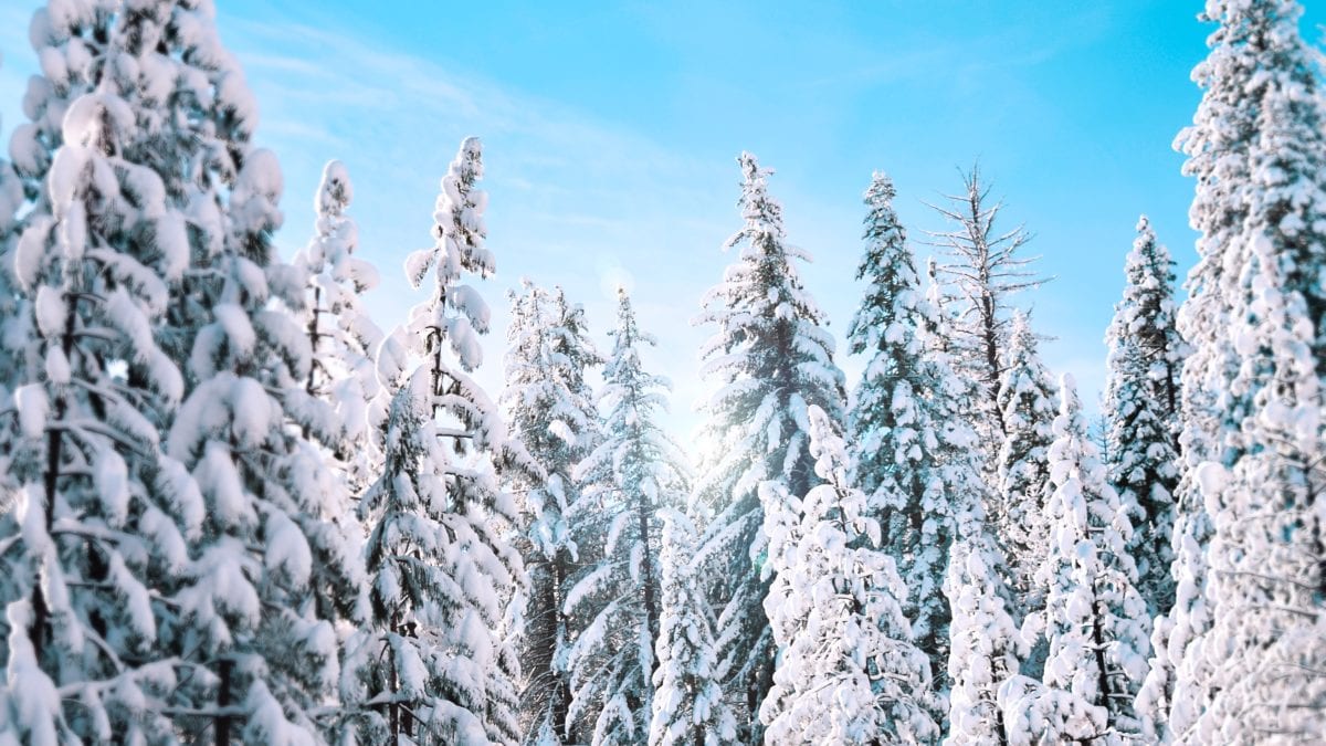
Snow is in the forecast! Photo: Stanley Dai
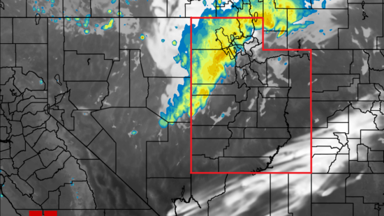
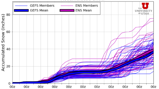
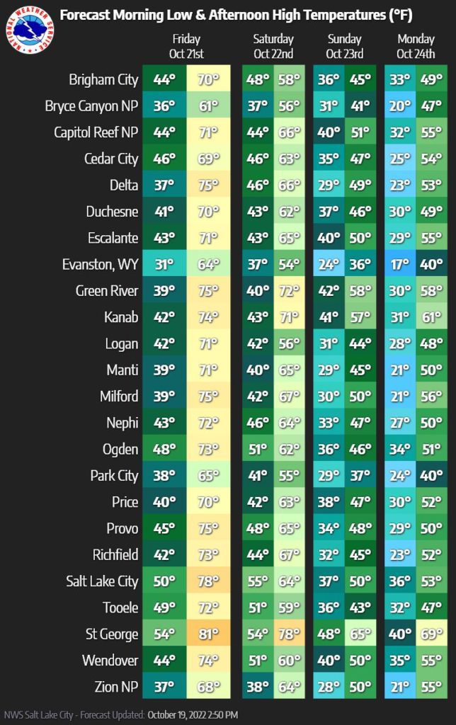
Park City, UTAH — As we head into the weekend, the forecast for a significant snowfall from this first winter storm keeps growing. Evan Thayer from OpenSnow and Powderchasers has updated the forecast, predicting snow totals to reach as high as 10 to 30 inches. Across the state, temperatures are forecasted to plummet, with lows going into the 20s.
Pow day conditions should reach into the Wasatch on Saturday, pushing aside the dry conditions from the summer and early fall and ushering in a period of rain and snow into the region. The highest elevations of the Wasatch are predicted to get the highest snow accumulation, with a good chance of reaching well over a foot. Powderchasers is even going as far as saying the conditions might even be chase-worthy for some backcountry fun.
The Cottonwoods will likely see the most snow totals of a minimum of a foot being forecasted, while other locations such as Park City could be in the 6 to 12-inch range.
Either way, it does appear that the colorful season is coming to an end, and the powder-seeking days of winter are beginning.
By: Kevin Cody

2475 W White Pine Lane
Park City, UT 84060
137 W Bridlewood Lane
Midway, UT 84049
2154 S Rio Verde
Moab, UT 84532
2400 E Walker Lane
Holladay, UT 84117Talk of the Town


Park City Jobs

Sommet Blanc Senior Technician, Diversified Property Services
1 day ago Full time
Resident Manager - Empire Residences, Diversified Property Services
1 day ago Full time $60,000 - $65,000 yearly
Chiropractic Front Desk/Therapy Assistant, Lundstrom Chiropractic
4 days ago Part time $21.50 hourly
Maintenance Tech, Park City Rental Properties
5 days ago Full time $22.00 - $25.00 hourly

Love Fashion, Creativity & Artisan Goods? Join the Blue Sky Nomads Team, Blue Sky Nomads
8 days ago Part time $18.00 - $25.00 hourly