News
Temperatures will stay warm through the end of the month
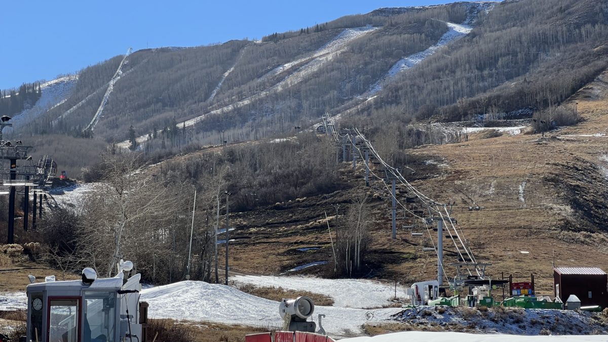
Park City Mountain's opening day was delayed due to warm weather conditions. Photo: Twitter @ozskier
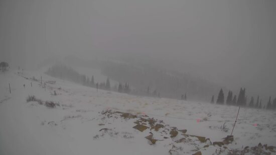
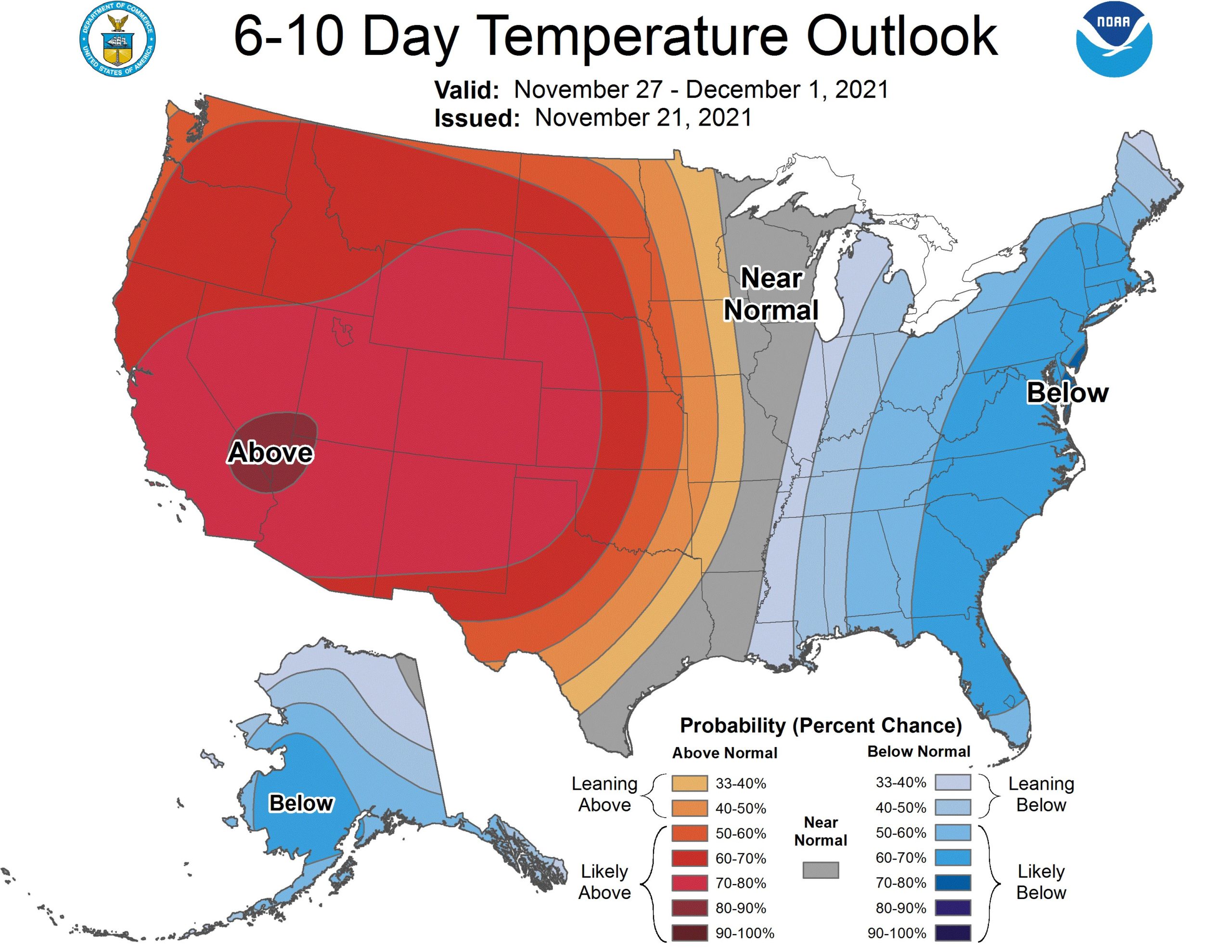
SALT LAKE CITY — In a forecast released on Sunday, the National Weather Service (NWS) said that the entire western United States is looking to be above normal temperature conditions through the end of the month.
“A warming trend indeed,” NWS said.
—
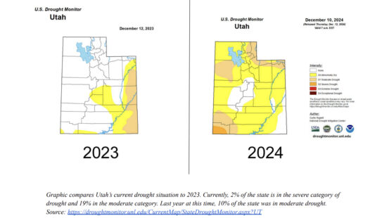
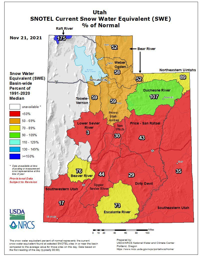
A look at snowpack totals through the state:
—
Despite the outlook, the Utah Department of Natural Resources (DNR) has reported a good start to the new water year, which started on October 1.
“While this is exciting, we have a long way to go,” said Brian Steed, executive director of DNR. “Snowpack typically peaks around the first week of April, which means we have five months to collect as much snowpack as possible. While we wait on our snowpack, we will continue to plan for all scenarios if the snowpack doesn’t replenish our water storage.”
Highlights:
Thirty-seven of Utah’s largest 45 reservoirs are below 55% of available capacity. Overall statewide storage is 49% of capacity. This time last year, reservoirs were about 62% of capacity.
Soil moisture is 16% above median for this time of year. Wet soils are critical in the fall as the state begins to accumulate its winter snowpack. Frequent storms are needed to keep moisture in the soil as we head into winter.
Of the 97 measured streams, 48 are flowing below normal.
Harmful algal bloom (HAB) monitoring by the Department of Environmental Quality has ended for the season, but HABs may still be present in Utah’s water bodies during the fall, winter and spring. Recreators are advised to avoid areas of scum, avoid ingesting water and rinse off after coming into contact with water.
By: TownLift

5314 W Rolling Brook Drive
Herriman, UT 84096
5497 S Walker Estates Circle
Holladay, UT 84117
7020 E Creekside Road
Castle Valley, UT 84532
1198 E Elkhorn Lane
Oakley, UT 84055
2549 W Sinagua Trail, #26
St. George, UT 84770Talk of the Town


Park City Jobs
Senior Development Manager, Park City Education Foundation
1 day ago Full time $70,000 yearly
Development Associate, Park City Education Foundation
1 day ago Full time $46,000 yearly
Stio Mountain Studio Associate Manager, Stio
2 days ago Full time $50,000 - $60,000 yearly
Pharmacist, Alpine Apothecary
5 days ago Part time

Dental Assistant, Rise Dental Wellness
5 days ago Part time