Weather
Utah mountains forecast to receive 9″ to 15″ of snow by Thursday
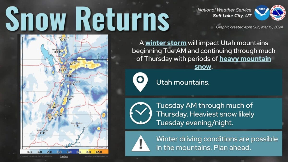
Photo: National Weather Service
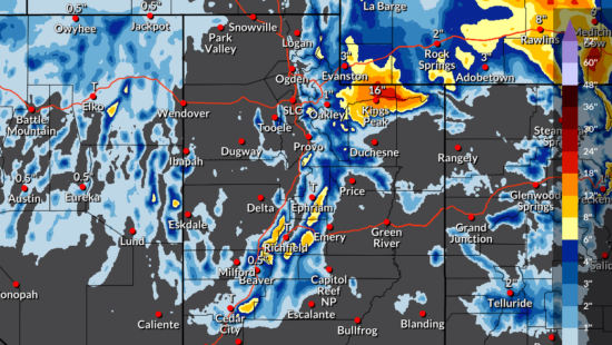
PARK CITY, Utah — The National Weather Services (NWS) shared an update for the midweek storm currently impacting Park City. While accumulations in town are set at a few inches, regional mountains could pick up 9″ to 15″ of snow by Thursday. According to the Winter Weather Advisory, the snow is expected to be heaviest Tuesday afternoon into early Tuesday evening.
Powderchasers says that the Wasatch Mountains on Tuesday midday will see 2″ to 5″ of snow, with additional amounts Tuesday night of 4″ to 9″. Storm totals in Utah will likely be in the 4″ to 9″ range for Park City Mountain, with 9″ to 15″ in the Cottonwoods.
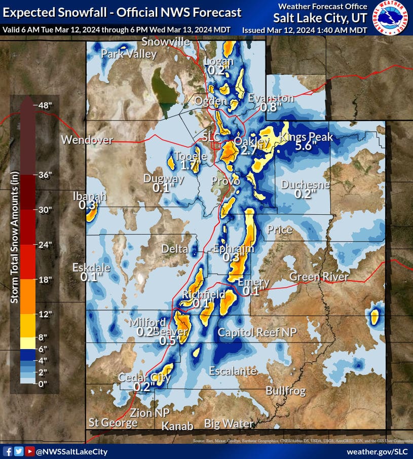
NWS Ski Resort Snow Totals Through 3/13 at 6 p.m.
| Low End Snowfall | Expected Snowfall | High End Snowfall | |
| Alta Ski Area, UT | 9 | 14 | 16 |
| Beaver Mountain, UT | 3 | 6 | 7 |
| Brian Head Resort, UT | 4 | 9 | 13 |
| Brighton Resort, UT | 7 | 11 | 13 |
| Canyons Village, UT | 6 | 10 | 12 |
| Cherry Peak Resort, UT | 5 | 9 | 10 |
| Deer Valley, UT | 4 | 6 | 10 |
| Eagle Point Resort, UT | 8 | 12 | 14 |
| Nordic Valley, UT | 1 | 3 | 5 |
| Park City Mountain Resort, UT | 5 | 8 | 11 |
| Powder Mountain, UT | 2 | 4 | 7 |
| Snowbasin Resort, UT | 4 | 8 | 9 |
| Snowbird Ski and Summer Resort, UT | 9 | 16 | 17 |
| Solitude Mountain Resort, UT | 7 | 13 | 14 |
| Sundance Mountain Resort, UT | 3 | 6 | 7 |
By: TownLift

4539 S Willow Road
Holladay, UT 84117
10584 Basin Canyon Road
Park City, UT 84098
24 South 600 East
Salt Lake City, UT 84102
965 Goshen Canyon Road
Mona, UT 84645
19 East 100 North
Spring City, UT 84662Talk of the Town


Park City Jobs

Assistant Manager, LOMA
1 day ago Full time $35.00 hourly
Property Inspector, Park City Rental Properties
2 days ago Full time $23.00 - $25.00 hourly
Owner Relations Manager, Park City Rental Properties
2 days ago Full time
Operations Manager, Park City Rental Properties
2 days ago Full time

Hiring Barista Assistants and Baristas, Silver King Coffee
4 days ago Part time $17.00 - $30.00 hourly