Weather
Avalanche danger jumps to HIGH after storm drops 3+ feet of snow
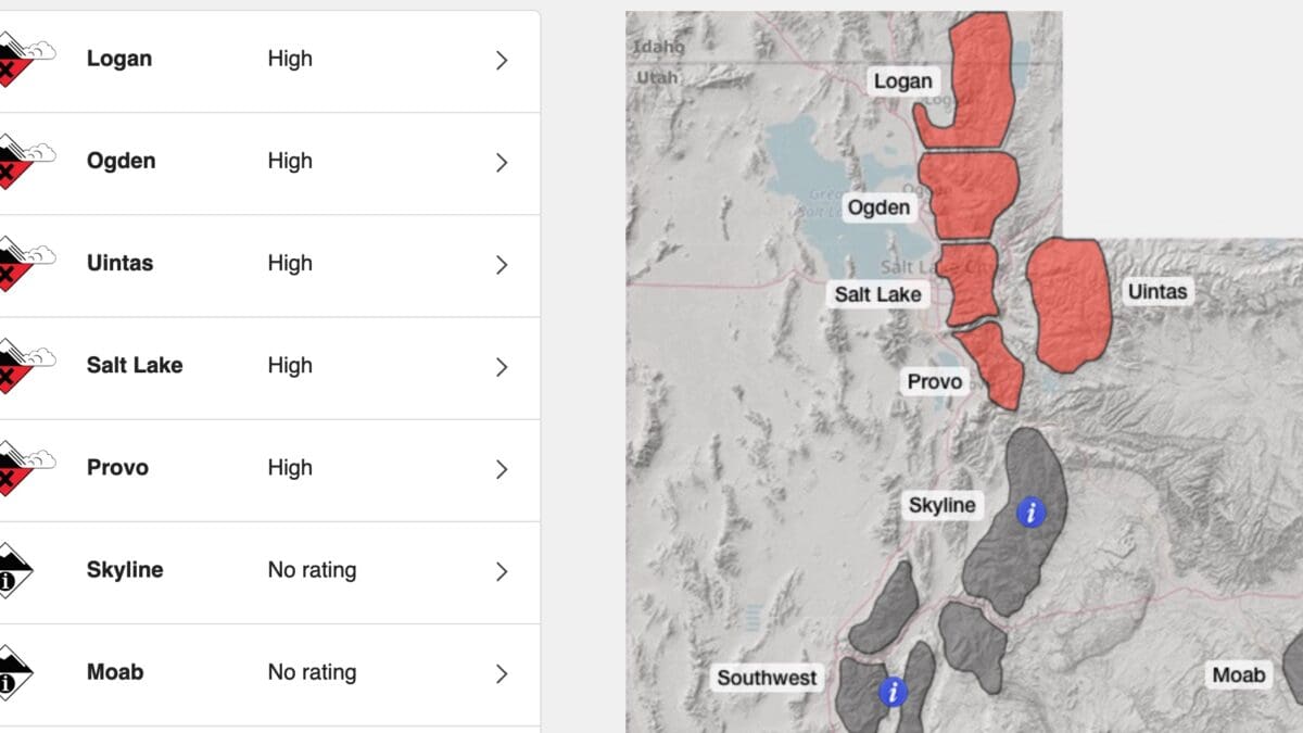
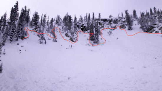
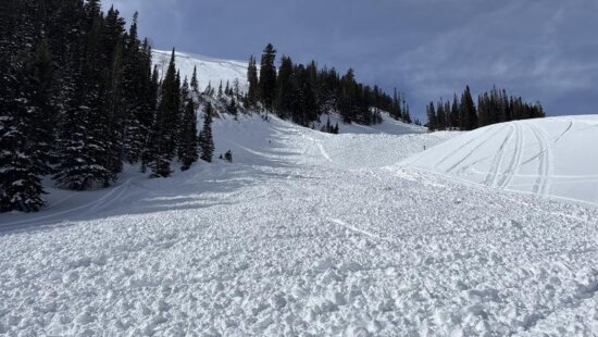
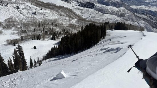
High Avalanche Danger Photo: Utah Avalance Center.
PARK CITY — The Utah Avalanche Center ( UAC) has issued a high avalanche danger warning for mid and upper elevations for Dec. 3. 48 hour snow storm totals are over three feet with 39″ at Snowbird, 36″ at Alta, 18″ at Park City Mountain, and 16″ at Deer Valley.
The UAC says “The TRAVEL ADVICE is easy today: Travel in avalanche terrain is not recommended. This includes below avalanche terrain. Remember that traumatic injury is likely with any avalanche involvement this early season.”
Read the full report here.
The weather forecast indicates a continuation of snowfall at diminished rates, accompanied by moderate to strong westerly winds. Temperatures are expected to hover in the mid to upper 20s. An additional snow accumulation of 8-14 inches is anticipated through tomorrow morning, with the winds gradually subsiding. Clearer conditions are expected by Monday afternoon, with a warming trend raising mountain temperatures to the upper 30s and 40s in mid-elevations by Tuesday. A weaker weather system is predicted to follow on Thursday.
By: TownLift

371 N Pinion Hills Drive
Dammeron Valley, UT 84783
1511 S Valley View Circle
Springville, UT 84663
2075 E Munsey Drive
Moab, UT 84532
8905 Parleys Lane
Park City, UT 84098Talk of the Town


Park City Jobs
Property Inspector, Park City Rental Properties
Today Full time $23.00 hourly

Junction Commons Retail Openings, Junction Commons
1 day ago Part time $16.00 - $22.00 hourly

Accounting & Office Administrator, Canyons Village Management Association
4 days ago Full time $65,000 - $70,000 yearly

Operations Houskeeping Manager - Year Round, Casago
4 days ago Full time $19.00 - $23.00 hourly

Property Manager, Mountain Estates Property Management
6 days ago Full time