Environment
Snowpack SWE of 29 inches surpasses 1952 estimated levels

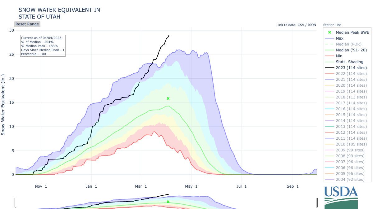
Utah's Snowpack Snow Water Equvilient surpases 1952 levels as it climbs to 29 inches. Photo: Courtesy of USDA.
PARK CITY, Utah — As more snow continues to fall across the state, the statewide snowpack snow water equivalent continues to climb, reaching 29 inches on Tuesday. Reaching 29 inches milestone surpasses the 1952 estimated level of 28.8 inches, making this year’s snowpack higher than any season in over 71 years.
Social media posts, such as from Alta Ski Area, saying that the resort has received over 2 feet in the last 24 hours, means that the snowpack will only continue to rise to heights never seen before or at least not in recent memory.
Alta Ski Area will not open today ⚠️
We have received 27" in the past 24 hours and 37" from this current storm. We are working towards an opening tomorrow. Thanks for your continued patience during this historically snowy winter. 🙏 pic.twitter.com/uvq3EHdb2E
— Alta Ski Area (@AltaSkiArea) April 4, 2023
Time will tell where the melt will finally stop the climb, but it doesn’t appear to be anytime soon if this week’s monster storm is any indication.
29" SWE. As Utah officially surpasses the estimated 1952 levels, those concerned with flooding can learn more about risks and other state resources by going to the @UtahDPS emergency management page: https://t.co/gfkjF2yFlE #utwx pic.twitter.com/jHQQ62QUXr
— NRCS Utah (@NRCS_Utah) April 4, 2023


