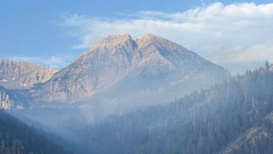
Snow
NASA-developed technology takes flight in Weber Basin as Utah tracks snowpack
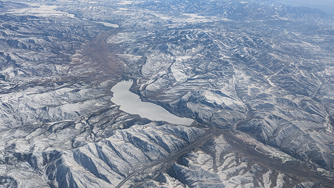
Aerial view of Echo Reservoir Photo: Utah DNR Water Resources
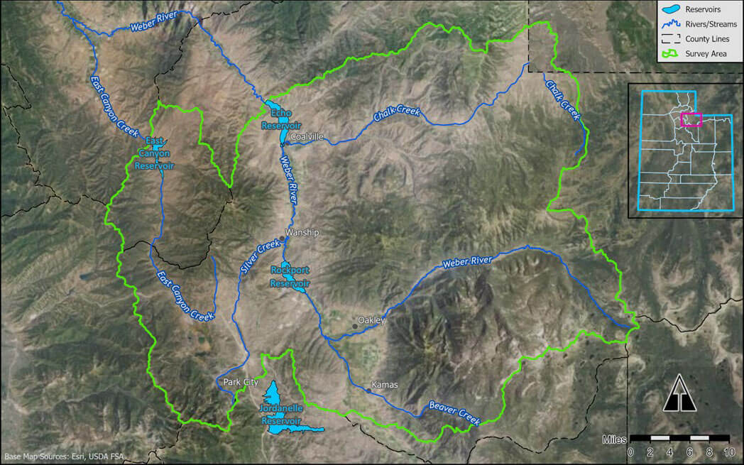
SALT LAKE CITY, Utah — Utah water managers are testing a NASA-developed snow-mapping system in the Weber River Basin as they look for sharper forecasts of how much water the state’s mountain snowpack will deliver to rivers, reservoirs, and, ultimately, the Great Salt Lake. The state’s new “Wings Over Weber” pilot combines airborne measurements with existing forecasting tools to give water planners a fuller picture of snow conditions across an entire basin, rather than relying only on ground-based surveys and fixed monitoring stations.
The Utah Division of Water Resources says the project is a collaboration among the division, Airborne Snow Observatories, the Office of the Great Salt Lake Commissioner, Weber Basin Water Conservancy District, and the U.S. Bureau of Reclamation. The agency describes it as a pilot project intended to improve snow monitoring and water supply forecasting in the Weber River Basin.
State officials say the effort matters because snowpack drives most of Utah’s water supply. The Utah Division of Water Resources says about 95% of the state’s available water supply comes from snowpack, making accurate measurement of snow depth and snow water equivalent central to reservoir operations, water allocation, and drought planning.
The technology at the center of the project was developed by NASA’s Jet Propulsion Laboratory and is now operated by Airborne Snow Observatories, according to the Utah Division of Water Resources. The state says the system combines LiDAR, imaging spectrometers, and other remote sensors to map snow depth, snow water equivalent, and albedo — the amount of sunlight the snow reflects.
NASA’s Jet Propulsion Laboratory has described the Airborne Snow Observatory as a mission created to produce comprehensive basinwide maps of snowpack and the water it holds. JPL says the system was designed to improve estimates of how much water will flow from mountain basins as snow melts, giving water managers more precise, timely information than previously available.
In a separate overview, NASA says the technology has since become a key tool for water managers because it measures the amount of water contained in snow, along with snow depth and reflectivity, in ways that can improve operational decisions during drought and runoff forecasting.
Utah’s snowpack has long been tracked through the federal Snow Telemetry Network, or SNOTEL, along with manual surveys and forecast models. The Natural Resources Conservation Service says Utah’s Snow Survey Program provides mountain snowpack data and streamflow forecasts across the state, while SNOTEL sites monitor snowpack, precipitation, temperature, and other weather conditions in high-elevation watersheds.
What the new flights add, state officials say, is full-basin coverage. The Utah Division of Water Resources says airborne surveys can capture snow depth and albedo across mountainous terrain at high resolution, then combine those measurements with modeled snow density to estimate snow water equivalent and support runoff forecasts.
The Weber Basin project is scheduled as a three-year pilot running from 2025 through 2027, with two to three flyover surveys each year, according to the state. The Utah Division of Water Resources says the first of two planned 2026 aerial surveys was completed March 8, and that data from the flights will be incorporated into advanced snowpack modeling used to generate seasonal water supply forecasts for the basin.
The state also says the project is the second of its kind in Utah and the first focused on a watershed within the Great Salt Lake Basin. Funding comes in part through a Bureau of Reclamation grant, according to the division.
“This partnership represents a critical step forward in our efforts to understand and manage our snowpack,” Joel Williams, director of the Utah Division of Water Resources, said in a statement published by the agency. “By utilizing this new technology, we can gain insights into our snowpack, which is crucial to our water supply.”
State officials say better snow data could help managers make more informed decisions about reservoir releases, flood control, drought response, and planning tied to Great Salt Lake conditions. The project does not replace Utah’s existing snow survey network, but adds another layer of information as water managers try to better understand how much water is stored in the mountains and when it will arrive downstream.
By: Rebecca Brenner

597 Deer Valley Loop Road
Park City, UT 84060
2154 S Rio Verde
Moab, UT 84532
137 W Bridlewood Lane
Midway, UT 84049
2475 W White Pine Lane
Park City, UT 84060
2400 E Walker Lane
Holladay, UT 84117Talk of the Town


Park City Jobs

Architect/Architectural Designer, Vera Iconica Architecture
1 day ago Full time $60,000 - $95,000 yearly

Assistant Pit Master, Lush's BBQ
1 day ago Part time $20.00 - $25.00 hourly

Chef de Cuisine, Washington School House Hotel
3 days ago Full time $50,000 - $60,000 yearly
Housekeeper, Washington School House Hotel
3 days ago Full time $20.00 - $22.00 hourly