Weather
After a month with almost no snow, active weather pattern finally set to begin
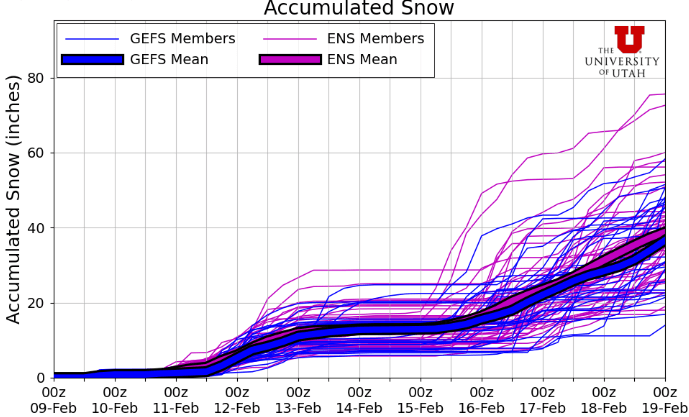
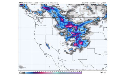
Photo: Utah Snow Ensemble model total snowfall shows an active period starting, with two major storm systems in the long-range outlook // UofU Dept. of Atmospheric Sciences
Up to a foot of snow is possible for parts of the Wasatch by Thursday, with the potential for a large storm starting this weekend and persisting into early next week.
PARK CITY, Utah –With only a few inches of snow reported in the last 30-days, things are getting desperate here in Utah as we remain in uncharted territory with the lowest snowpack statewide since automated snowpack monitoring began in 1981. Some relief is finally on the horizon as a more active long-term weather pattern is expected to begin today and last through at least the end of the long-range outlook, typically defined as around 10 days out.
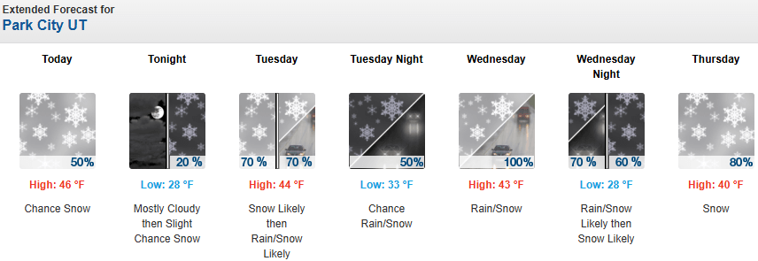
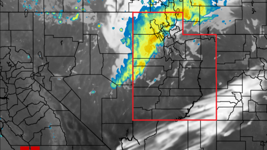
A weak cold front is currently moving through northern Utah Monday morning as we remain on the southern end of the moisture associated with a small storm to our north. Besides a dip towards more normal seasonal temperatures, little impact beyond an inch or two of snow in the mountains are expected through Tuesday before a larger and more potent storm system is forecast for Wednesday into Thursday.
Forecast Snow Totals Through Thursday
- Cottonwood Canyons: 8 – 16″
- PC Base/Town: 1 – 3″
- Deer Valley/PCMR: 6 – 12″
- N. Wasatch (Powder/Snowbasin): 6 – 12”
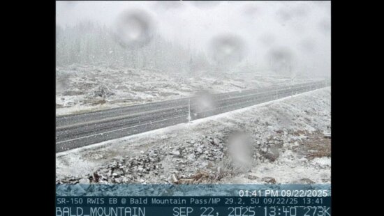
Snow levels will begin to rise on Tuesday to around 7,000 feet or higher as southwest winds ramp up and bring in warmer air ahead of this next system. Snowfall begins in earnest during the day Wednesday, with slowly dropping snow levels overnight and into Thursday as the coldest air arrives. Snow showers continue Thursday morning and become more showery in nature in the afternoon. Moisture becomes limited Friday, but cold, light northwest winds may keep some unstable isolated snow showers possible, with little accumulation expected. Snow totals look to be in the 6-to-12-inch range for most northern mountains. Accumulations in town will be modest with the relatively high snowline for most of the period.

Extended Outlook
After a brief lull in activity Friday-Saturday, the forecast models generally agree that a persistent low-pressure system will strengthen and remain near the west coast for the latter part of the weekend. Although the models disagree on the exact timing, with precipitation onset either overnight Saturday or overnight Sunday, it looks like another foot or two of snow is possible through early next week.
By: Adam Lenkowski

1104 West 10125 South
South Jordan, UT 84095
4028 E Outcrop Road
Park City, UT 84098
1355 E Snow Canyon Parkway, Lot 27
Ivins, UT 84738
4155 S Parkview Drive
Salt Lake City, UT 84124
4170 Vista Antigua Road
Moab, UT 84532Talk of the Town


Park City Jobs

Dog Walker, wagging tails on the trails
5 days ago Part time $20.00 - $25.00 hourly
Retail Sales Associate - Promontory Club, Promontory Club
6 days ago Part time $23.00 hourly
SENIOR HOA BOOKKEEPER WANTED, Compass Management Services
13 days ago Full time

Systems Administrator, Basin Recreation
17 days ago Full time $70,645 - $88,306 yearly
Accounts Payable Lead Coordinator, Basin Recreation
17 days ago Full time $58,871 - $73,588 yearly