News
White Christmas possible for Park City as storms stack up
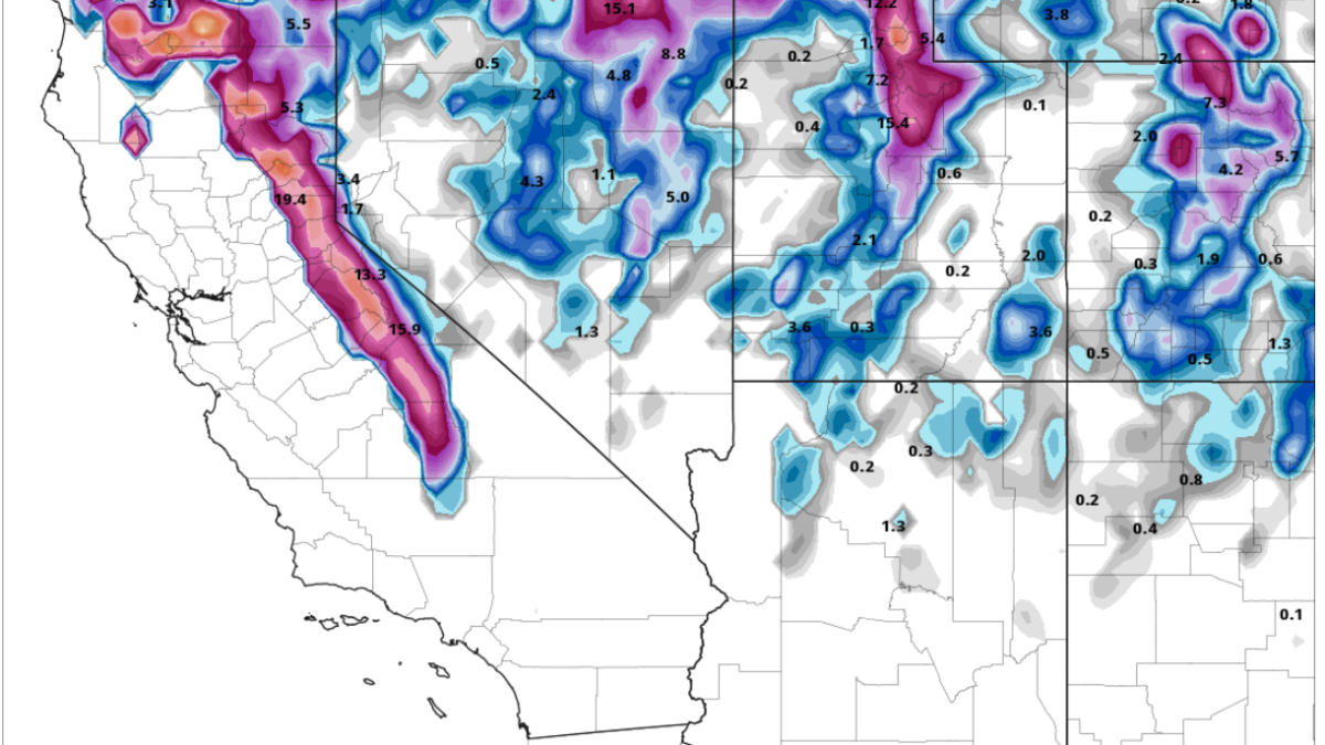
Photo: Total snow through Sunday evening GFS model // PivotalWeather.com
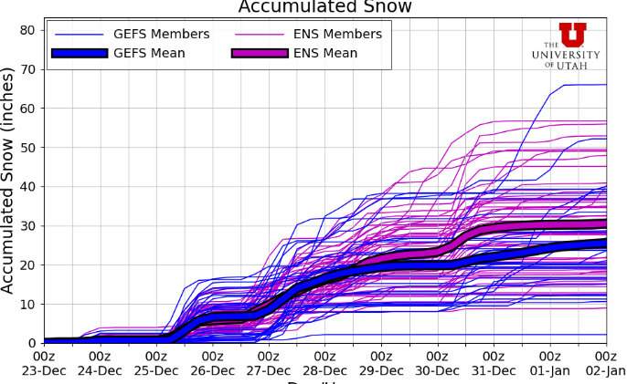
Active weather pattern beginning Christmas Eve could bring 1 to 2 feet of snow to the mountains by Sunday evening
PARK CITY, Utah – A weak storm system is grazing northern Utah this morning, with a trace of snow reported last night for the Wasatch and possibly another inch falling throughout the day. However, things begin to ramp up on Christmas Eve as another storm digs to our south.
Snow levels will be quite high Tuesday evening as warm air enters the state, with the cold front tracking sometime early Christmas morning. Snowfall totals are expected to be in the 2-6” range for most of the central Wasatch mountains. The Park City base/town area should receive about an inch of snow, just in time for a white Christmas morning.

Several more storms expected throughout the week
After a brief lull in activity Wednesday evening / Thursday morning, strong westerly flow kicks in for several days, bringing with it a stream of moisture off the California coast and several distinct periods of snowfall. The first wave of snow is forecast for Thursday afternoon, with a couple inches of snow expected.
On Friday, a somewhat stronger portion of the storm with more moisture will impact the area. Snow totals for Thursday through Friday night look to be in the 4-8” range for the central Wasatch, with the far northern mountains in the Ogden and Logan areas that do well in westerly flow favored.
Another storm may impact the Area on Sunday evening through Monday. There is a lot of uncertainty in the location and strength of the moisture in this latter half of the forecast period, but in general most of the Wasatch should receive a foot or two of snow by the beginning of next week.
