Weather
Park City snowpack hits 30 year record low

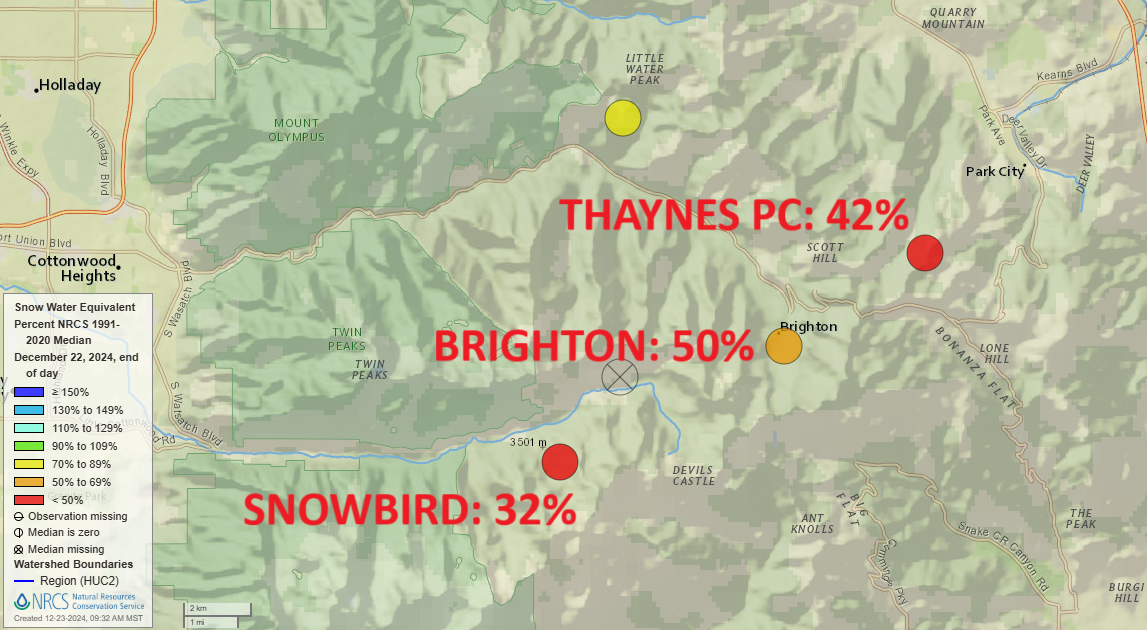
Photo: Multiple SNOTEL stations in the central Wasatch reading less than 50% of normal
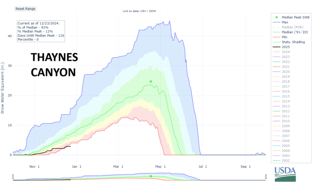
Both the Snowbird snowpack monitoring station and Thayne’s Canyon on the Park City side are at record lows, with Thayne’s at 42% of normal and Snowbird reporting just 32% of normal.
PARK CITY, Utah – As we begin the last full week of December with the winter solstice in the rearview mirror, things are not looking good for snowpack in the Wasatch. The 2024-25 season outlook was not far off as of November but in the last two dry weeks, the central Wasatch has dipped into drastically low-snow territory.
Despite last week’s mid-December statewide water report update from the NRCS discussing snowpack and reservoir levels, many Snotel monitoring stations in the Central Wasatch are now well below the 30-year average.
Both the Snowbird snowpack monitoring station and Thayne’s Canyon on the Park City side are at record lows, with Thayne’s at 42% of normal and Snowbird reporting just 32% of normal.

At the top of Big Cottonwood Canyon, Brighton is at its 2nd lowest water equivalent on record. At Alta in Little Cottonwood, which typically receives 90.6” of snow in December on average, has only recorded 22.5” so far in December 2025. However, we still have a week left in December and are entering an active weather period, so we should see these numbers increase and potentially double through the end of the month.
This December has also been much warmer than normal. Based off current climate data from the Salt Lake City International Airport, daily high temperatures have been on average 6.0 degrees F higher than normal for the month of December. The past 10-days have been 10.3 degrees F above normal.
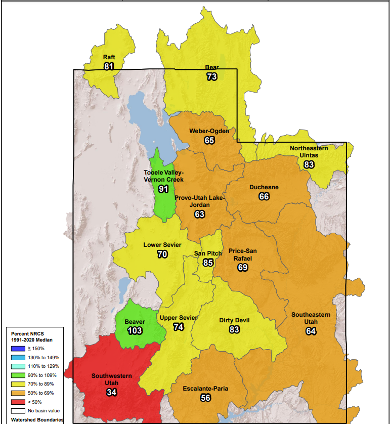
Nearly all of Utah’s drainage basins are now reading below normal, as depicted by the snowpack map below.


