Weather
Park City anticipates 6 days of snow to close out March
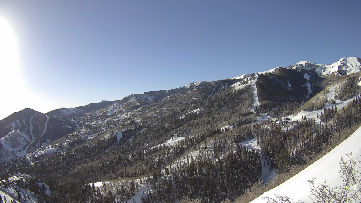
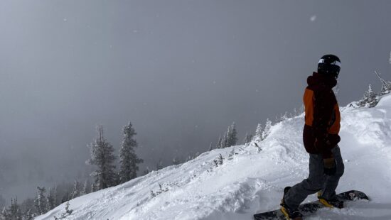
March 25, 2024. Photo: Silverlode Outlook webcam // Park City Mountain
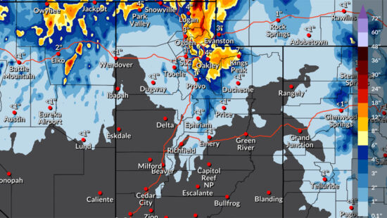
The National Weather Service snowfall forecast is calling for 9 to 14" of snow in the Cottonwoods, while Park City can expect to see 7″ at Canyons Village and 5″ at both Park City Mountain and Deer Valley through Wednesday.
PARK CITY, Utah — Bundle up Park City, there is the chance of snow six days this week, according to a forecast from the National Weather Service.
Powderchasers.com says to expect between 8-15 inches of snow for the Cottonwoods through Wednesday, March 27.
The National Weather Service snowfall forecast is also anticipating similar totals in the Cottonwoods. Park City can expect to see seven inches at Canyons Village and five inches at both Park City Mountain and Deer Valley through Wednesday.
| Low End Snowfall | Expected Snowfall | High End Snowfall | |
| Alta Ski Area, UT | 5 | 9 | 14 |
| Beaver Mountain, UT | 2 | 4 | 5 |
| Brian Head Resort, UT | <1 | 2 | 4 |
| Brighton Resort, UT | 4 | 7 | 12 |
| Canyons Village, UT | 4 | 7 | 11 |
| Cherry Peak Resort, UT | 2 | 4 | 5 |
| Deer Valley, UT | 3 | 5 | 9 |
| Eagle Point Resort, UT | 2 | 5 | 6 |
| Nordic Valley, UT | 1 | 3 | 5 |
| Park City Mountain Resort, UT | 3 | 5 | 10 |
| Powder Mountain, UT | 1 | 3 | 5 |
| Snowbasin Resort, UT | 2 | 5 | 7 |
| Snowbird Ski and Summer Resort, UT | 5 | 10 | 14 |
| Solitude Mountain Resort, UT | 5 | 9 | 12 |
| Sundance Mountain Resort, UT | 1 | 3 | 7 |
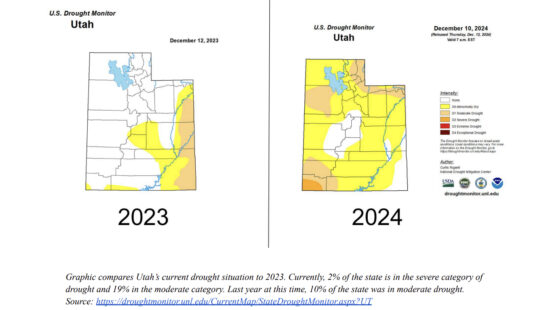
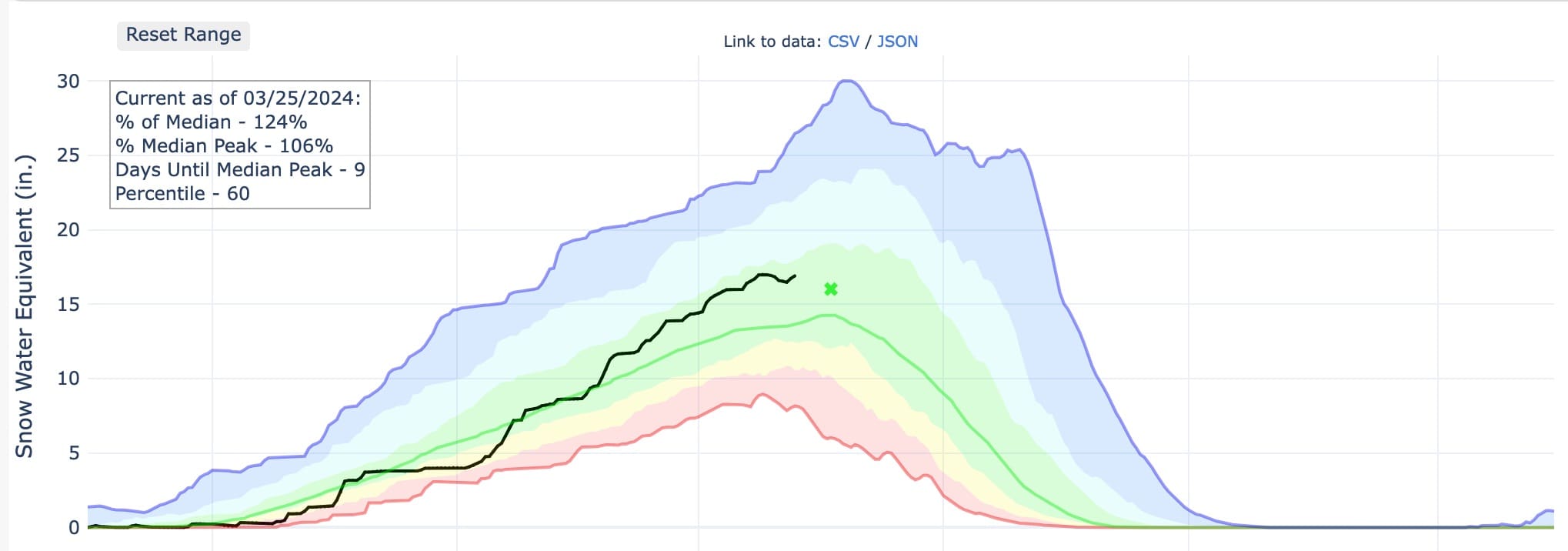
Utah Snowpack
The USDA Snow Water Equivalent or Snowpack is sitting at 124% of average as of Monday, March 25.
“Our statewide snowpack has been consistently above normal since the beginning of February, which has really put Utah in a good position as we head into spring,” Candice Hasenyager, director of the Utah Division of Water Resources, recently said in a press release.
Monday, March 25
Snow showers are likely on Monday, mainly after noon. Mostly cloudy, with a high near 36. Northwest wind 7 to 10 mph. Chance of precipitation is 70%. Total daytime snow accumulation of less than one inch possible.
There is a 50 percent chance of snow showers on Monday night. Mostly cloudy, with a low around 21. West wind 5 to 10 mph. New snow accumulation of 1 to 2 inches possible.
Tuesday, March 26
Snow showers are forecasted for Tuesday with a high near 35 and west northwest wind 6 to 13 mph. Chance of precipitation is 90%. New snow accumulation of 1 to 3 inches possible.
There is a 50 percent chance of snow showers Tuesday night, mainly before midnight. Mostly cloudy, with a low around 22. West wind 6 to 11 mph. New snow accumulation of less than one inch possible.
Wednesday, March 27
Wednesday is forecasted to be mostly sunny, with a high near 40 and southwest wind 5 to 10 mph. Wednesday night is expected to be mostly cloudy, with a low around 30.
Thursday, March 28
There is a chance of snow showers before noon on Thursday, then rain showers likely. Mostly cloudy, with a high near 46. Chance of precipitation is 60%. New snow accumulation of less than a half inch possible. Snow showers are likely Thursday night, mainly before midnight. Mostly cloudy, with a low around 29.
Friday, March 29
There is a chance of snow showers before noon on Friday, then a chance of rain showers. Mostly cloudy, with a high near 45. There is a chance of rain and snow showers on Friday night. Mostly cloudy, with a low around 32.
Saturday, March 30
Rain and snow showers likely are likely Saturday. Mostly cloudy, with a high near 46. There is a chance of rain and snow showers on Saturday night. Mostly cloudy, with a low around 32.
Sunday, March 31 (Easter Sunday)
There is a chance of rain and snow showers on Sunday. Mostly cloudy, with a high near 48.
By: TownLift

6110 E Blue Wing Loop
Kamas, UT 84036
2304 N Cohonina Trail
St. George, UT 84770
3764 Prickly Pear Circle, Unit 5-A6
Moab, UT 84532
760 E Edgehill Rd
Salt Lake City, UT 84103
1545 N Red Castle Circle
Heber City, UT 84032
1042 W Shoreline Drive
Layton, UT 84041Talk of the Town


Park City Jobs

Equestrian Stall Cleaner/Feed - EVENINGS, Part-time, SkyRidge
Today Part time $22.00 hourly
Barista/ Cashier, chomp donuts
1 day ago Full time $17.00 - $25.00 hourly
Pastry chef/ Donut Chef, chomp donuts
1 day ago Full time $55,000 - $75,000 yearly
Donut chef/ maker, chomp donuts
1 day ago Full time $17.00 - $24.00 hourly
Content and Social Media Specialist, National Ability Center
1 day ago Full time $50,000 - $52,000 yearly