Weather
Weather Alert: New storm will bring up-to 27 inches of snow by Friday

An SUV slid off Kilby Road on Wednesday morning Jan. 10. Road conditions from the recent storm have been slippery and icy with more snow on the way. Photo: TownLift
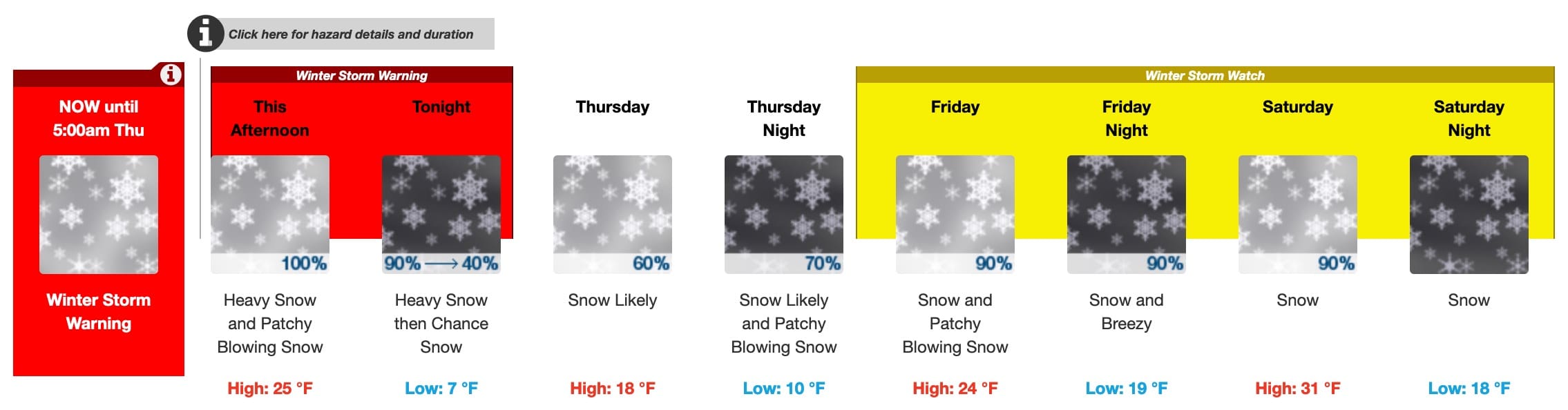
SUMMIT COUNTY, Utah — The National Weather Service has issued a winter storm warning for Park City through 5:00 a.m. Jan. 11.
Projected to be more substantial than the previous day’s storm, Snow rates are expected to increase significantly, continuing into Thursday with 5-10″ of snow predicted for the Wasatch Back.
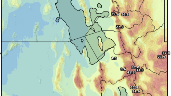
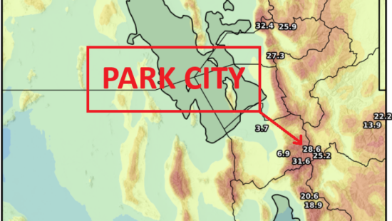
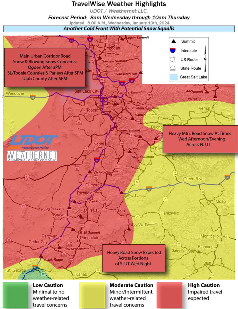
As of 2:30 p.m., the National Weather Service released an update that a snow squall has developed in Northwest Utah and will head Southeast through the afternoon and evening. Brief but intense squalls are projected to hit the Summit County area after 5 p.m. this evening.
Squalls hit Parley’s Canyon yesterday with multiple accidents including tractor trailers showcased in this video from Marie Dierman taken from her evening drive through Parleys on Jan. 9.
The following routes in the Park City area, are expected to experience weather-related travel concerns during the storm: I-80, US-40 between Heber and Park City, SR-224, SR-248.
27″ of Snow in the mountains
This storm is forecast to bring significant snowfall to Park City Mountains with up-to 27″ at Canyons Village, 22″ at Park City Mountain and 21 to Deer Valley.
NWS projected resort snow totals through Jan. 12
| Low End Snowfall | Expected Snowfall | High End Snowfall | |
| Alta Ski Area, UT | 12 | 20 | 27 |
| Beaver Mountain, UT | 10 | 16 | 16 |
| Brian Head Resort, UT | 3 | 6 | 7 |
| Brighton Resort, UT | 11 | 18 | 26 |
| Canyons Village, UT | 11 | 20 | 27 |
| Cherry Peak Resort, UT | 9 | 14 | 14 |
| Deer Valley, UT | 8 | 13 | 21 |
| Eagle Point Resort, UT | 4 | 6 | 6 |
| Nordic Valley, UT | 8 | 15 | 17 |
| Park City Mountain Resort, UT | 8 | 15 | 22 |
| Powder Mountain, UT | 9 | 15 | 18 |
| Snowbasin Resort, UT | 10 | 18 | 24 |
| Snowbird Ski and Summer Resort, UT | 11 | 21 | 28 |
| Solitude Mountain Resort, UT | 11 | 21 | 27 |
| Sundance Mountain Resort, UT | 7 | 14 | 17 |
For live updates on current travel conditions, visit TownLift’s webcam page, which has live webcams for all major Park City travel routes.
By: Laura M

6110 E Blue Wing Loop
Kamas, UT 84036
2304 N Cohonina Trail
St. George, UT 84770
3764 Prickly Pear Circle, Unit 5-A6
Moab, UT 84532
1545 N Red Castle Circle
Heber City, UT 84032
760 E Edgehill Rd
Salt Lake City, UT 84103
1042 W Shoreline Drive
Layton, UT 84041Talk of the Town


Park City Jobs

Digital Marketing Associate, Park City Community Foundation
2 days ago Contractor $24.00 - $27.00 hourly

Equestrian Stall Cleaner/Feed - EVENINGS, Part-time, SkyRidge
3 days ago Part time $22.00 hourly
Barista/ Cashier, chomp donuts
4 days ago Full time $17.00 - $25.00 hourly
Pastry chef/ Donut Chef, chomp donuts
4 days ago Full time $55,000 - $75,000 yearly
Donut chef/ maker, chomp donuts
4 days ago Full time $17.00 - $24.00 hourly