Weather
Wasatch Mountains could see 12 to 24 inches of new snow by Thursday morning
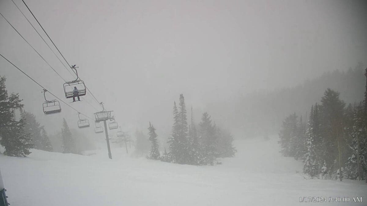
Sultan Express, Deer Valley Resort. Photo: Deer Valley Resort
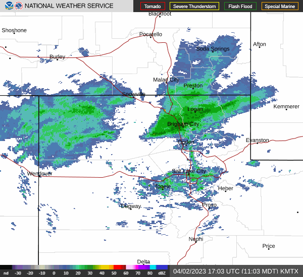
PARK CITY, Utah — The National Weather Service has issued a Winter Storm Warning for the Wasatch Mountains. Potential snow accumulations of 12 – 24 inches are predicted by Thursday morning. The NWS warns that travel may be difficult to impossible and that blowing snow could significantly reduce visibility.
Regional Ski Resort storm totals through Thursday Jan. 18 include Deer Valley Resort: 11″, Park City Mountain: 14″, Canyons Village: 16″, Alta: 23″ and Snowbird: 24″.
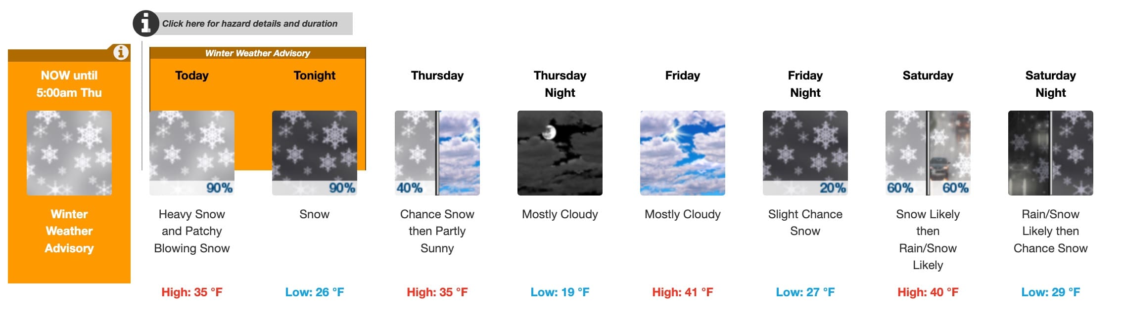
Park City is currently under a Winter Weather Advisory with 4 – 8 inches of snow today and 1 – 3 tonight.
Resort Snowfall totals through Jan 18
| Low End Snowfall | Expected Snowfall | High End Snowfall | |
| Alta Ski Area, UT | 13 | 23 | 24 |
| Beaver Mountain, UT | 10 | 18 | 19 |
| Brian Head Resort, UT | <1 | 2 | 2 |
| Brighton Resort, UT | 10 | 18 | 19 |
| Canyons Village, UT | 9 | 16 | 17 |
| Cherry Peak Resort, UT | 9 | 14 | 17 |
| Deer Valley, UT | 7 | 11 | 13 |
| Eagle Point Resort, UT | 1 | 3 | 3 |
| Nordic Valley, UT | 9 | 16 | 17 |
| Park City Mountain Resort, UT | 8 | 14 | 14 |
| Powder Mountain, UT | 9 | 17 | 18 |
| Snowbasin Resort, UT | 10 | 18 | 18 |
| Snowbird Ski and Summer Resort, UT | 13 | 24 | 26 |
| Solitude Mountain Resort, UT | 12 | 22 | 22 |
| Sundance Mountain Resort, UT | 11 | 17 | 17 |
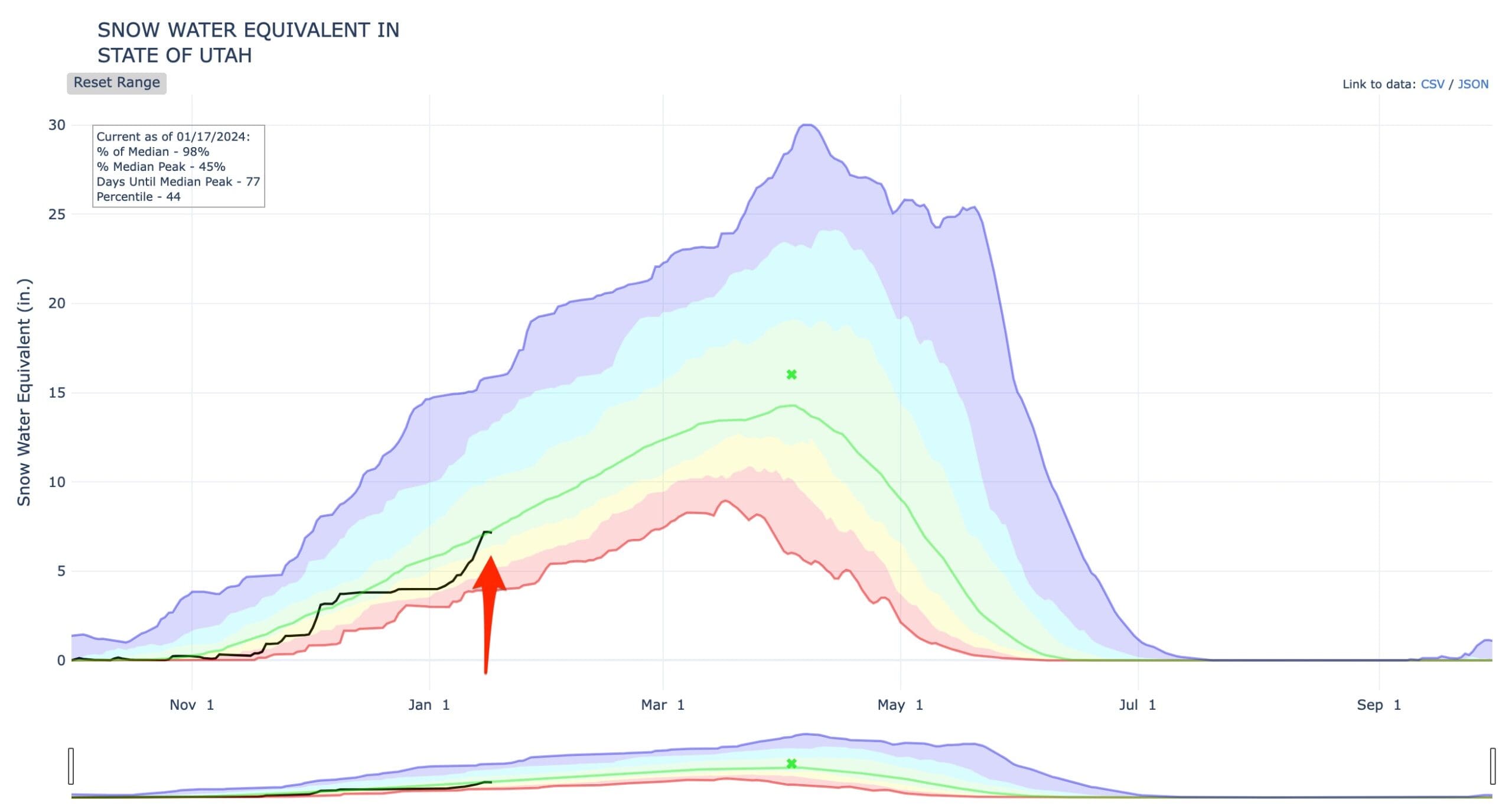
SnowPack
The recent storm cycle has pushed the Utah snowpack from nearly setting a new all-time low to right back on track at 98% of the median today.
By: TownLift

4539 S Willow Road
Holladay, UT 84117
965 Goshen Canyon Road
Mona, UT 84645
10584 Basin Canyon Road
Park City, UT 84098
24 South 600 East
Salt Lake City, UT 84102
19 East 100 North
Spring City, UT 84662Talk of the Town


Park City Jobs

Assistant Manager, LOMA
2 days ago Full time $35.00 hourly
Property Inspector, Park City Rental Properties
3 days ago Full time $23.00 - $25.00 hourly
Owner Relations Manager, Park City Rental Properties
3 days ago Full time
Operations Manager, Park City Rental Properties
3 days ago Full time

Hiring Barista Assistants and Baristas, Silver King Coffee
5 days ago Part time $17.00 - $30.00 hourly