Weather
April showers bring… 1 to 2 feet of snow
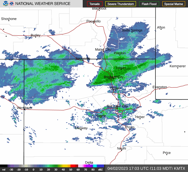
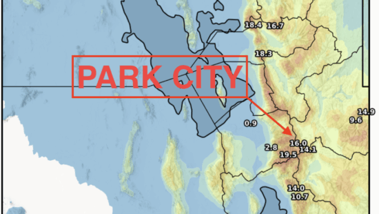
Utah radar loop Photo: National Weather Service
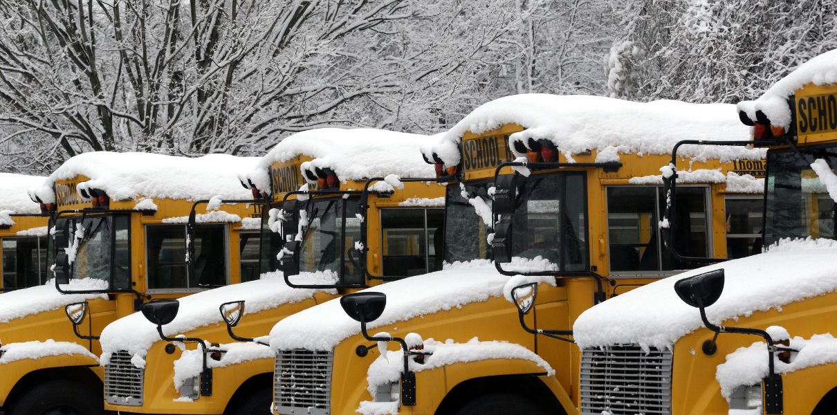
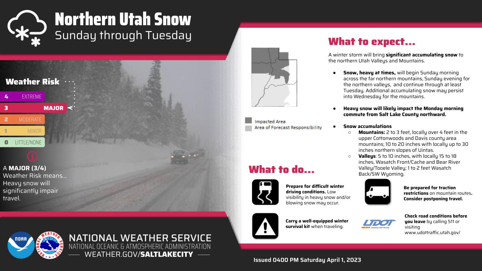
SUMMIT COUNTY, Utah — A rare but powerful April winter storm has the Wasatch Back in its sights. A Winter Storm Warning has been issued for Sunday night through 6 p.m. Tuesday. Expect heavy snow with total snow accumulations of 1 to 2 feet across the Wasatch Back. Park City Mountains may receive 2 – 3 feet of snow with up to 4 feet forecasted for the Cottonwoods.
 Snow will be heavy at times Sunday night into early Monday afternoon. Snow intensity may decrease Monday afternoon before increasing once again Monday evening into Tuesday morning. Travel could be very difficult to impossible at times and commuters should expect roadways to be impacted on Monday.

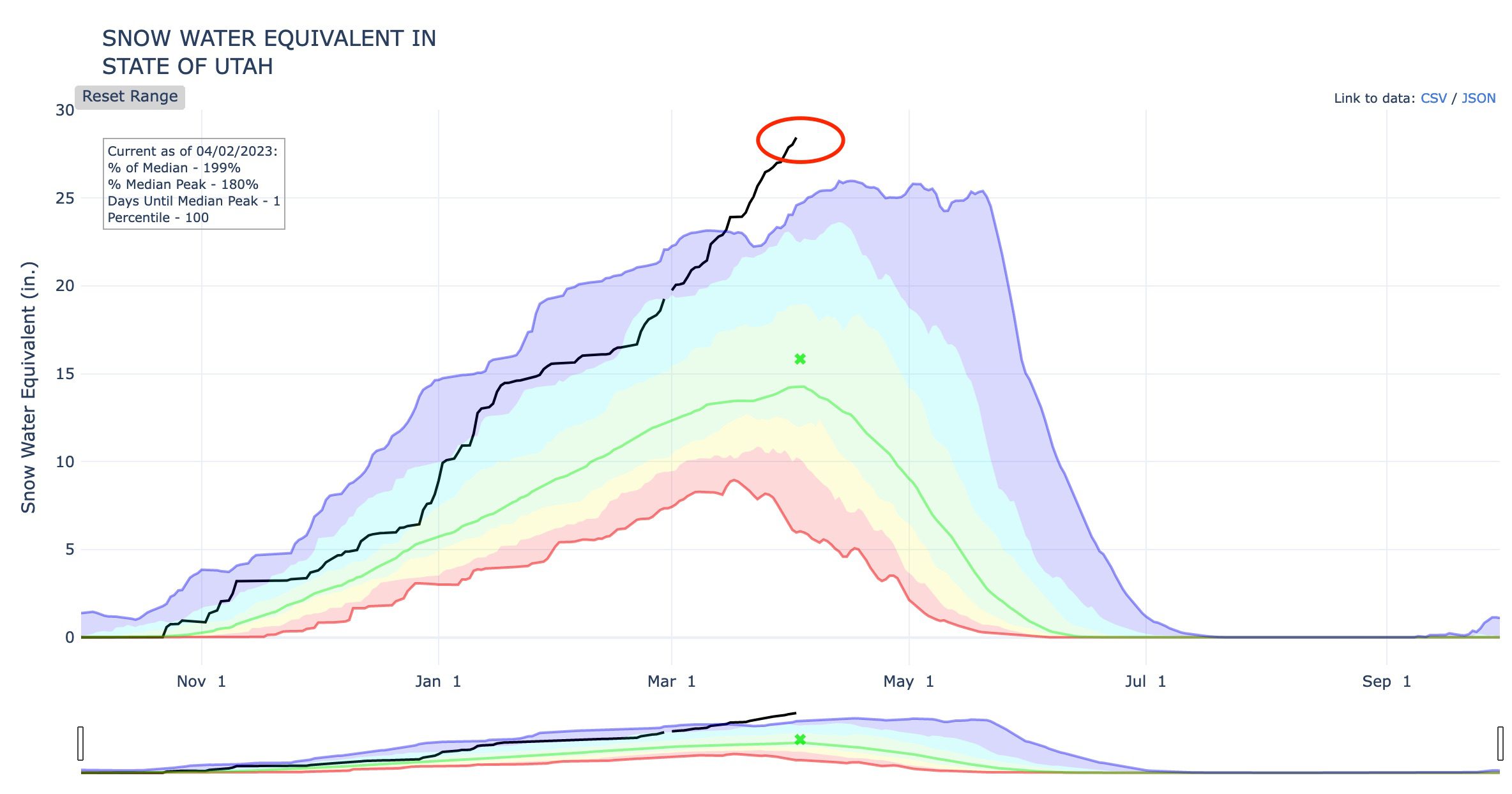
Snow Water Equivalent Record Smashed
Preceding this storm the record is now 28.4 in. and is well on track to hit 30 or more! The prior record was 26 in. The USDA Snow Water Equivalent tracking service is going to need a bigger graph.
Governor Cox summed up this storm and upcoming flooding concerns in a Tweet “One more monster storm and then we finally get a break. I never thought I would be relieved to see some brown on this map. So far temps looks good for slow melt. Flood mitigation efforts are well underway and sand bag stations are popping up. Check with your local city/county.”
One more monster storm and then we finally get a break. I never thought I would be relieved to see some brown on this map. So far temps looks good for slow melt. Flood mitigation efforts are well underway and sand bag stations are popping up. Check with your local city/county. https://t.co/iLTlCLt5Pw pic.twitter.com/QmFWWH8B9C
— Spencer Cox (@SpencerJCox) April 1, 2023
By: TownLift

597 Deer Valley Loop Road
Park City, UT 84060
137 W Bridlewood Lane
Midway, UT 84049
2475 W White Pine Lane
Park City, UT 84060
2154 S Rio Verde
Moab, UT 84532
2400 E Walker Lane
Holladay, UT 84117Talk of the Town


Park City Jobs
Full or Part Time Dishwasher/Prep Cook, Rebekah's Kitchen
1 day ago Part time $13.00 - $18.00 hourly
Head of Maintenance, Ptarmigan Property Services
4 days ago Full time $70,000 - $85,000 yearly