Community
Mountain Trails Foundation launches Park City Trails Resource Page
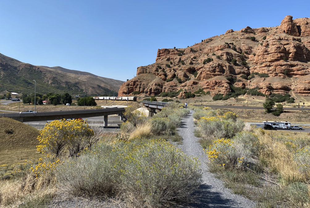
The Rail Trail is a public 28-mile non-motorized trail that spans from Park City to Echo Reservoir. Photo: Summit County.
PARK CITY, Utah — The extensive network of trails in the Park City area amounts to 400 miles of trails. To help the public navigate and enjoy using them, the Mountain Trails Foundation has launched a new website dedicated to providing local and visiting trail users with up-to-date information such as current condition reports, interactive wayfinding tools, live feed to trailhead cameras, suggested routes, individual trail data, and other information.
“As population and visitation along the Wasatch Back have grown, managing outdoor recreation assets has become a priority,” said Lora Smith, Mountain Trails Foundation executive director. “Promoting responsible trail use and dispersing trail users across the trail system are the most effective strategies we have for preserving Park City’s world-class trail experience.”
“In order to make good trail choices, trail users, both local and visiting, need accurate, timely information. The Trails Resource Page provides that information. With 400 miles of trails and widespread infrastructure, the Trails Resource is a colossal undertaking and is supported by the trails and open space leaders in the Park City community.”
The Trail Resource page information is provided through a coordinated effort between the Mountain Trails Foundation, Snyderville Basin Recreation Special Service District, Park City Municipal, Utah Open Lands, and Summit Land Conservancy. Park City Mountain, Deer Valley Resort, Utah Olympic Park, and other landowners will also work to be a part of the process in providing accurate and current information on trails.
Funding for the project is being provided by the Park City Chamber and Vistor’s Bureau’s Sustainable Tourism Plan.
By: Kevin Cody

6110 E Blue Wing Loop
Kamas, UT 84036
1545 N Red Castle Circle
Heber City, UT 84032
1042 W Shoreline Drive
Layton, UT 84041
3764 Prickly Pear Circle, Unit 5-A6
Moab, UT 84532
2304 N Cohonina Trail
St. George, UT 84770
760 E Edgehill Rd
Salt Lake City, UT 84103Talk of the Town


Park City Jobs

Digital Marketing Associate, Park City Community Foundation
2 days ago Contractor $24.00 - $27.00 hourly

Equestrian Stall Cleaner/Feed - EVENINGS, Part-time, SkyRidge
2 days ago Part time $22.00 hourly
Barista/ Cashier, chomp donuts
4 days ago Full time $17.00 - $25.00 hourly
Pastry chef/ Donut Chef, chomp donuts
4 days ago Full time $55,000 - $75,000 yearly
Donut chef/ maker, chomp donuts
4 days ago Full time $17.00 - $24.00 hourly