Weather
Heavy snowfall forecasted for Utah on Wednesday
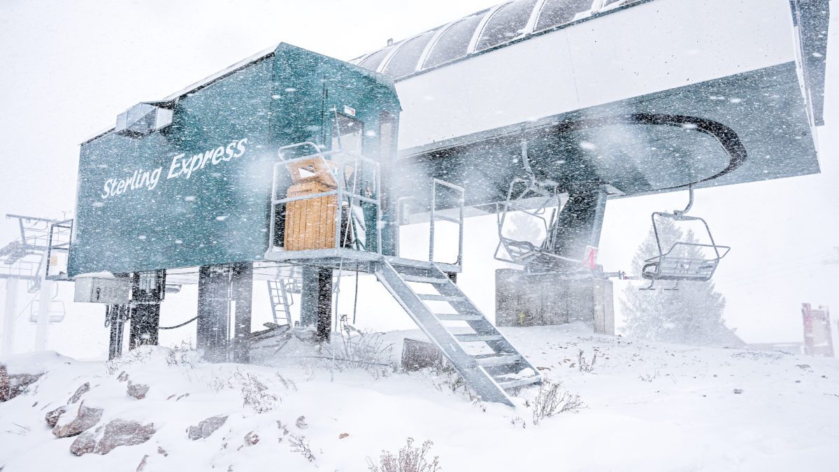
Heavy Snowfall at Silver Lake Express on Bald Mountain at Deer Valley Resort. Photo: TownLift // Kevin Cody
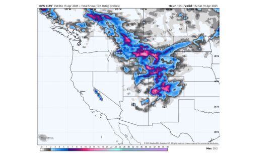
PARK CITY, Utah — Powderchasers forecasts the next wave of snow on Wednesday. The storm is expected to cross over the Cascades in the Pacific Northwest on Monday before bringing snow to the four corners region, giving the Wasatch a high probability for heavy snowfall.
The start of the 2022/23 winter season has been colder and wetter than average for the Rockies and Pacific Northwest showing the signature of a La Niña effect, according to Powderchasers. In particular, the cooler air has allowed snow to build up at lower elevations than usual. These conditions have allowed Keystone and Arapahoe Basin in Colorado to be the first two ski resorts to open for the year.
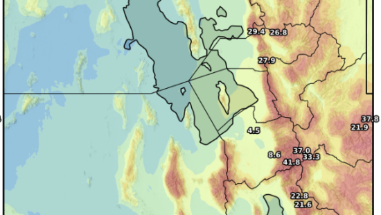
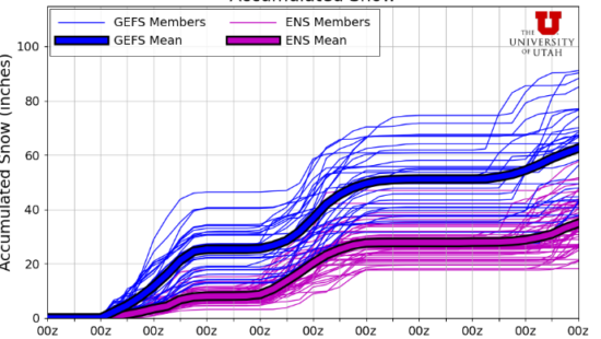
The current projection has the Wasatch receiving 6 to 12 inches of snow, with a high probability that some will hit the southern part of the state bringing snow to Brian Head Resort.
Following the storm moving into the area on Wednesday, a second storm is projected to reach the Pacific Northwest on Thursday or Friday, bringing big snow totals. It is unclear at this moment how far south the storm will go.
By: Kevin Cody

6110 E Blue Wing Loop
Kamas, UT 84036
1042 W Shoreline Drive
Layton, UT 84041
2304 N Cohonina Trail
St. George, UT 84770
1545 N Red Castle Circle
Heber City, UT 84032
760 E Edgehill Rd
Salt Lake City, UT 84103
3764 Prickly Pear Circle, Unit 5-A6
Moab, UT 84532Talk of the Town


Park City Jobs
Soccer Coach August Through October (Mon - Thu 3:15pm - 5:15pm), City League PC
2 days ago Part time $25.00 hourly

Tour Guide & Driver Park City, Heber Valley &, Midway PT, Park City Travel and Tours LLC
2 days ago Contractor $15.00 - $18.00 hourly
Technician, Trails, Basin Recreation
3 days ago Full time $49,927 - $62,409 yearly
Education Coordinator and Summer Camp Manager , Kimball Art Center
3 days ago Full time $23.00 hourly

Digital Marketing Associate, Park City Community Foundation
6 days ago Contractor $24.00 - $27.00 hourly