News
Tuesday’s storm could help or hurt firefight effort

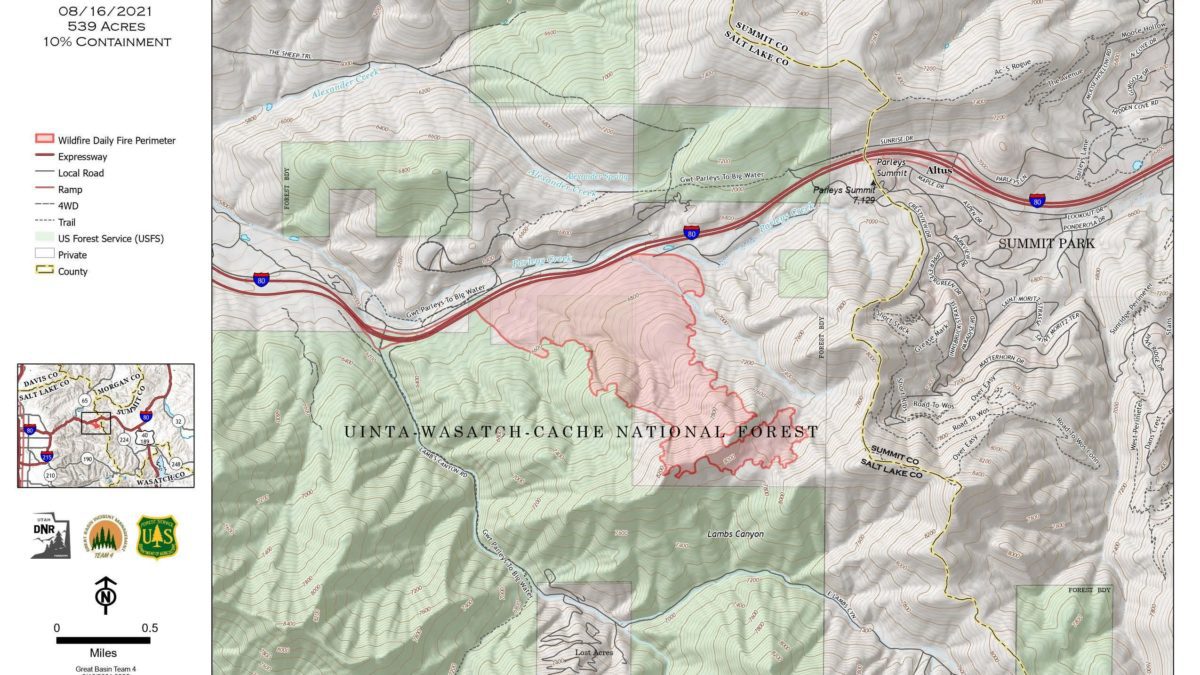
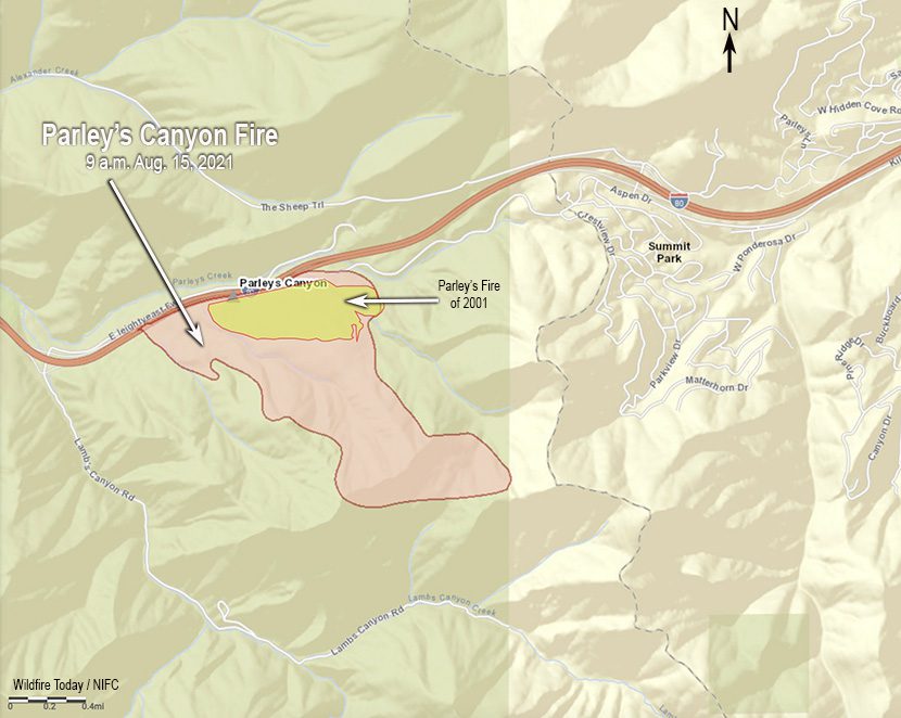
The Parley's Canyon Fire is burning in mountain brush and heavy timber and is currently 539 acres with 10% containment. Photo: Utah Division Forestry Fire State Lands
SUMMIT COUNTY, Utah — A Hazardous Weather Outlook is in effect for most of Utah through Sunday, August 22, as heavy rainfall and severe thunderstorms are expected to start on Tuesday and last through Thursday.
First on deck for Tues: thunderstorms after a long stretch (approx. 2 weeks) of dry weather across portions of the forecast area will create critical fire weather conditions. A Red Flag Warning has been issued in these areas for 12PM – 9PM Tuesday. #utwx pic.twitter.com/IzlfD7Jw1j
— NWS Salt Lake City (@NWSSaltLakeCity) August 16, 2021
A marginal risk for flash flooding is also in place for most of Utah on Tuesday.
Elevations above roughly 11,000 feet may even see snow on Wednesday night into Thursday morning.
The change in weather brings a new dynamic to the fight against the Parley’s Canyon Fire.

Jesse Bender, public information officer (PIO) with the Utah Division of Forestry, Fire, and State Lands said there are both reasons to be optimistic and concerned about the storm.
On the positive side, the rainfall might bring great moisture, which can help with fire suppression and containment efforts.
It could also benefit the air quality by reducing the smoke outdoors.
“If it rains shortly after a fire, that smoke will have a very short journey,” writes Jillian Mock in Discover Magazine.
Smoke particles can hang around in the atmosphere for up to two to three weeks on average, Bob Yokelson, an atmospheric chemist at the University of Montana, told Mock.
Early on Monday morning, IQAir ranked Salt Lake City as having the worst air quality of any major city in the world.
In terms of negative storm effects, strong winds could help fan the flames and strengthen the fire.
Also, if precipitation reaches around the one inch that is forecasted, it could produce mudslides in the freshly burned area of the fire.
 The freshly burned area of the Parley’s Canyon Fire, August 16. Photo: Michele RoepkeCurrently, 200 total personnel are fighting the wildfire that is 539 acres and 10% contained.
The most updated outlook says there is potential for growth in the southeast portion of the fire which is located in a “heavily timbered bowl.” There is a chance of uphill fire runs in the area of the Summit Park neighborhood.
There is minimal potential for growth in the southwest region of the blaze near Lambs Canyon because of “patchy fuels and sheltered terrain.”
The estimated containment date is Wednesday, September 1.
Due to a red flag weather warning, Parley’s Canyon Fire officials are extending the evacuation order for the following areas:
Upper Pinebrook – Upper Pinebrook will remain evacuated through Wednesday, August 18, 2021 at 8pm. Fire officials will continue to evaluate and adjust this timing according to weather and fire behavior.
Summit Park & Timberline – Summit Park and Timberline will remain evacuated through Thursday, August 19, 2021 at 8pm. Fire officials will continue to evaluate and adjust this timing according to weather and fire behavior.
Lower Pinebrook residents may return to their homes. Homes within the yellow highlighted area may return home.


