Community
Early snowpack and rainfall boost Utah’s 2025 water year outlook

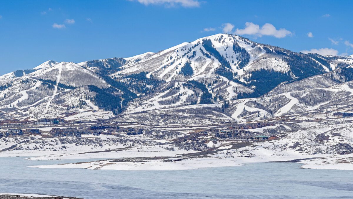
Panorama of Jordanelle Reservoir with Deer Valley Resort in the distance. Photo: TownLift // Kevin Cody
SALT LAKE CITY, Utah — Utah’s 2025 water year began with higher-than-average valley precipitation, reaching 125% of normal in October, according to a report from the Natural Resources Conservation Service (NRCS). Boosted by significant rain in the Uinta Basin and Southeastern Utah, the early season totals offer a hopeful start despite regional soil moisture challenges.
“Precipitation totals in Utah’s valley locations were impressive,” stated the report, noting geographic disparities in soil moisture. Statewide soil saturation ended October at 35%, on par with last year but well below average. Jordan Clayton, data collection officer for the NRCS Snow Survey, said that Northern and western Utah, along with the St. George area, experienced particularly dry soil conditions, while soil moisture in the Uinta Basin rebounded to around the bottom 30th percentile after mid-October storms.
“Utahns might be eager to see early snowpack buildup, but it’s worth noting that snowpack percent of normal values aren’t meaningful this early,” the report advised. The NRCS emphasized that despite last winter’s above-normal snowpack, trends can shift midseason due to atmospheric pressure patterns, advising residents to temper expectations until later in the season.
The state’s mountain regions, which recorded 2.1 inches of precipitation in October, saw 90% of typical October totals, slightly trailing valley percentages. Soil moisture levels in mountain regions remain near the 10th percentile, potentially affecting spring runoff efficiency. Shallow and mid-level soil layers (2-inch and 8-inch depths) showed improvement following October storms, while deeper layers (20-inch depth) continued to lag.
Statewide reservoir storage held steady at 71% of capacity, marking a slight decrease from last year’s November 1 figure. Water Availability Indices (WAIs), which reflect reservoir and streamflow conditions, varied across the state. WAIs ranked in the top 20th percentile for the Ogden, Price, and Joe’s Valley basins but fell below normal in the Blacks Fork, Smiths Fork, Lower Sevier, and Virgin River watersheds.
This report’s preparation included contributions from Logan Jamison, a staff hydrologist at the NRCS.


