Environment
State water levels declining after two dry months, raising worries of impending drought
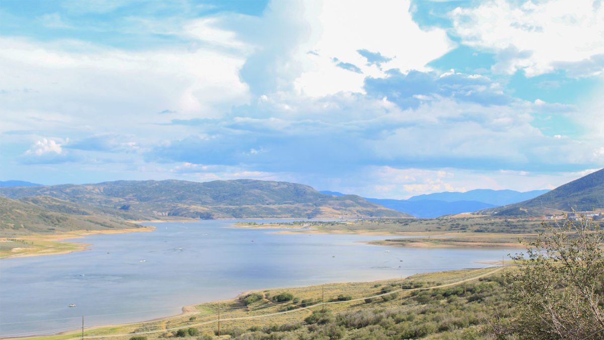
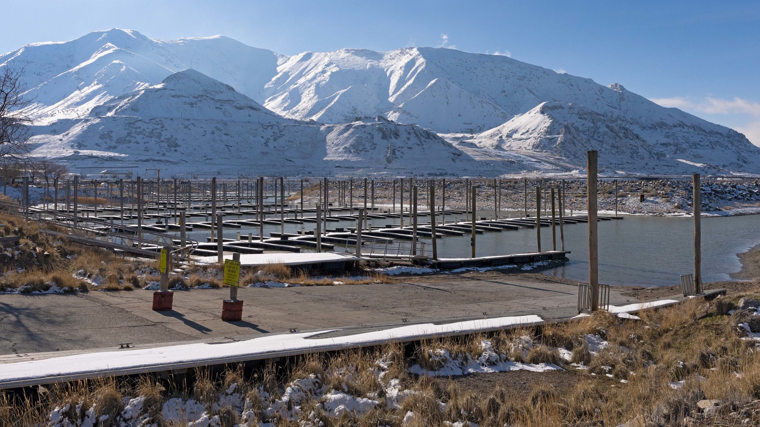
The Jordanelle Reservoir. As SNOTEL sites in the mountains are snowing drying soil, experts are concerned about future drought un Utah. Photo: TownLift // Rayne Moynahan
SUMMIT COUNTY, Utah – After two consecutive dry months in June and July, state officials are beginning to worry about the possibility of future drought conditions.
July was a disappointing month for Utah’s mountain precipitation. A recent report published by Natural Resources Conservation Science (NRCS) shows July precipitation levels around the state relative to average, but the high-elevation mountainous areas where water supply is generated, called SNOTEL sites, received a meager 0.6 inches of precipitation during July, which is only 54% of normal.
This brings Utah’s statewide water year-to-date precipitation to 103% of normal and raises concerns about water availability moving forward.
As of August 1, statewide mountain soil moisture began to dip below normal, at 35% saturation. Experts say comparing soil moisture levels at different depths can provide an indication of future drought conditions.
“We are really hoping to avoid a repeat of the 2020 summer, where an above-normal preceding snowpack season was followed by extremely hot and dry conditions resulting in historically dry soil moisture levels going into the subsequent winter,” the report read.
That confluence of events is what would, in turn, contribute to poor runoff conditions the following spring because more snowmelt would seep into the dry layer of soil before reaching state reservoirs.

exception of the Bear watershed, July rainfall was quite meager across the state. Image: NRCS
Water availability
Statewide reservoirs are currently at 83% of capacity, which is 8% lower than last month. While our reservoir capacity is still high, the decreases shown per basin present some reason for concern among scientists. Water Availability Indices (WAIs) for Utah basins combine current reservoir conditions with observed monthly streamflow for each region. WAIs have dipped below normal—50th percentile—for the Western Uintas, Blacks Fork, Smiths Fork, Joes Valley, and Lower Sevier areas.

have been able to retain a large percentage of their storage capacity, others, such as the San Pitch and
Upper Sevier basins as well as the Tooele-Vernon Creek area, have depleted available water resources at
a faster rate. While Utah’s reservoirs are generally in good shape, officials continue to encourage water
managers to conserve water where possible to prepare for the possibility of a return to drought
conditions in future years. Chart: NRCS
By: Marina Knight

438 Castle Valley Drive
Castle Valley, UT 84532
2349 S Lava Vista Drive, Lot 32
Santa Clara, UT 84765
80 West 300 North
Salt Lake City, UT 84103
3267 W Deer Hollow Road, Unit 2305
Park City, UT 84060Talk of the Town


Park City Jobs

Junior Interior Designer, Abigail Hill
3 days ago Contractor

Dental Assistant, Rise Dental Wellness
3 days ago Full time

Sales & Marketing Coordinator – B2B Publishing, Power Trade Media
5 days ago Full time $40,000 - $45,000 yearly
Computer / Website Assistant, Summit Support
10 days ago Part time $20.00 - $30.00 hourly

Garden Steward and Educator, Summit Community Gardens and EATS
10 days ago Seasonal