Weather
Weekend storm may save Utah snowpack from plunging to new 43 year low

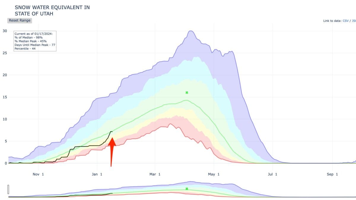
Snow water equivalent in the state of Utah. Jan. 1, 2024 Photo: USDA
Despite some variability in exact amounts, forecasts consistently point to a high probability of accumulating snow with 6-12 inches expected across the mountains.
PARK CITY, Utah — The Utah snowpack is on track to break through the hydrologic normal minimum level with 43 years of recorded data by Jan. 11 if we do not get more snow. As of Jan. 1, 2024 the current Utah Snow Water Equivalent level is 3.9 inches according the the USDA Snow Water Equivalent chart. Without adding to the current snow pack depth Utah will cross below the minimum recorded snowpack level set in 1981 at 3.9 inches on Jan. 11, 2024 and that is assuming it does not shrink prior.
For the first time in a long while, snowflakes are in the long range forecast from the National Weather Service. Light snowstorms are expected late this week starting Wednesday night through Friday with an inch or so of accumulation.
Weekend Storm
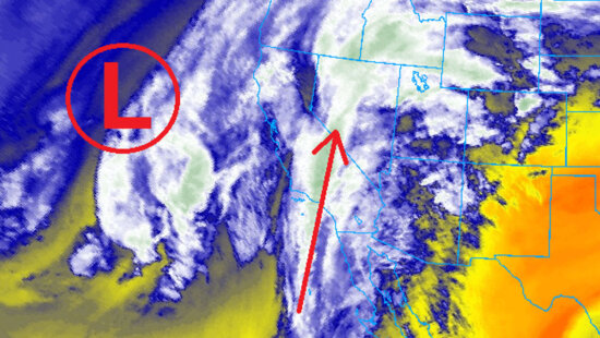
The upcoming storm we have our eye on is set to unfold from the evening of Jan. 6 through Sunday, Jan. 7, with promise of significant snowfall. Current projections indicate a minimum accumulation of 0.5-1.5 inches in most central and northern Utah valleys, with 6-12 inches expected across the mountains. Despite some variability in exact amounts, forecasts consistently point to a high probability of accumulating snow, particularly in mountainous areas.
Powderchasers, who’s watching the storm, says, “Moderate confidence exists for double digits in the Wasatch by Sunday” and that the more optimistic “European deterministic model shows a more northerly track with double digits possible for the Wasatch extending into the Tetons and most of Idaho and northern Montana.”
powderbuoy, who’s also tracking this system, is putting the 8th, 10th, 13/14th on the radar for future storms.
So yes, “We are saying there’s a chance” of some fresh POW this weekend and it might just keep this years snowpack from becoming the worst in 43 years of recorded history.


