Weather
Snow headed for the Wasatch followed by warmer temps returning on Sunday
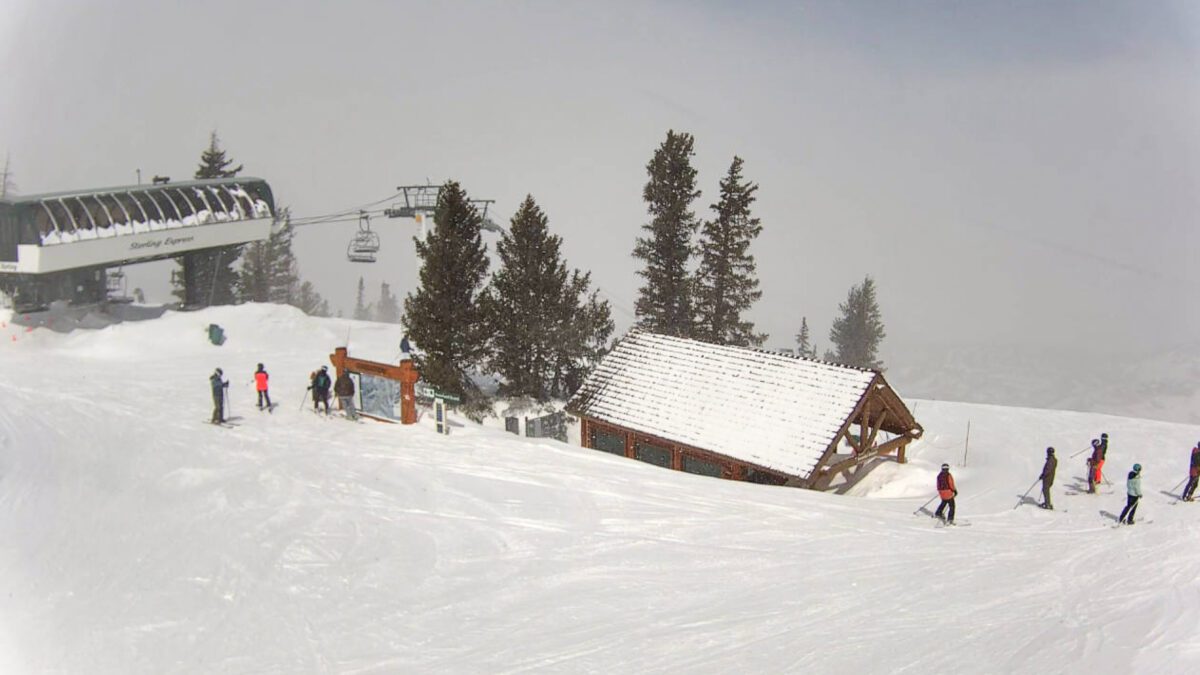
View from the Wasatch Express Cam at Deer Valley Resort at 11:30 a.m. on Thursday. Photo: Courtesy of Deer Valley Resort.
PARK CITY, Utah — Cooler temperatures and a fresh storm means a return to snow for the Wasatch. The Pacific Northwest storm is expected to drop as much as a foot in the Cascades before passing through Utah sometime after noon on Thursday.
Powderdchasers forecasts light to moderate snowfall, reaching as much as six inches across the Wasatch Range on Thursday. Snow will pick up again Friday morning before eventually passing into Colorado by Saturday.
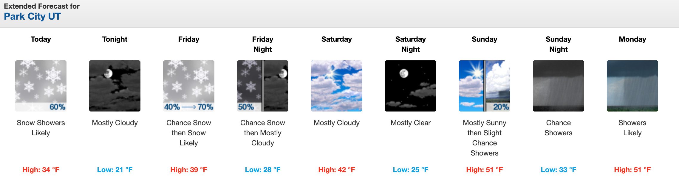
Summit County resorts and the Cottonwoods are likely to receive decent snow totals thanks to Northwesterly winds of cold air containing half to three-forths inches of water, according to Powderchasers. With several Utah resorts remaining open, the fresh wave of snow and cooler temperatures will only add to the good skiing.
Soft groomer laps after a little refresh. 🤘
🎥: @GoPro #GoPro pic.twitter.com/aPsxCO9aOo
— Solitude Mountain Resort (@SolitudeMTN) April 19, 2023
Perhaps the biggest win from this wave of cold air and snow is that it will stop snow melt and allow for already high water levels in streams, rivers, and drainage areas to go down, making room for the next round of runoff. While there have already been flooding and various landslides, having the thaw and freeze cycles is what makes the spring runoff season occur in a more orderly fashion, unlike what happened in 1983.
A look back at the flooding of 1983 as Utah gears up for heavy spring runoff
By: Kevin Cody

2154 S Rio Verde
Moab, UT 84532
2475 W White Pine Lane
Park City, UT 84060
2400 E Walker Lane
Holladay, UT 84117
137 W Bridlewood Lane
Midway, UT 84049Talk of the Town


Park City Jobs

Food & Beverage Operations Manager, Hotel Thaynes
2 days ago Full time $70,000 - $80,000 yearly
Director of Operations, City League PC
7 days ago Full time $70,000 - $80,000 yearly

Lead Property Manager, Mountain Estates Property Management
10 days ago Full time $70,000 - $90,000 yearly
Groups and Military Assistant Manager, National Ability Center
12 days ago Full time $49,000 - $51,000 yearly
Equestrian Assistant Program Manager, National Ability Center
13 days ago Full time $49,000 - $51,000 yearly