Top Stories
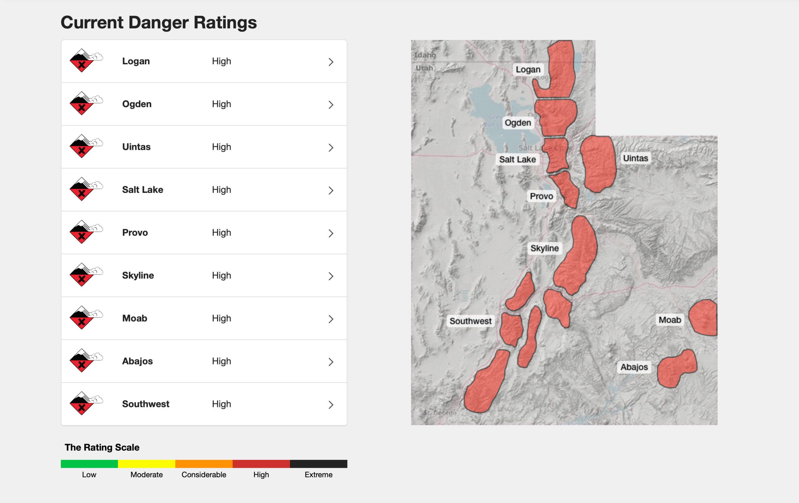
High Avalanche danger rating across the state, with large, destructive, and long-running avalanches likely
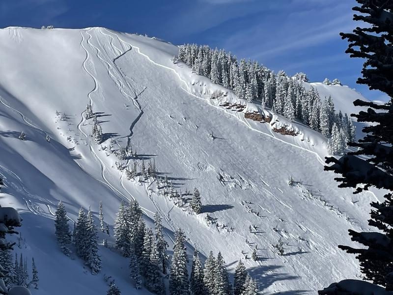
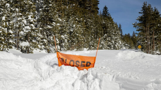
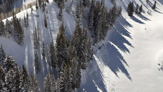
Large avalanche at Dutch Draw in the Park City area on December 29, 2022. Photo: Courtesy of the Utah Avalanche Center.
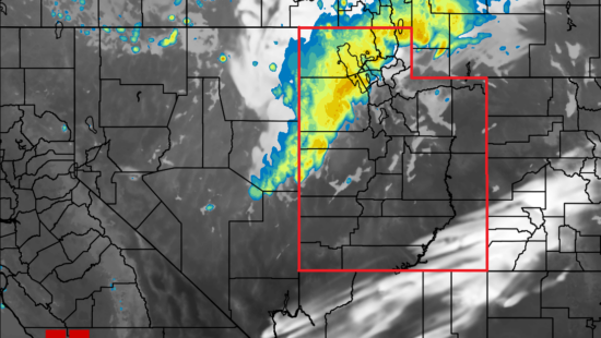
UTAH — An end-of-the-year snowstorm has brought multiple feet of snow to the Wasatch Mountains, with Brighton Ski Resort reporting that it has received 83 inches of snow since Wednesday.
This extreme snowfall, combined with already weak snow layers and fluctuating temperatures, has led to the Utah Avalanche Center rating every region of Utah as having a high danger of avalanches to occur.
All this new snow has come after a warm front and high winds; the combination of those on top of an already existing persistent weak layer could lead to large avalanches. The danger is compounded by the fact that signs of instability, such as cracking or collapsing in the new snow, can be hidden, making a trek out onto a slope more like a game of minesweeper where at any point, an avalanche could be triggered.
From the forecast in the Salt Lake area mountains, the forecaster went as far as saying that the large avalanches that are likely to occur are not ones that a person would have a good chance of surviving, with the recent avalanche on the east face of Reynolds Peak in Big Cottonwood Canyon being cited as an example of what could happen. That avalanche reached a depth of 4 feet and stretched 300 feet wide.
By: Kevin Cody

4539 S Willow Road
Holladay, UT 84117
19 East 100 North
Spring City, UT 84662
965 Goshen Canyon Road
Mona, UT 84645
24 South 600 East
Salt Lake City, UT 84102
10584 Basin Canyon Road
Park City, UT 84098Talk of the Town


Park City Jobs

Assistant Manager, LOMA
5 days ago Full time $35.00 hourly
Property Inspector, Park City Rental Properties
6 days ago Full time $23.00 - $25.00 hourly
Owner Relations Manager, Park City Rental Properties
6 days ago Full time
Operations Manager, Park City Rental Properties
6 days ago Full time

Hiring Barista Assistants and Baristas, Silver King Coffee
9 days ago Part time $17.00 - $30.00 hourly