Community
Park City paved section of the Rail Trail could almost double in width under plans
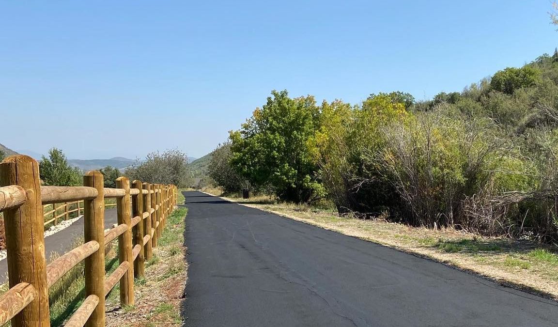
The Park City section of the Rail Trail. Photo: City Government of Park City, Utah
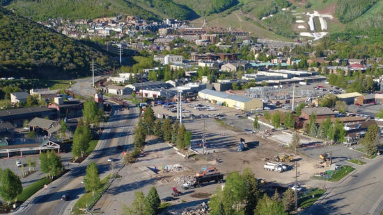
PARK CITY, Utah — Park City is currently exploring options to improve the safety and maintenance of the Rail Trail, specifically the 2.75-mile paved section that the city manages between Bonanza Drive and SR-248.
The Rail Trail is a 27-mile trail that goes from Prospector to Echo in northern Summit County. Park City has a cooperative agreement with Utah State Parks, which manages the full trail, to master plan the Park City (paved) section.
The city’s trails and open space manager, Heinrich Deters, said that on average that section of the trail sees 200 users per hour at peak times. “E-bikes have been steadily growing,” he told the Park City Planning Commission on Wednesday.
Numerous open houses have been held and a survey was conducted for public feedback. The improvement process kicked off last year after receiving direction from the city council.
Generally, the public wants to see more connections made, including at Quinn’s Junction, Park City Heights, and Jordanelle. In addition, many have said that design features such as signage and striping, overcrossings/bridges, and separating the trail by mode would help improve the overall experience.
Maria Vyas with Fehr & Peers, a consultant hired by the city for the project, said safety and enforcement were common themes from respondents.
“Really, this is primarily applying to bikes and dogs. The dogs, you know, people wanting them to be on leash where they’re supposed to be on leash, and a lot of sentiment about the bikes, especially e-bikes,” Vyas said.
“It was kind of funny. People that were on bikes were like, ‘oh, the pedestrians they’re so accommodating, they’re so friendly’ — and the people that were walking were like, ‘oh my god, the bikes are scaring me half to death.'”
More seating options was another thing that came up, Vyas said.
“We also got some more extreme aspects,” Deters said. “We had several people say bring the train back. We had ‘people could use it for a gondola corridor.’ We also got a fair amount of feedback like ‘leave it alone.'”
He said there were people asking for more lights and others that didn’t want any whatsoever. He also noted in the draft recommendations that they are considering expanding the width to 18 feet. It is currently roughly 10 feet wide. He said that panels could be added in the future to delineate between walkers and bikers.
Deters also said they are looking at putting a bathroom by the section of the trail near White Pine Touring, and exploring parking options.
Summit County is also exploring additional aspects with Utah State Parks for the remainder of the trail, which goes to Echo.
Concrete plans are expected to be in front of the city council in July. You can still submit feedback via Park City Engage.
Appreciate the coverage? Help keep Park City informed.
TownLift is powered by our community. If you value independent, local news that keeps Park City connected and in the know, consider supporting our newsroom.
By: Parker Malatesta

6110 E Blue Wing Loop
Kamas, UT 84036
1042 W Shoreline Drive
Layton, UT 84041
760 E Edgehill Rd
Salt Lake City, UT 84103
3764 Prickly Pear Circle, Unit 5-A6
Moab, UT 84532
2304 N Cohonina Trail
St. George, UT 84770
1545 N Red Castle Circle
Heber City, UT 84032Talk of the Town


Park City Jobs

Digital Marketing Associate, Park City Community Foundation
Today Contractor $24.00 - $27.00 hourly

Equestrian Stall Cleaner/Feed - EVENINGS, Part-time, SkyRidge
1 day ago Part time $22.00 hourly
Barista/ Cashier, chomp donuts
2 days ago Full time $17.00 - $25.00 hourly
Pastry chef/ Donut Chef, chomp donuts
2 days ago Full time $55,000 - $75,000 yearly
Donut chef/ maker, chomp donuts
2 days ago Full time $17.00 - $24.00 hourly