Weather
Utah fire danger rises as hot, dry conditions collide with weekend winds
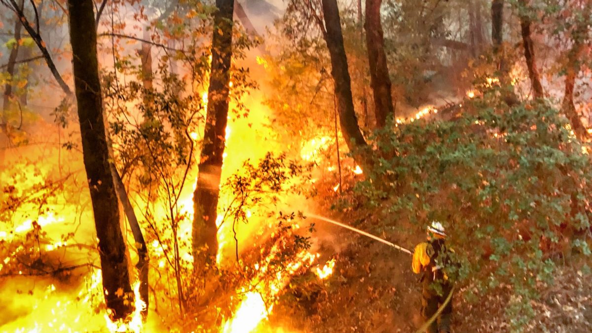
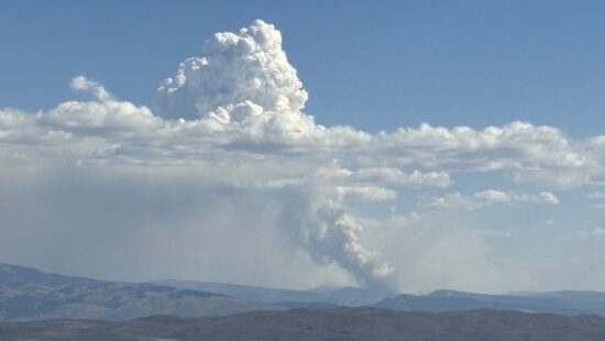
LNU Lightning Complex Fire Photo: TownLift
Forecast comes as the state enters summer under a drought emergency after a record-low snowpack year
PARK CITY, Utah — Fire danger is increasing across Utah as hot, dry conditions combine with rising winds, with the most immediate concerns in southern Utah before stronger winds spread across the state this weekend.
KUTV 2News meteorologist Chase Thomason warned Tuesday that Utahns should use extra caution outdoors as conditions become increasingly favorable for wildfire ignition and rapid fire spread.
“Any spark could quickly start a wildfire,” Thomason wrote in a social media post. “Please avoid activities that could cause a fire and use extra caution outdoors.”
The National Weather Service in Salt Lake City issued a similar warning Thursday morning, forecasting near-critical fire weather conditions across southern Utah throughout the day as winds increase and humidity levels remain low.
Stronger southwesterly winds are expected to develop on Saturday, increasing the likelihood of more widespread critical fire weather conditions this weekend. The National Weather Service said very dry conditions are expected to continue across much of Utah into early next week, with low relative humidity and limited overnight moisture recovery.
The forecast comes as Utah enters the summer under a statewide drought emergency following its warmest winter on record and the lowest snowpack on record.
Gov. Spencer Cox declared a statewide state of emergency on May 21 due to extreme drought conditions. Utah Division of Water Resources officials said 100% of the state is experiencing some form of drought, with 59% classified in extreme drought.
TownLift has tracked the deepening conditions throughout the winter and spring. Utah’s snowpack peaked March 9 at just 8.4 inches of snow water equivalent, more than three weeks earlier than average and about half of what the state typically receives by the beginning of April. The snowpack then melted at the fastest rate ever recorded in March.
The conditions are particularly significant in Summit County, which sits near the headwaters of the Weber and Provo river systems and relies heavily on snowpack in the Uinta Mountains for the downstream water supply.
Early snowmelt also carries implications beyond drinking water and irrigation. In March, Utah State University Extension wildfire specialist Bradley Washa told TownLift that the state’s record-low snowpack and unusually warm winter could contribute to an earlier and potentially more intense wildfire season.
Drying vegetation is now adding to those concerns. The Utah Division of Water Resources said drought conditions are expected to worsen as temperatures rise, increasing stress on water supplies, wildlife, and recreation, and creating conditions for elevated fire danger.
Rocky Mountain Power has also warned customers that heightened wildfire risk could result in longer or more frequent power outages this summer. During periods of extreme fire risk, the utility may use enhanced safety settings or temporarily shut off power lines to reduce the chance that electrical equipment could spark a wildfire.
Officials are urging residents to avoid activities that could ignite dry vegetation, including dragging trailer chains, parking vehicles on dry grass, and leaving campfires unattended. With winds expected to strengthen over the weekend, even a small spark could spread quickly.
By: Rebecca Brenner

4739 W Snowflake Drive
Highland, UT 84003
2410 W Entrada Trail, Unit #4
St. George, UT 84770
950 S Aspen Circle
Woodland Hills, UT 84653
1011 E Mill Road
Heber City, UT 84032Talk of the Town


Park City Jobs
Director of Operations, City League PC
3 days ago Full time $70,000 - $80,000 yearly

Lead Property Manager, Mountain Estates Property Management
6 days ago Full time $70,000 - $90,000 yearly
Groups and Military Assistant Manager, National Ability Center
9 days ago Full time $49,000 - $51,000 yearly
Equestrian Assistant Program Manager, National Ability Center
10 days ago Full time $49,000 - $51,000 yearly

Marketing Manager, Junction Commons
15 days ago Full time