Environment
Utah snowpack behind schedule as warm storms push snowlines higher
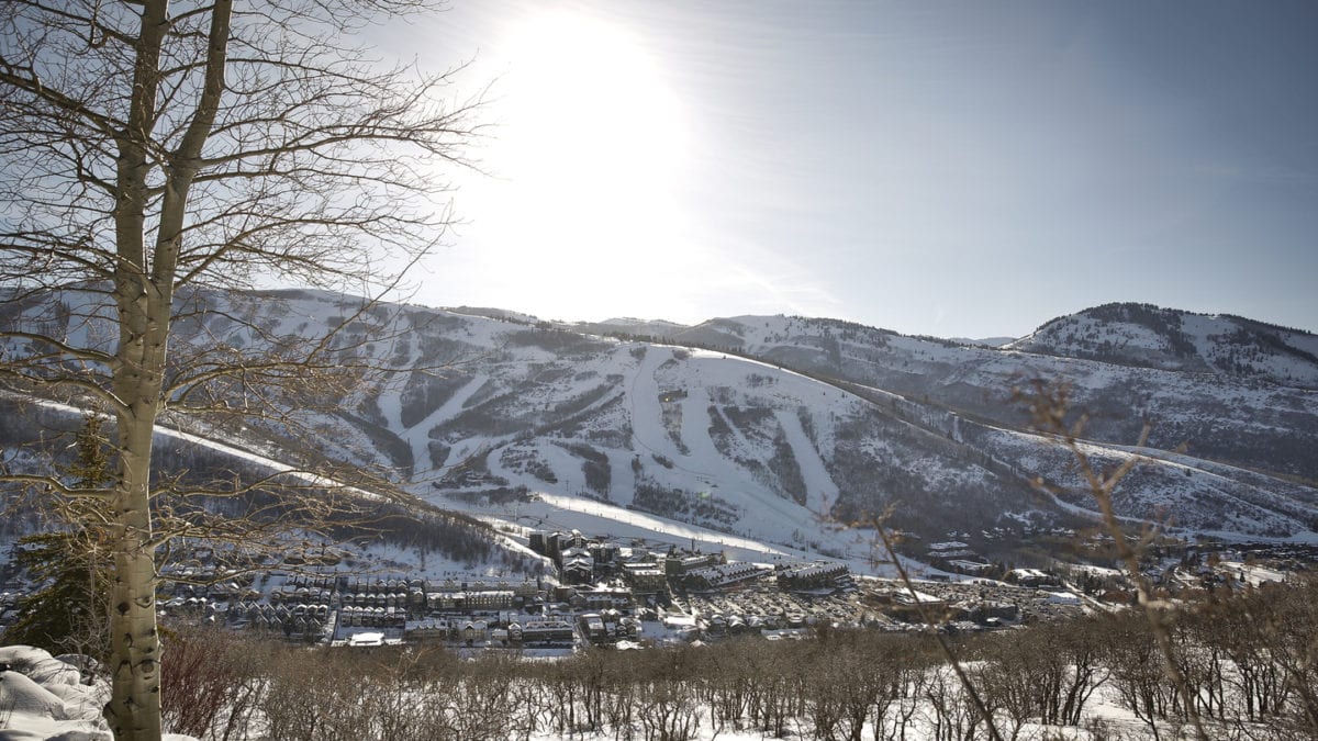
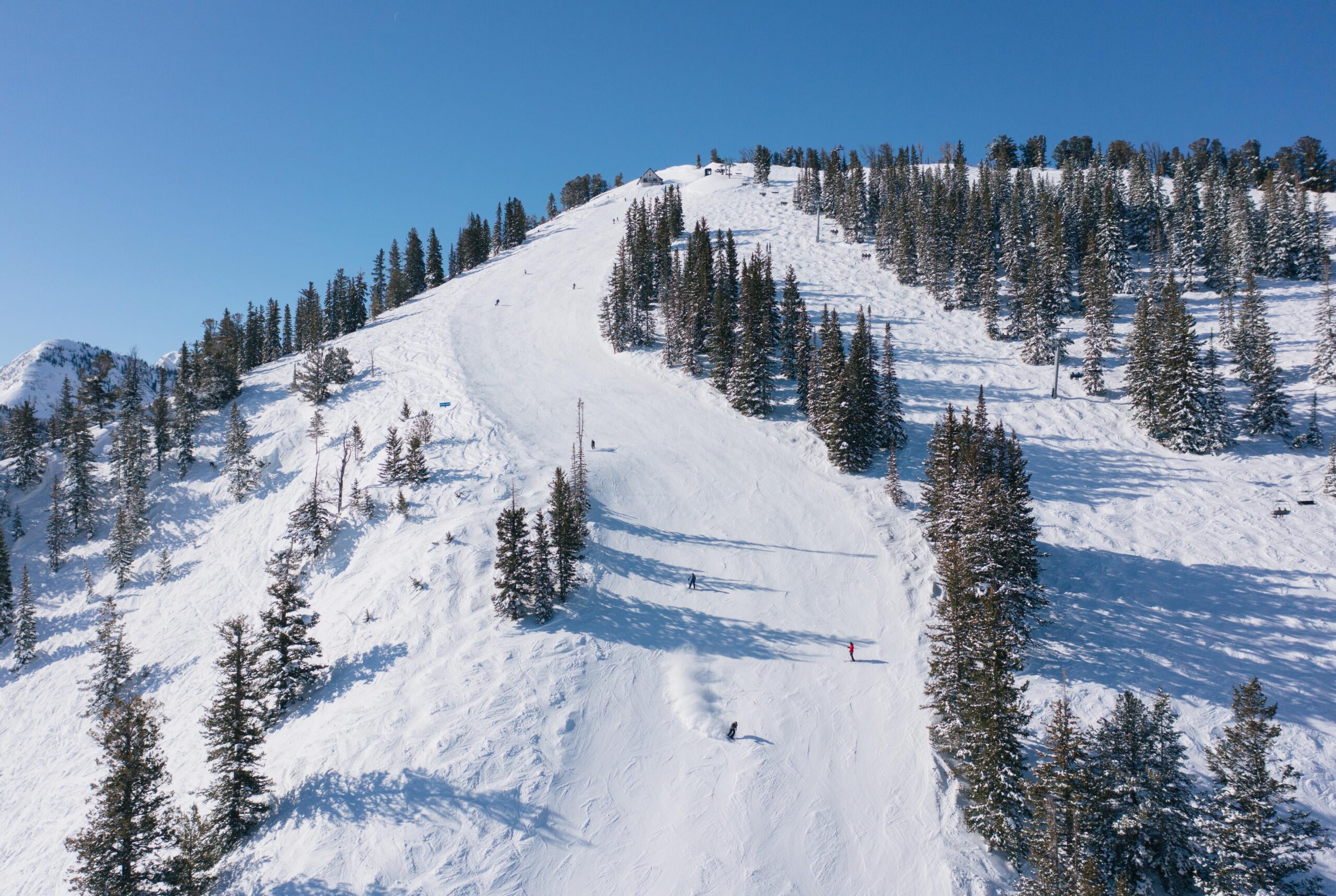
Photo: Park City Chamber/Bureau
SALT LAKE CITY, UT — Utah’s winter brings much-needed moisture, but too little of it is falling as the cold mountain snow that serves as the state’s water “savings account” for spring and summer.
As of Jan. 4, 62% of Utah stations were in “snow drought”—a term meaning that the amount of water stored in the snowpack, known as snow water equivalent, was below the 20th percentile, according to Drought.gov’s latest western snow drought update.
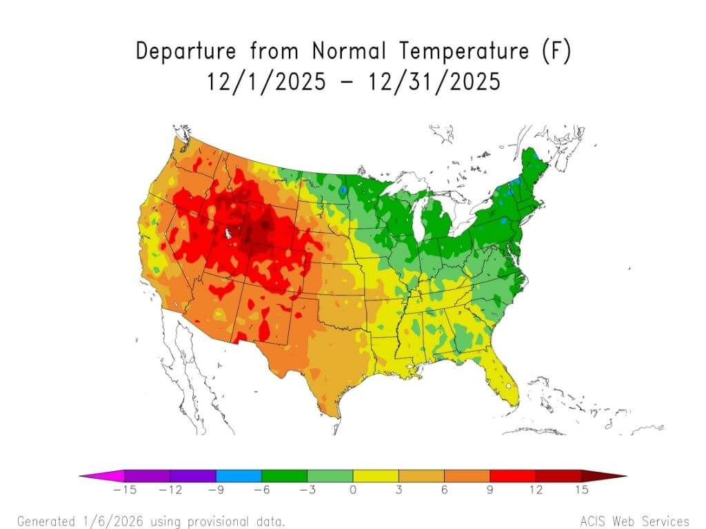
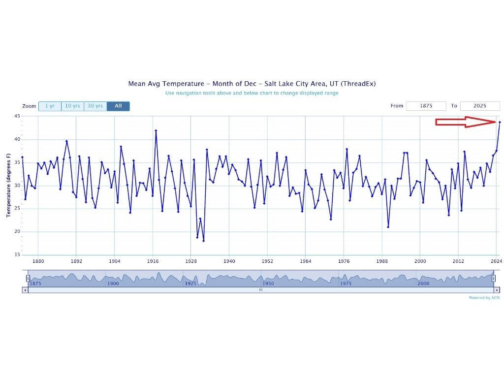
Drought.gov attributed the poor start in part to record warmth in December. Warmth can push precipitation toward rain, melt low-elevation snow, and reduce the amount of water stored in snowpack.
Warm storms, high snowlines
In a Jan. 9 email shared with TownLift, Jordan Clayton, a data collection officer and supervisor with the USDA Natural Resources Conservation Service (NRCS) Utah Snow Survey, said the season began with “record-breaking warm conditions and poor snow cover.” He explained that storms have brought heavy snowfall, leading to “an unusual amount of liquid precipitation” at mid- and high-elevation areas. (NRCS Utah Snow Survey monitors snowpack and water content in the state.)
Clayton said that as of Jan. 1, 20 SNOTEL stations in Utah were at record-low snow water equivalent, with eight more reporting their second-worst conditions for the date. (SNOTEL, or Snow Telemetry, stations are automated sensors that track snowpack and its water content.) He noted conditions improved somewhat after early January storms, raising statewide snow water content from 56% of normal to 75%, but said much of the state remained “way well below where we want to be.”
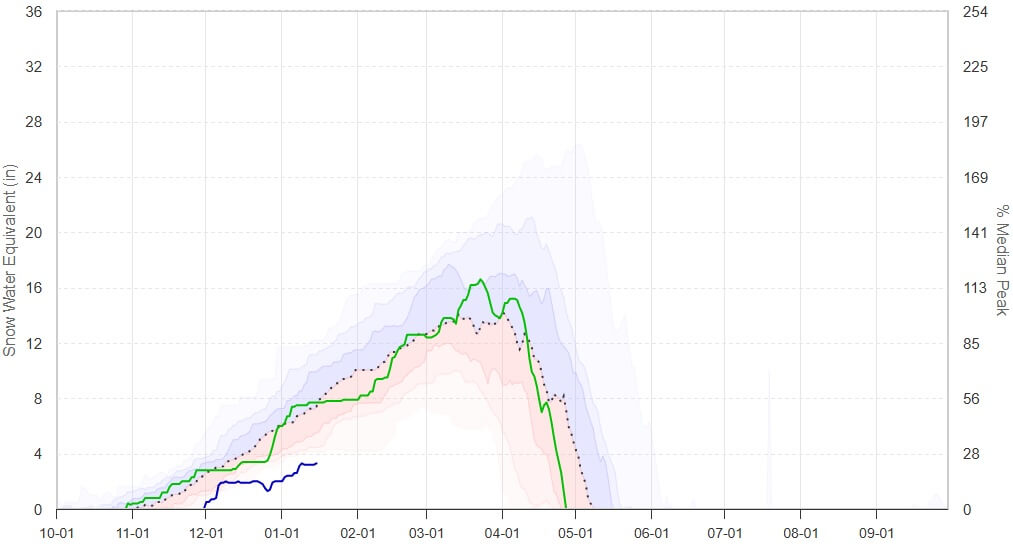
What the latest SNOTEL report shows
NRCS’ Utah SNOTEL Snowpack Update Report—based on the first reading of the day for Thursday, Jan. 15, 2026—shows the snowpack gap is still especially sharp in several basins. (SNOTEL reports use data from the automated snowpack sensors to measure snow water equivalent.)
Among the lowest basin indices in the Jan. 15 update:
- Lower Sevier River: 27%
- Tooele Valley–Vernon Creek: 32%
- Price–San Rafael: 62%
For the Wasatch Back and much of northern Utah, the report lists:
- Weber–Ogden rivers: 65%
- Provo River–Utah Lake–Jordan River: 65%
Some higher terrain is doing better. This includes the Northeastern Uintahs, which are at 87% in the same update.
NRCS notes the SNOTEL report is provisional and subject to revision.
Why this matters for Utah’s water
Utah is unusually dependent on mountain snowpack. The Utah Division of Water Resources reports that the state receives about 95% of its water from snowpack and that reservoir storage depends on snowpack and runoff.
That’s why a warm, rainy storm can be a mixed bag. Rain can boost short-term moisture and even help soils. But it doesn’t “bank” water for late spring and summer the way snowpack does.
What comes next
Clayton said early-season conditions can still change. He pointed to several past winters with similar early snow water content that ultimately finished above normal. But with multiple basins still far behind as of Jan. 15, Utah’s water outlook will hinge on whether upcoming storms become colder and begin building snowpack, not just precipitation.
By: Rebecca Brenner

1104 West 10125 South
South Jordan, UT 84095
4155 S Parkview Drive
Salt Lake City, UT 84124
1355 E Snow Canyon Parkway, Lot 27
Ivins, UT 84738
4028 E Outcrop Road
Park City, UT 84098
4170 Vista Antigua Road
Moab, UT 84532Talk of the Town


Park City Jobs

Administrative Assistant, Grand Hyatt Deer Valley
Today Full time

Junior Interior Designer, Abigail Hill
7 days ago Contractor

Dental Assistant, Rise Dental Wellness
7 days ago Full time

Sales & Marketing Coordinator – B2B Publishing, Power Trade Media
9 days ago Full time $40,000 - $45,000 yearly

Garden Steward and Educator, Summit Community Gardens and EATS
14 days ago Seasonal