Weather
Park City snow conditions: What skiers & riders can expect during Christmas week
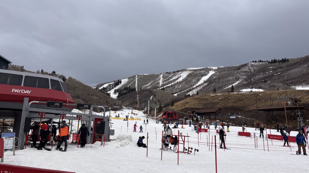
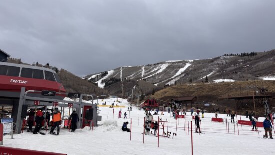
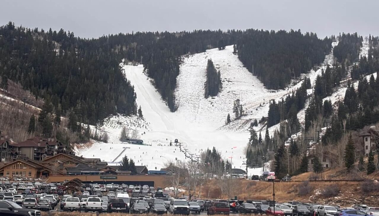
PayDay LIft with sparse snow coverage on the mountains, Park City Mountain Dec. 21, 2025 Photo: TownLift
The bottom line for holiday visitors: Expect limited terrain and marginal snow conditions before Christmas, with gradual improvement beginning Christmas Day. Resorts are leaning into extra holiday programming, a reminder that even without fresh powder, you are still on vacation.
PARK CITY, Utah — Christmas week begins with limited terrain and below-normal snowpack at Park City’s ski resorts, with better conditions up high and meaningful snowfall not expected until around Christmas Day, according to the National Weather Service and mountain weather forecaster Chris Tomer.
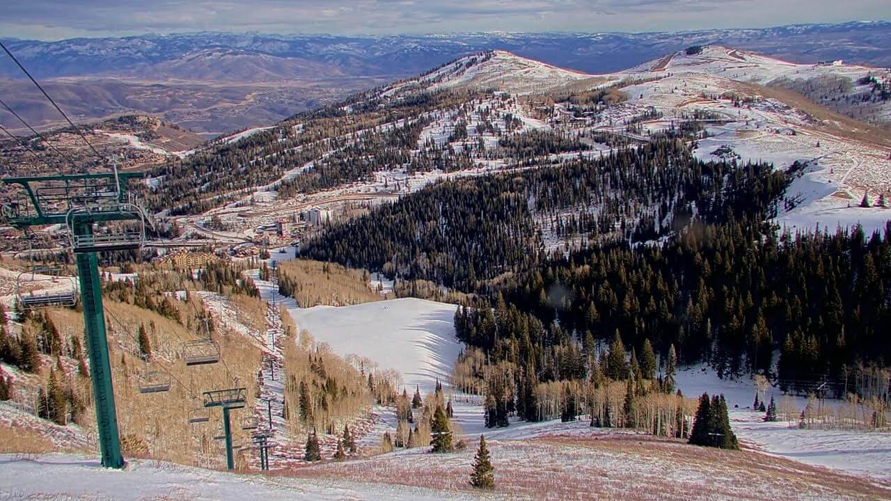
Park City Mountain & Deer Valley Resort Conditions Report
The resorts are doing everything they can amid unseasonably warm weather.
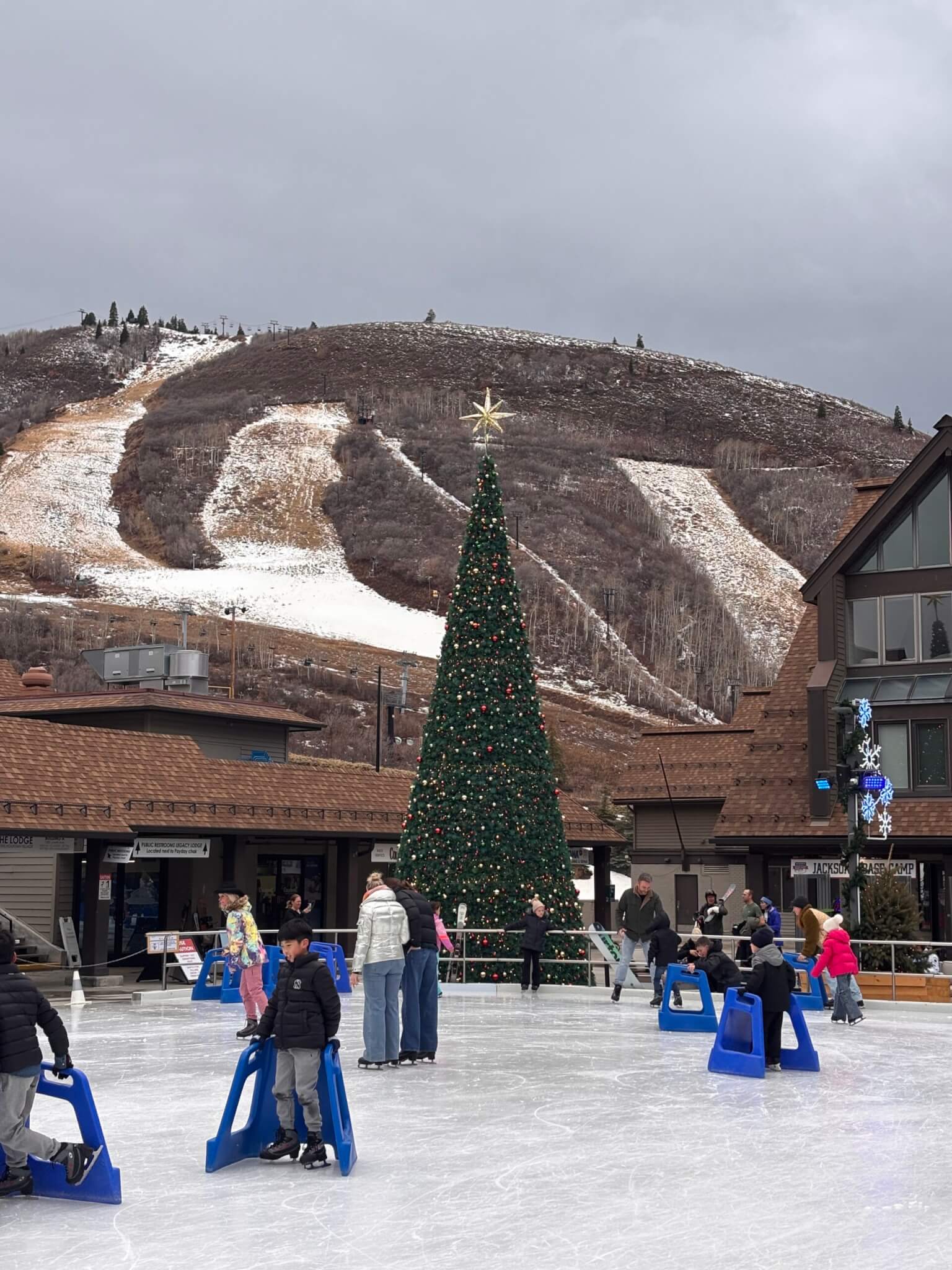
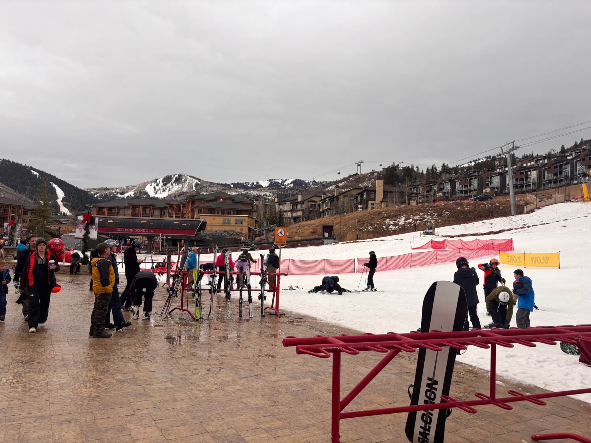
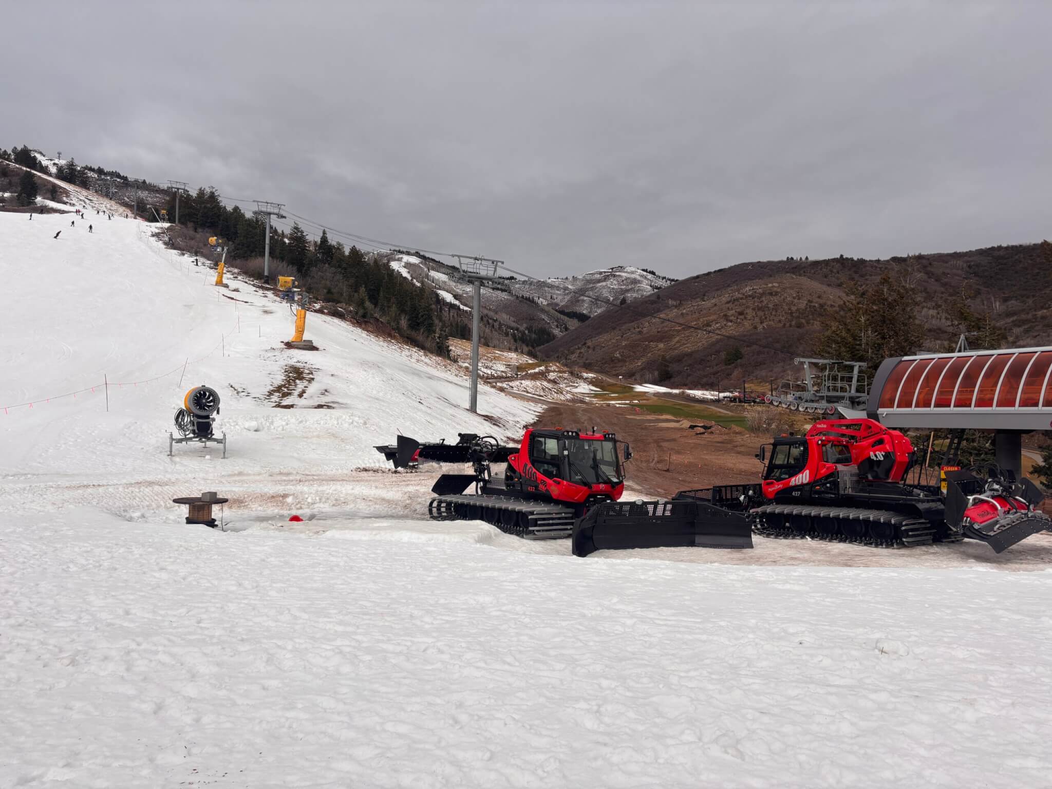
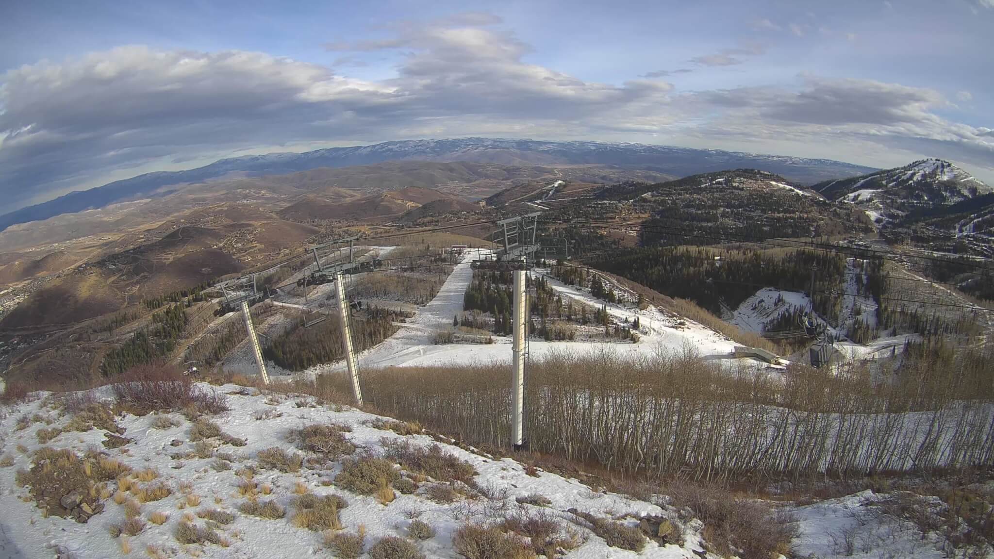
As of Dec. 21, Park City Mountain has 14 of 348 runs open, about 4% of its terrain with a 23″ Base. Photos from Sunday Dec 21, 2025.

Deer Valley Resort has 23 of 202 runs open, roughly 11% with a 18″ Base. Photos from Dec 21, 2025.

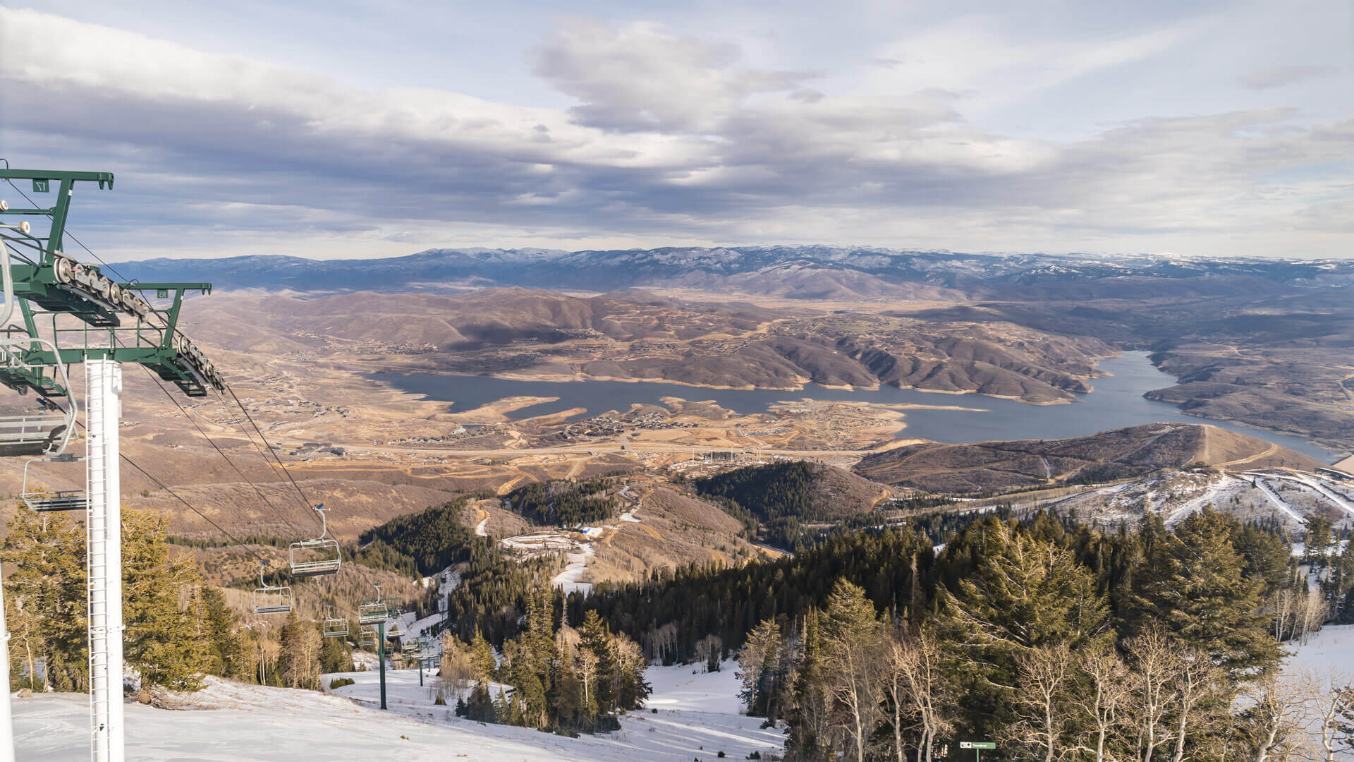
The sparse openings reflect a warm, dry early winter pattern that has left Utah resorts well behind typical late-December conditions.
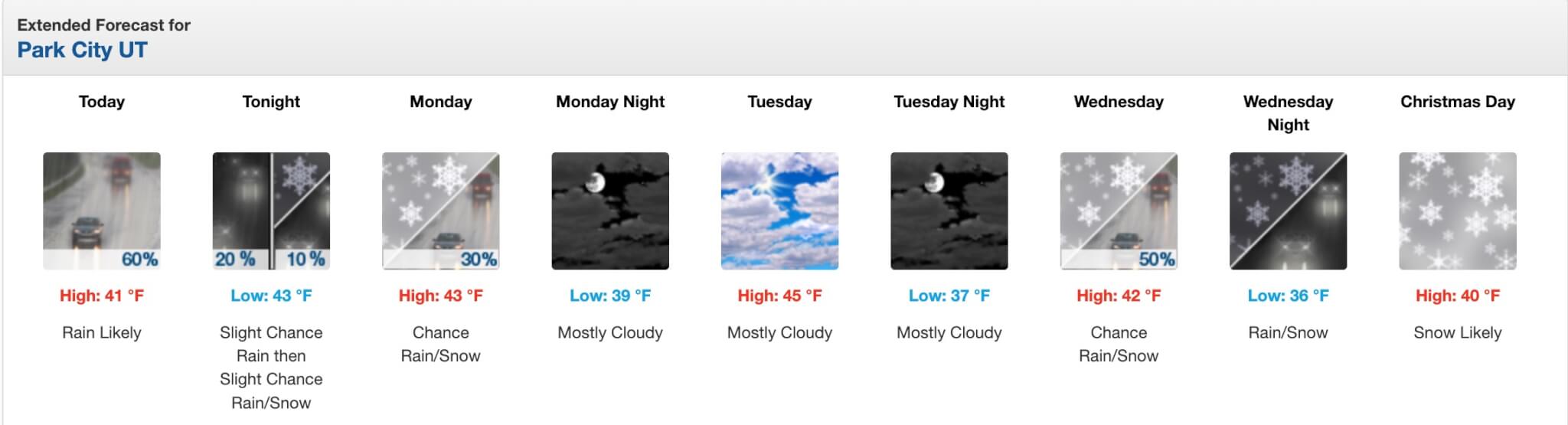
Christmas Week Weather Forecast
Early week precipitation is either rain or too warm to help much according to the National Weather Service noting that temperatures are expected to hover near or above freezing during the day.
Chris Tomer, a Colorado-based meteorologist who focuses on mountain weather, said Utah and Colorado are experiencing warmer- and drier-than-normal conditions, with rain-snow lines running between 8,000 and 10,000 feet during early storms — a major issue for resorts like Park City that rely on colder systems for natural snow.
“That’s an awful setup for base building,” Tomer said in a video forecast released Sunday. “Utah needs multiple storms just to get back near where it should be for this time of year.”
Christmas Miracle?
Relief may arrive just in time for the holiday. Both the National Weather Service and Tomer point to a colder storm system moving into the central Rockies on Christmas Eve and Christmas Day, bringing the best chance of accumulating snow during the week.
The weather service calls for snow likely on Christmas Day, with colder air allowing precipitation to fall as snow rather than rain at resort elevations. Snow chances continue into Friday and Saturday, improving conditions for grooming and snowmaking.
Tomer estimates that Park City could see roughly 7″ of snow with the big cottonwood resorts in the 10 to 20 inches of snow range over an eight- to nine-day window centered on Christmas.
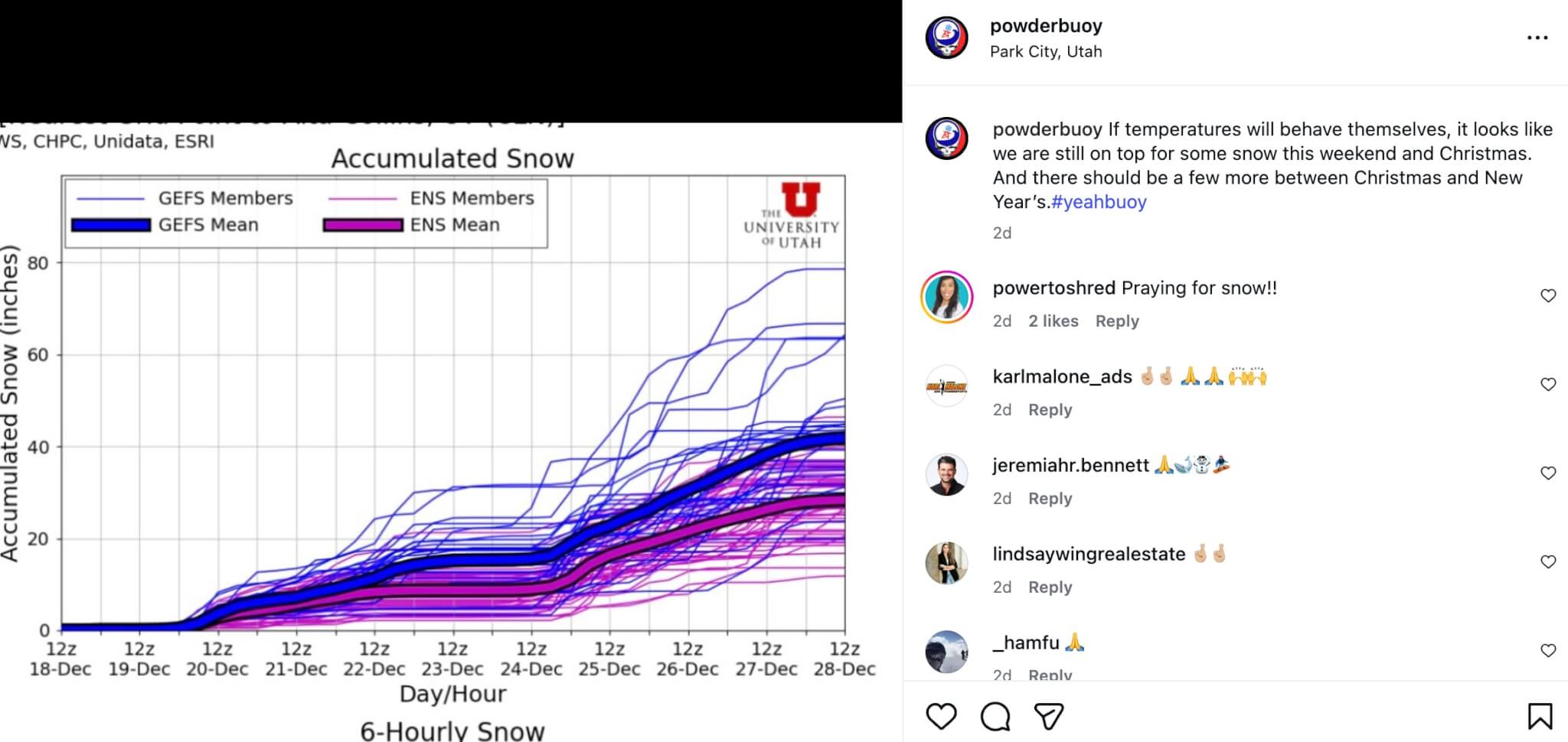
Powderbuoy is optimistic on a Christmas pop in snow accumulations saying “If temperatures will behave themselves, it looks like we are still on top for some snow this weekend and Christmas. And there should be a few more between Christmas and New Year’s.”
For skiers and riders arriving early in the week, conditions will likely be firm or slushy depending on elevation and time of day, with open terrain remaining limited. Any terrain expansion following Christmas will depend on snowfall amounts and how quickly resorts can stabilize and prepare new runs.
The outlook improves slightly after Christmas, with additional storm chances late in the week and into the New Year, but forecasters stress that Park City will remain well below normal for late December even if the Christmas storm delivers.
The bottom line for holiday visitors: Expect limited terrain and marginal snow conditions before Christmas, with gradual improvement beginning Christmas Day. Local resorts have added additional guest programming, and as the saying goes, there is no such thing as bad snow, only bad skiers.
By: TownLift

3267 W Deer Hollow Road, Unit 2305
Park City, UT 84060
438 Castle Valley Drive
Castle Valley, UT 84532
2349 S Lava Vista Drive, Lot 32
Santa Clara, UT 84765
80 West 300 North
Salt Lake City, UT 84103Talk of the Town


Park City Jobs

Junior Interior Designer, Abigail Hill
4 days ago Contractor

Dental Assistant, Rise Dental Wellness
4 days ago Full time

Sales & Marketing Coordinator – B2B Publishing, Power Trade Media
6 days ago Full time $40,000 - $45,000 yearly

Garden Steward and Educator, Summit Community Gardens and EATS
11 days ago Seasonal
PROGRAM AND EVENT COORDINATOR, PC READS
12 days ago Part time $25.00 hourly