Snow
Cottonwoods receive over 40 inches of snow, snowfall continues this week
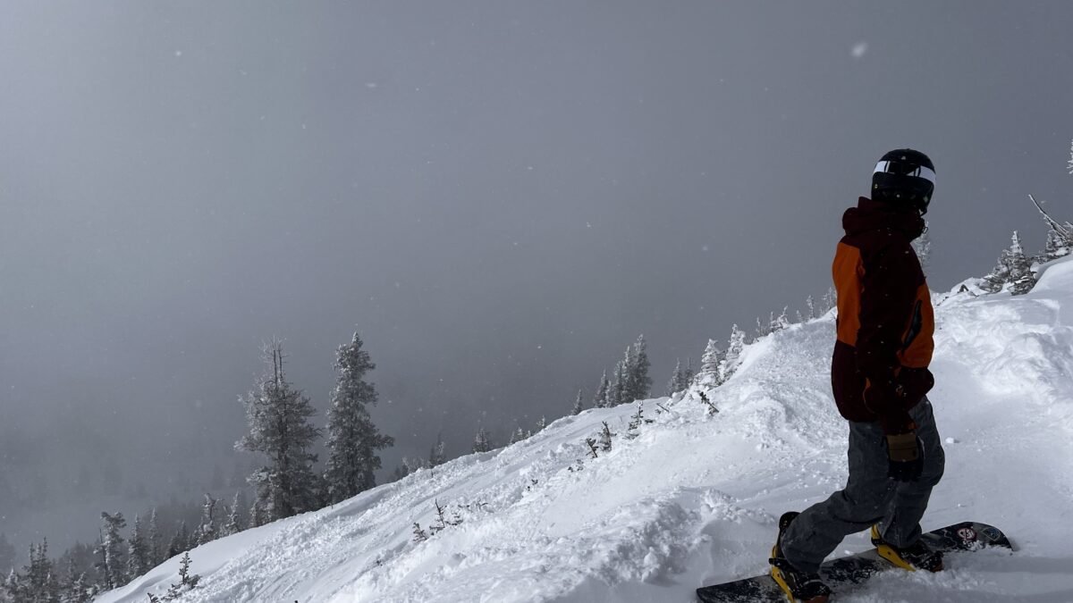
Photo: Snowboarder at Snowbird in Little Cottonwood Canyon this weekend // Adam Lenkowski
Multi-day storm cycle continues through tomorrow, with another storm expected Wednesday night
PARK CITY, Utah—The storm cycle that began Thursday, Feb. 13, is still going. We will remain in an unstable west to northwest flow pattern through Tuesday afternoon. The Wasatch Mountains will pick up another 1-4” of snow throughout the day today, Monday, Feb. 17, with similar accumulations overnight into Tuesday. A brief period of high pressure and slightly warmer temperatures moves in through Wednesday.
Snowfall totals (Thursday, Feb. 13, through Monday morning, Feb. 17)
- Cottonwood canyons: 34 – 44”
- Park City / Deer Valley: 25 – 33”
This impressive storm cycle began with strong south-southwest winds on Thursday around midday. This ended up favoring Deer Valley, as they quickly stacked up 15” of snow by early Valentine’s Day morning. However, as the flow shifted more west/northwest on Friday, the second part of the storm targeted upper Little Cottonwood Canyon, with Alta reporting another 18” Saturday morning. Bursts of snowfall continued Saturday and Sunday for some areas in the Wasatch, with accumulations in the 4 to 8-inch range on both days.
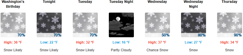
Long range outlook: Wednesday evening storm
After a lull in activity Tuesday afternoon into Wednesday, a storm system will move into Utah but will split from the main flow, shifting southward and weakening by Thursday evening. Currently, snow totals are expected to be around 5-8” for this storm later in the week. The active weather pattern we’ve been in looks to finally calm down as we move into the weekend.
High avalanche danger is forecasted today, with “multiple weak layers all over the place on many different aspects and elevations”, according to the Utah Avalanche Center.
By: Adam Lenkowski

325 White Pine Canyon Road
Park City, UT 84060
80 West 300 North
Salt Lake City, UT 84103
1511 S Valley View Circle
Springville, UT 84663
438 Castle Valley Drive
Castle Valley, UT 84532
3267 W Deer Hollow Road, Unit 2305
Park City, UT 84060
2349 S Lava Vista Drive, Lot 32
Santa Clara, UT 84765Talk of the Town


Park City Jobs

Computer / Website Assistant, Summit Support
Today Part time $20.00 - $30.00 hourly

PROGRAM AND EVENT COORDINATOR, PC READS
1 day ago Part time $25.00 hourly
Development Manager, Blue Sky Utah
1 day ago Part time $28.00 - $32.00 hourly
Executive Assistant / Property Manager Administrator, Model HOA
1 day ago Full time $30.00 hourly