Weather
Sunny skies and mild temps on tap this week, no snow in short-term forecast
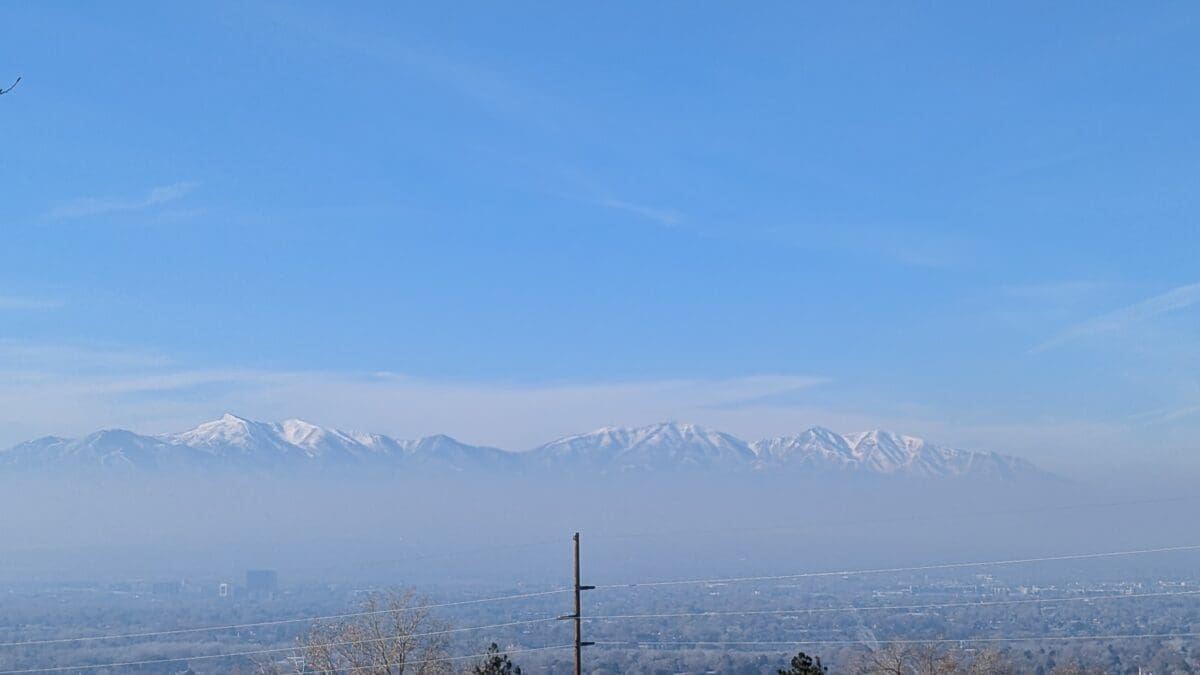
Photo: Smog begins to build over the Salt Lake valley as inversion conditions set in for the week
Warm temperatures, sunny skies, and hazy conditions persist in northern Utah valleys through Friday
PARK CITY, Utah – Utah remains under a large area of high pressure through most of the week, resulting in slightly warmer than normal temperatures and mostly sunny conditions. This will keep Park City temperatures in the mid-40s during the day and mid-20s at night.

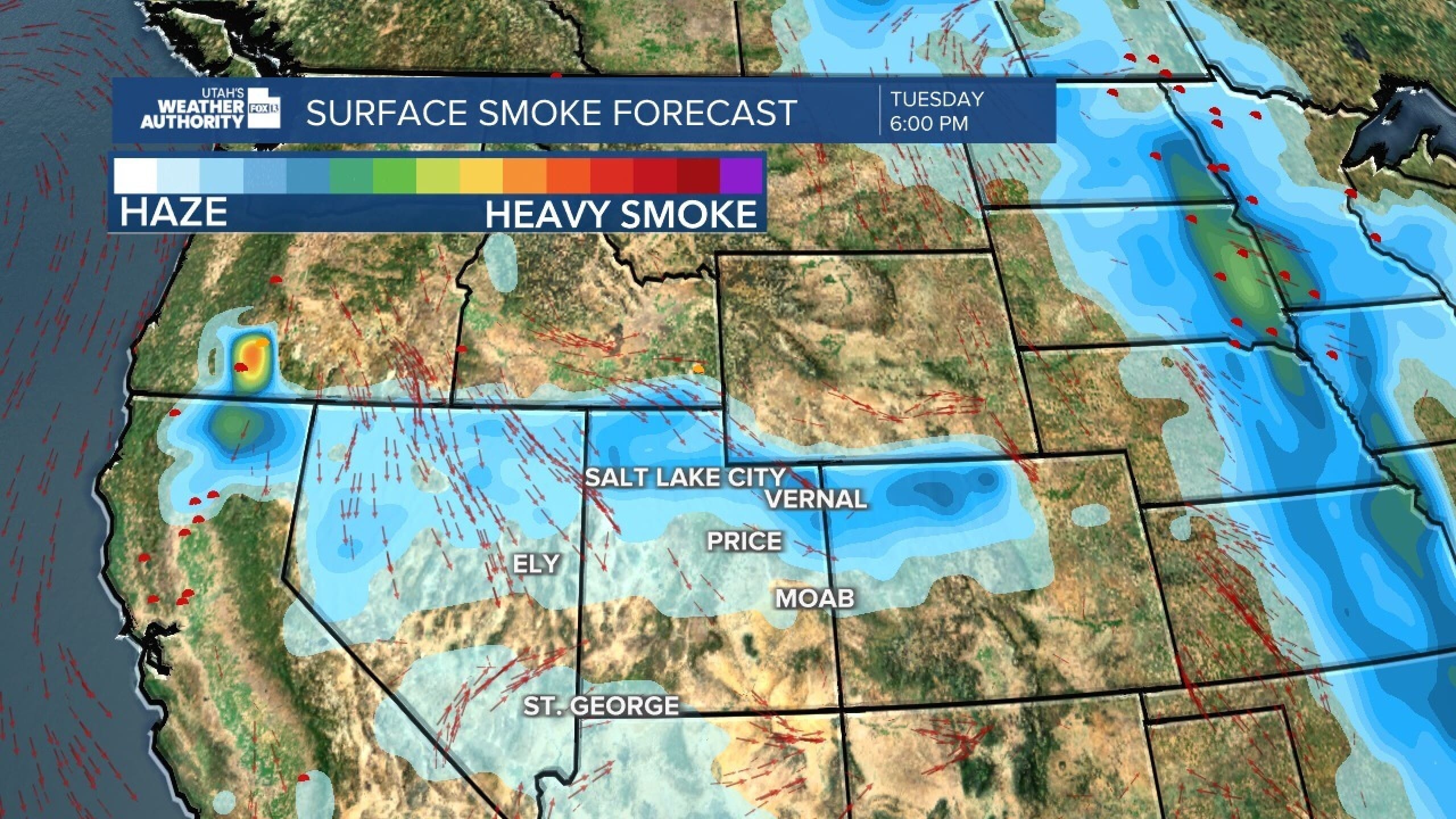
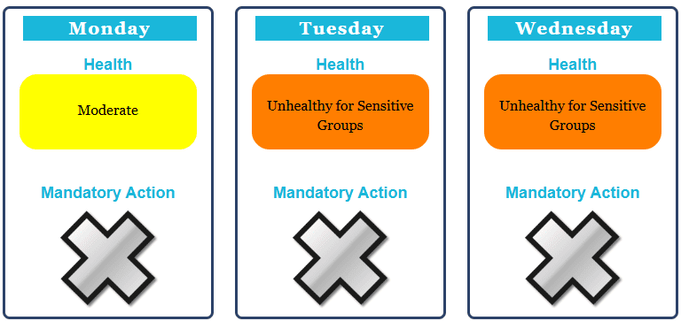
Northern Utah valleys will be under strengthening inversion conditions throughout the week, resulting in degrading air quality in some locations. UDAQ air quality forecasts are available here: UDAQ Air Quality Forecasts. Park City and Heber valleys are not forecast to have poor air quality at this time, whereas the Salt Lake valley air quality forecast goes from moderate on Monday to unhealthy for sensitive groups for the rest of the week.
A weak, dry cold front looks to impact northern Utah on Friday, which should help mix out the valley inversions and improve air quality. The next chance of significant snow looks to be on Sunday a stronger storm system is anticipated to move in, although forecast confidence is low at this time and too early to predict any snow totals.
Snow totals from last week
The highly-anticipated decaying, bomb cyclone and atmospheric river storm on November 26 came in two waves. The first part of the storm favored the Park City ridge line, Deer Valley and Big Cottonwood in the moist southwesterly flow in the early morning hours.
The cold front arrived later in the evening and set its sights on upper Little Cottonwood canyon, while snowfall in the Park City area mountains tapered off. Park City Mountain Resort and Deer Valley received between 10-14”, while the Cottonwood Canyons recorded 14-19” of snow. Mountains in central Utah picked up roughly 2 feet of very wet snow, with one SNOTEL monitoring site reporting an accumulation of 4 inches of liquid water.
Current snowpack assessment
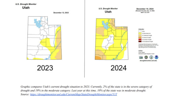
Early season conditions exist across much of Utah, with a mix of slightly above average snowpack for central Utah and slightly below average for the northern basins. The recent storm added a hefty dose of high water-content snow to the mountains of central Utah, greatly increasing the snowpack numbers in that region.
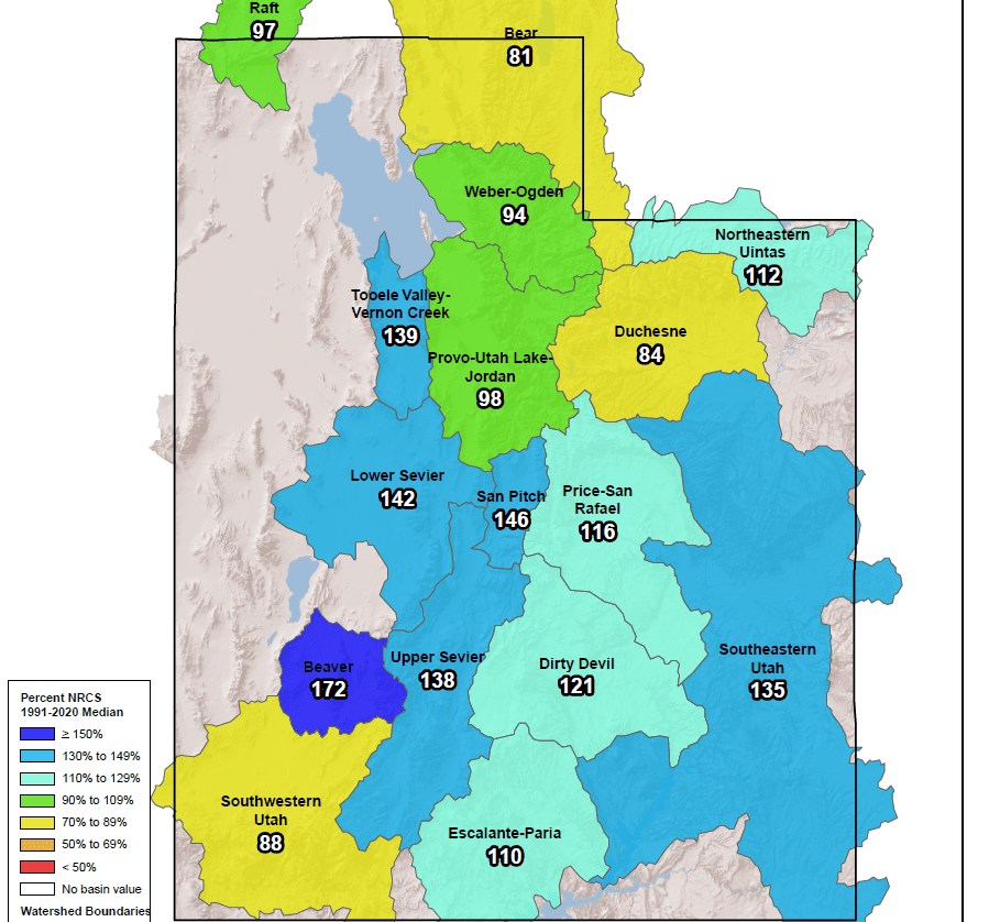
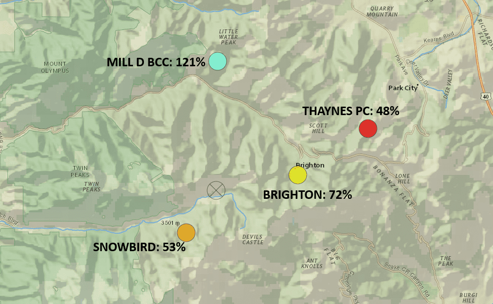
Despite a very active early season, it’s a bit of a different situation if we zoom in on the Central Wasatch, with 3 of the 4 high elevation SNOTEL monitoring sites reporting well below average for this time of year. However, the winter season is just barely getting started, and percent of normal comparisons can be slightly misleading as one storm can greatly impact these percent of average comparisons. In general, individual storms have less of an impact on the percentage of normal snowpack the farther along in the winter season we go as they get averaged over a much longer time period. The Utah Avalanche Center forecast hints at a weakening snowpack throughout this extended period of clear skies and calm weather.
