Police & Fire
UPDATED: Mandatory evacuations ordered as Yellow Lake Fire grows to 10,817 acres
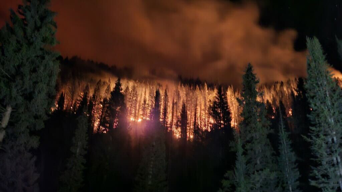
The Yellow Lake Fire burns in a stand of timber near Mill Hollow Road on Friday, Oct. 5, 2024. Photo: Published with permission
Due to immediate fire danger, both the West and the North Fork of the Duchesne River are now under an active evacuation order. The community of Hannah has been placed on alert
UPDATED at 6:02 p.m. – The National Interagency Fire Center (NIFC) said the Yellow Lake fire has now grown to 10,817 acres in the Uinta-Wasatch Cache National Forest. After heavy winds and red flag conditions all day Saturday the fire grew just over 3,000 acres, forcing mandatory evacuations (updates below.)
UPDATED at 3:55 p.m. – A fast-moving fire is threatening the North Fork area. The community of Hanna has been placed on alert, according to a wireless emergency alert from the Duchesne Co. Sheriff’s office. The alert was issued at 3:50 p.m. on. Saturday, October 5.
People in the community of Hannah should ready for a potential evacuation.
Refer to Watch Duty for more information and resources or call the Duchesne Co. Sheriff’s office – 435-789-4222.
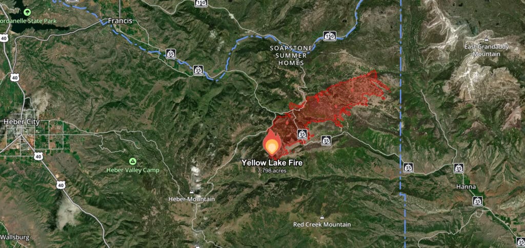
UPDATED at 1:35 p.m. – Due to immediate fire danger, both the West and the North Fork of the Duchesne River are now under an active evacuation order, according to Utah Fire Info. An imminent threat to life and property exists and individuals must evacuate in accordance with the instructions of local officials.
All campers and recreationists in the Grandaddy Lakes region of the Ashley National Forest have entered a READY status. Meaning it is time to prepare and get ready in advance for the Yellow Lake Fire. Follow all instructions from emergency personnel. For updates, stay tuned to local authorities. Safety is the top priority.
FRANCIS, Utah – The Yellow Lake Fire has grown to 7,798 acres, fire officials reported Saturday morning. The human-caused fire has been burning for a week now and has spread nearly 5,400 acres in the last six days. Crews continue to work under difficult and high-temperature conditions to battle the spotting fire amid unfavorable windy conditions.
Public Information Officer Brian Trick said that winds Friday afternoon and evening took the fire northeast and conditions became so hot and smoky that they had to pull crews off the fire until conditions improved. The areas that had been contained are still holding strong, and winds Saturday are expected to shift to the south, blowing back into the already burning area.
The number of people actively working under a full-suppression order has grown to over 400.
Perimeter mapping uploaded to the National Interagency Fire Center (NIFC), which is viewable on the Watch Duty map shows containment is at 10 percent.
During the predicted wind event Friday, multiple wind-driven spot fires occurred further north across Highway 35 and the gas pipeline, burning through timber and producing more visible smoke.
7,797 acres is equivalent to just over 12 square miles.
Officials say they have not yet determined the exact cause of the fire.
Appreciate the coverage? Help keep Park City informed.
TownLift is powered by our community. If you value independent, local news that keeps Park City connected and in the know, consider supporting our newsroom.


