Weather
Ski beach weather to close out lackluster winter season
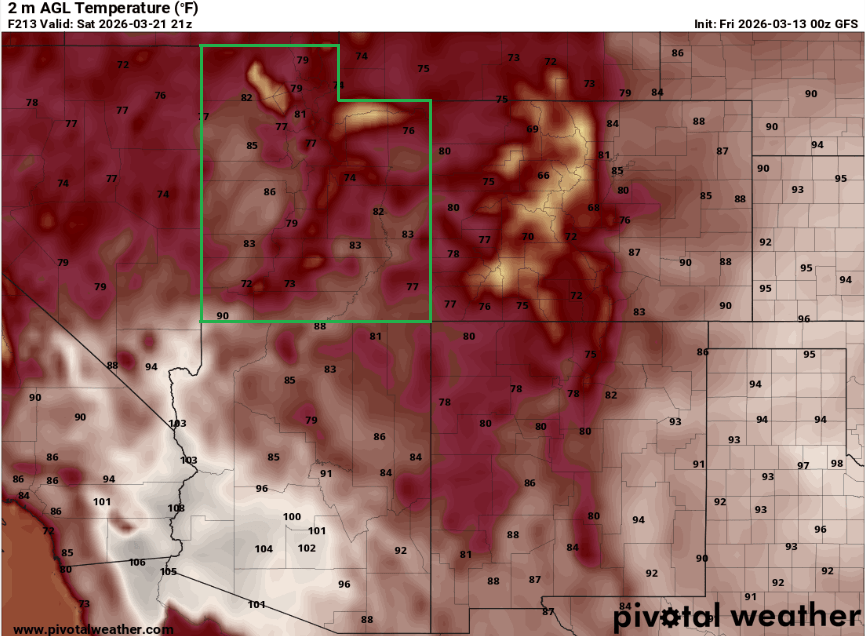
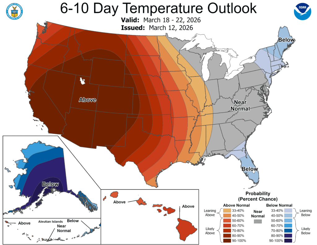
Photo: GFS model temperatures for next Friday show potentially record level heat for much of the west // PivotalWeather.com
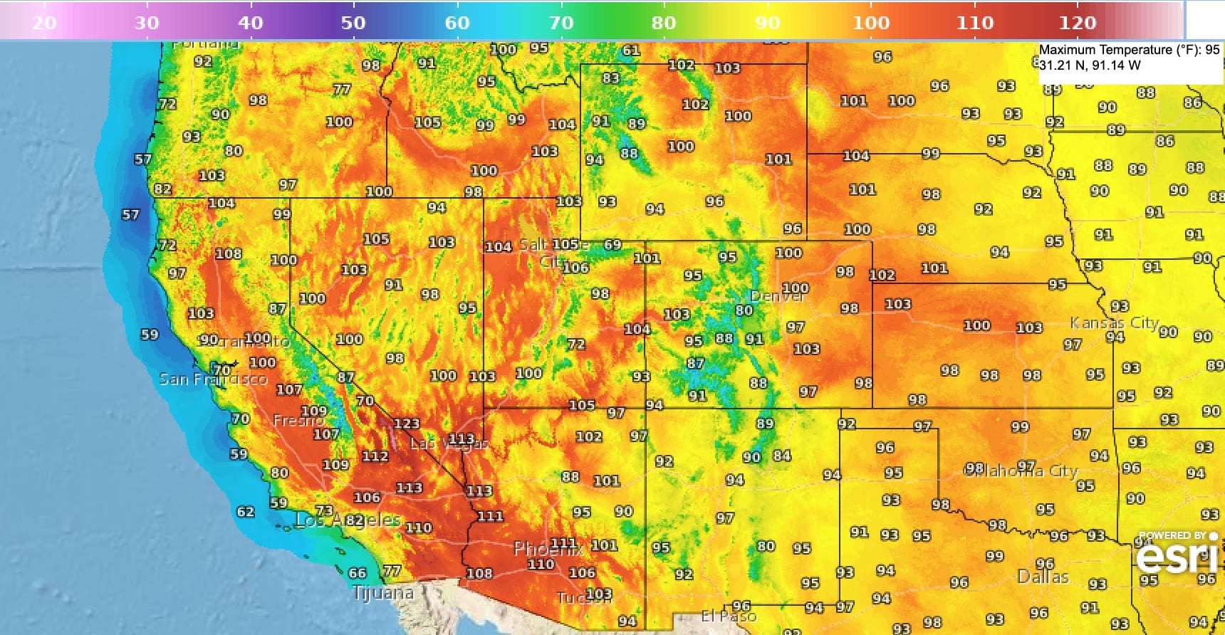
Potentially record-breaking heat is on the horizon as a strong high-pressure system and heat wave are forecast to impact the West starting next Wednesday
PARK CITY, Utah – It may be time to polish up the Pit Vipers and get your jean shorts ready, as spring skiing season looks primed to begin next week as a strong high-pressure system and potentially record-breaking temperatures descend upon Utah.
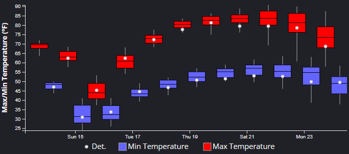
After a significant cool down in temperatures this weekend from a cold front dropping in from the north, temperatures are expected to rebound by Tuesday and warm to near 25-degrees above normal by Wednesday. Utah is on the back end of the storm forecast to arrive Saturday afternoon, catching only a glancing shot of 1 – 4” of snow for the Wasatch by Sunday morning above 7500 feet, but with much colder temperatures to follow Sunday and Monday. A chance of flurries is possible in town for Park City as the cold air arrives Saturday night.
The best chance for record high temperatures in Salt Lake City will likely be Thursday and Friday as the high-pressure ridge is nearly bullseyed over Utah, but the existing record of 79°F for Wednesday, March 18, will also be very close. The existing historical records drop to 75 degrees for March 19 and 20, so these have a better chance of being eclipsed by this unseasonably hot weather pattern.
For context, the earliest 80-degree day ever recorded in Salt Lake was on March 31, set in 2012.

The weather models currently show little relief through the end of the 10-day forecast period, with the high-pressure system expected to remain centered over the southwest through at least next Saturday, with a slight dip in temperatures possible.
By: Adam Lenkowski

24 South 600 East
Salt Lake City, UT 84102
10584 Basin Canyon Road
Park City, UT 84098
965 Goshen Canyon Road
Mona, UT 84645
19 East 100 North
Spring City, UT 84662Talk of the Town


Park City Jobs
Social Media Videographer & Editor, Well Plated
1 day ago Contractor $3,000 - $5,000 monthly
Showroom Specialist, Tanner Glass & Hardware
1 day ago Full time $25.00 - $30.00 hourly

Head of Maintenance, Ptarmigan Property Services
1 day ago Full time $70,000 - $85,000 yearly

Assistant Manager, LOMA
9 days ago Full time $35.00 hourly
Property Inspector, Park City Rental Properties
9 days ago Full time $23.00 - $25.00 hourly