Weather
Another foot of snow possible for the Wasatch as storm cycle continues
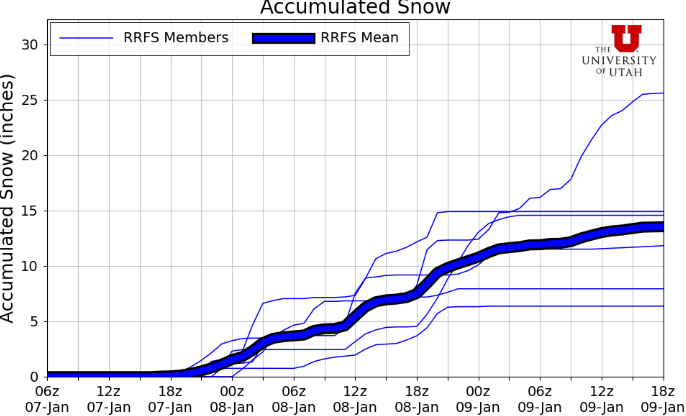
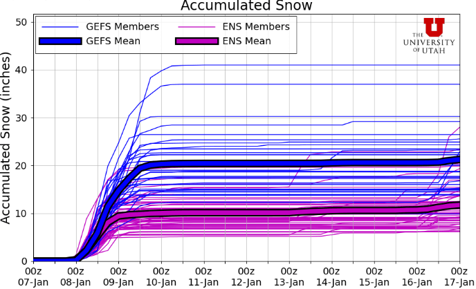
Photo: RRFS model total snow accumulation for Alta, UT shows snowfall starting later this afternoon and persisting through Friday morning potentially // UofU Dept. of Atmospheric Sciences
A cold storm dropping in from the Pacific Northwest is primed to deliver some low-density snow Wednesday evening into Thursday
PARK CITY, Utah – Coming in on the heels of the best winter storm we’ve seen so far this season is yet another low-pressure system, which is beginning to roll in this afternoon. After what seems like months of warm, southerly originating storms with high snow levels, this next system will be much colder, dropping in from the northwest.
Light snow showers will begin to fill in from north to south in the Wasatch Mountains starting Wednesday afternoon as we remain in mild, southwest flow. In town, Park City should see light snow Wednesday evening, and lower valley benches should begin to see a rain/snow transition as the sun sets and temperatures cool just enough with the onset of precipitation. A strong cold front is forecast to arrive overnight in the early morning hours Thursday, with the heaviest snow lasting through midday.
Forecast Snow Totals – Wednesday evening through Friday morning
- Cottonwood Canyons: 7 – 14″
- Deer Valley/PCMR: 5 – 10″
- PC Base/Town: 2 – 5″
- N. Wasatch (Powder/Snowbasin): 5 – 10”
Most snow showers look like they will begin to taper off by late Thursday afternoon. However, there remains a chance for some lake effect snow to kick in Thursday evening into Friday morning, which would boost snow totals possibly in the Cottonwood Canyons, or western Salt Lake Valley and the Oquirrh Mountain Range. We really haven’t seen many, if any, weather systems cold enough and coupled with northwest winds to really get the lake rocking yet this season. This could be a great setup of very cold air moving in over a relatively warm Great Salt Lake for this time of year.
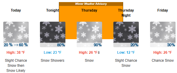
Temperatures will be very cold in the wake of this storm, with overnight lows dipping into the teens and single digits for many high elevation locations. A winter weather advisory has been issued by the National Weather Service for Thursday which includes a large swath of the state of Utah, with widespread snowfall and potential travel impacts possible.
The center of the low is digging a bit further south and to our west as of most recent forecast guidance than in prior weather forecast model runs. There also remains a bit of uncertainty in the total snow accumulation as to if and where any lake effect snow will kick in, and how long snow showers will persist into Thursday evening.
Extended Outlook
As the storm exits the region on Friday, high-pressure looks to build back in with seasonal temperatures in place. Get the goods while you can, as the long-range forecast remains mostly dry.
By: Adam Lenkowski

438 Castle Valley Drive
Castle Valley, UT 84532
2349 S Lava Vista Drive, Lot 32
Santa Clara, UT 84765
3267 W Deer Hollow Road, Unit 2305
Park City, UT 84060
80 West 300 North
Salt Lake City, UT 84103Talk of the Town


Park City Jobs

Junior Interior Designer, Abigail Hill
4 days ago Contractor

Dental Assistant, Rise Dental Wellness
4 days ago Full time

Sales & Marketing Coordinator – B2B Publishing, Power Trade Media
6 days ago Full time $40,000 - $45,000 yearly

Garden Steward and Educator, Summit Community Gardens and EATS
11 days ago Seasonal
PROGRAM AND EVENT COORDINATOR, PC READS
12 days ago Part time $25.00 hourly