Weather
Utah hits record-low snowpack ahead of approaching winter storm
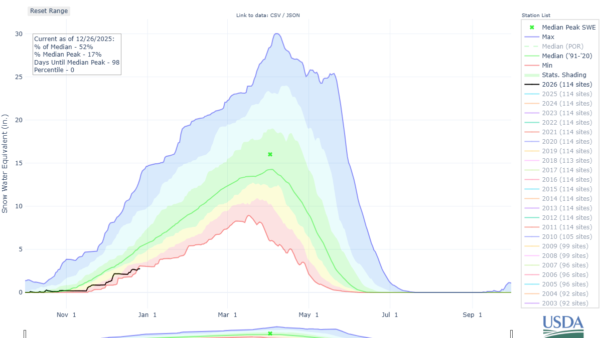
Photo: The black line depicts 2026 total snow water equivalent for the state of Utah, while the red line shows the historic minimum for December 26, 2025 // USDA NRCS – Snow Survey
Record high temperatures, multiple days of strong south winds, and rain near 10,000 feet were all contributing factors this holiday week that lead to a brief dip below historic-low snowpack levels
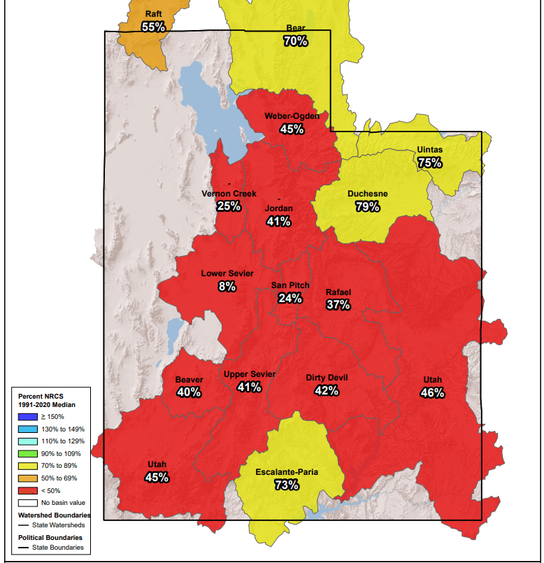
PARK CITY, Utah – Utah’s average statewide snowpack has fallen to its lowest level on record since 1981, according to SNOTEL data. Snow water equivalent is at just 2.7 inches, breaking the previous Dec. 26 record low of 3.1 inches set in 2018. This should be short-lived however, as a potent winter storm is already beginning to impact northern Utah. Record breaking high temperatures across Utah for November, and near-record highs in December have contributed to the melting of snow at lower elevations, and also lead to precipitation falling as rain instead of snow, further exacerbating the lack of any decent snowpack accumulation.
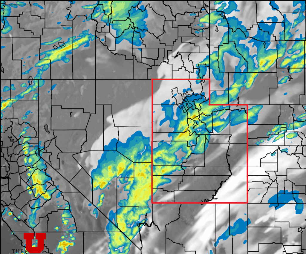
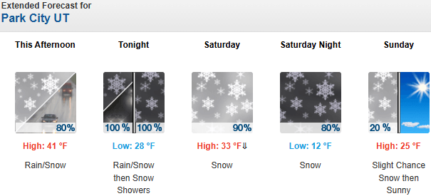
Luckily a winter storm is on our doorstep, with light snow currently falling in the Logan area mountains and the Cottonwood Canyons, with several locations reporting a few inches of snow already. Winds remain strong from the southwest as moisture is streaming in, eventually calming down a bit and shifting westerly overnight as the initial cold front moves through. Friday night through Saturday morning will be the heaviest period of precipitation, with showers continuing throughout the day Saturday.
Forecast Snow Totals (Today – Sunday morning)
- Cottonwood Canyons: 12-22″
- PC Base/Town: 3-6″
- Deer Valley/PCMR: 9-14″
- N. Wasatch (Powder/Snowbasin): 12-18″
A second part of the storm moves in Saturday night and will bring with it much colder temperatures, another blast of snowfall, and the potential for snow reaching down to the Salt Lake Valley by Sunday morning. Winter is finally returning to Park City, with temperatures forecast to be 20 degrees colder by Sunday, and 3 to 6 inches of snow expected in town. Winds eventually shift to the northwest overnight, bringing in drier air and winter like temperatures. Light snow showers will begin to taper off by late morning on Sunday.
A winter weather advisory has been issued by the National Weather Service, with widespread snowfall of 6-12” expected across many mountainous areas in Utah. While avalanche danger remains low to moderate in the Central Wasatch, Drew Hardesty from the Utah Avalanche Center warns, “rain crusts are notorious for both connecting slopes together AND fostering the development of weak, faceted grains. We’ll be watching with interest”.
By: Adam Lenkowski

325 White Pine Canyon Road
Park City, UT 84060
438 Castle Valley Drive
Castle Valley, UT 84532
80 West 300 North
Salt Lake City, UT 84103
1511 S Valley View Circle
Springville, UT 84663
3267 W Deer Hollow Road, Unit 2305
Park City, UT 84060
2349 S Lava Vista Drive, Lot 32
Santa Clara, UT 84765Talk of the Town


Park City Jobs

Hiring Barista Assistants and Baristas, Silver King Coffee
3 days ago Part time $17.00 - $30.00 hourly
General Maintenance Technician, Moose Management Vacation Rentals
7 days ago Full time

Office Coordinator, Park City Community Foundation
10 days ago Full time $50,000 - $55,000 yearly

Summit Land Conservancy Programs Specialist, Summit Land Conservancy
10 days ago Full time
Vice President of Finance, Park City Community Foundation
10 days ago Full time $115,000 - $130,000 yearly