Community
New state map shows which Utah homes will pay wildfire mitigation fee
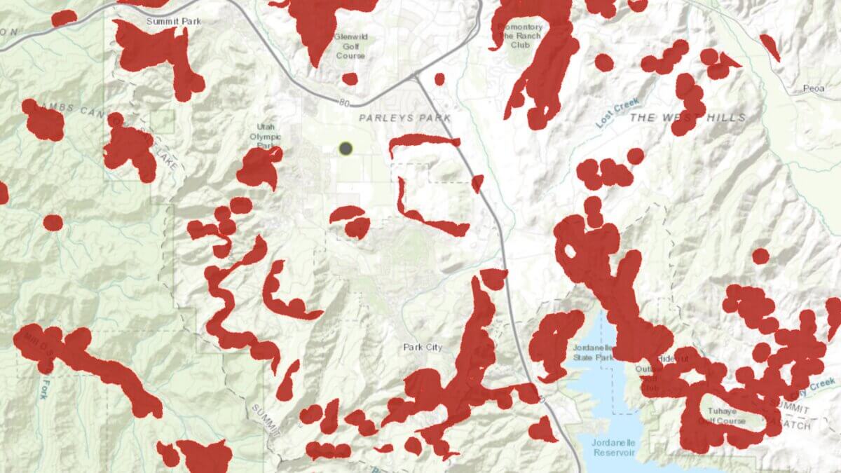
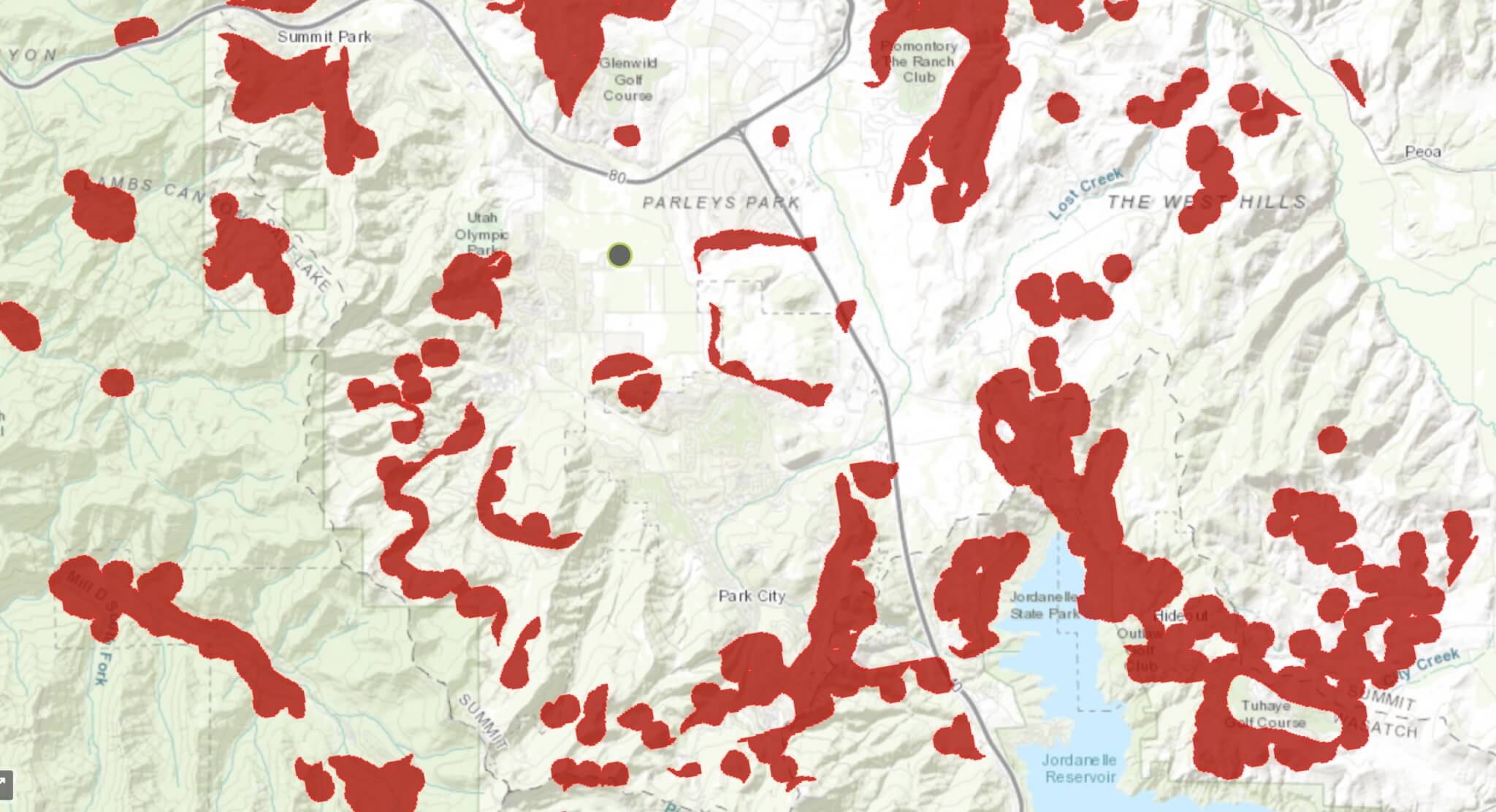
The high-risk Wildland User Interface map is now available. Photo: Utah Department of Natural Resources
Utah has finalized a statewide wildfire risk map that determines which properties fall within high-risk areas and will be subject to a new annual fee starting next year
UTAH — A new Utah law requiring some homeowners in wildfire-prone areas to pay an annual fee is moving into its next phase, as the state has finalized a map identifying which properties fall within high-risk wildfire zones.
House Bill 48 directs the Utah Division of Forestry, Fire and State Lands to identify areas where development meets wilderness, known as the wildland-urban interface (WUI), and assess an annual wildfire mitigation fee on properties deemed most at risk.
The newly released map, now available as a layer on the Utah Wildfire Risk Explorer, outlines which properties are included in the state’s high-risk WUI designation. The fee applies only to taxable structures, not vacant land, and will be used to fund Utah’s new Wildfire Preparedness Program.
Who will pay the fee?
After months of uncertainty for homeowners, the finalized map clarifies which neighborhoods will be subject to the fee and which will not. In Summit County, for example, much of upper Summit Park falls within the high-risk boundary. Some properties on the outer edges of communities such as Promontory and Tuhaye are also within the WUI fee zone. For the most part, the more densely populated areas of Park City and the Snyderville Basin won’t be subject to the fee.
Joseph Anderson with the Division of Forestry, Fire and State Lands said the annual fee will range from $20 to $100 per property, depending on a structure’s square footage, during the program’s first two years.
Property owners whose homes fall within the high-risk boundary can expect to receive notice of the fee in early 2026. Beginning in 2028, properties that do not complete a lot-level wildfire risk assessment will automatically be classified at the highest risk level.
Summit County response
Summit County Manager Shayne Scott told TownLift in November the county’s immediate focus is on education and mitigation.
“The primary desire of Summit County at this time is to inform those who find themselves in these wildland fire vulnerable areas about this state requirement and how they might minimize their susceptibility to fire, and thus their fee at the same time,” Scott said.
State officials say the program is intended not only to fund wildfire preparedness but also to encourage homeowners in high-risk areas to take steps to reduce their exposure as Utah faces longer and more severe wildfire seasons.
How will this affect home insurance?
The law requires property insurers to use the state’s high-risk WUI boundary when setting rates or deciding whether to renew coverage. “The key here is uniformity,” said Anderson.
If an insurer raises rates by 20% or more, or drops coverage due to wildfire risk, it must provide notice and justification based on the facts underlying the decision, if requested by the property owner.
All properties in WUI areas will be assessed using this single, state-developed high-risk wildfire map, replacing the patchwork of different methods previously used, which the state believes will bring greater consistency and transparency to insurance decisions.
By: Heather Bergeson

2349 S Lava Vista Drive, Lot 32
Santa Clara, UT 84765
3267 W Deer Hollow Road, Unit 2305
Park City, UT 84060
80 West 300 North
Salt Lake City, UT 84103
438 Castle Valley Drive
Castle Valley, UT 84532Talk of the Town


Park City Jobs

Sales & Marketing Coordinator – B2B Publishing, Power Trade Media
1 day ago Full time $40,000 - $45,000 yearly

Computer / Website Assistant, Summit Support
5 days ago Part time $20.00 - $30.00 hourly

Garden Steward and Educator, Summit Community Gardens and EATS
6 days ago Seasonal
PROGRAM AND EVENT COORDINATOR, PC READS
6 days ago Part time $25.00 hourly
Development Manager, Blue Sky Utah
7 days ago Part time $28.00 - $32.00 hourly